Well, the Super “snow” Moon certainly lived up to it’s name last night as moonlit skies glistened a bit off the fresh snow pack in place. With clear skies prevailing temperatures also faded back into the teens and wind chills first thing this morning run close to 0! Cold, yes, but overall, nothing we can’t handle. Grab the gloves, hat and the sunglasses this morning. With quite a bit of sunshine reflecting off the fresh snow pack, it’ll be a bright morning commute. That sunshine sticks with us through the day as highs recover close to 30 this afternoon. The breeze will be fairly steady, around 10-15mph, so wind chills will hover around 20. As long as the kids dress warm enough, they should be fine out there at the local sledding hills.

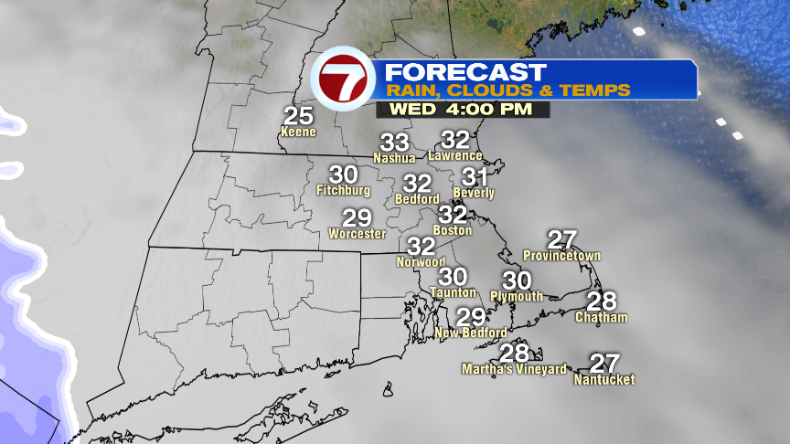
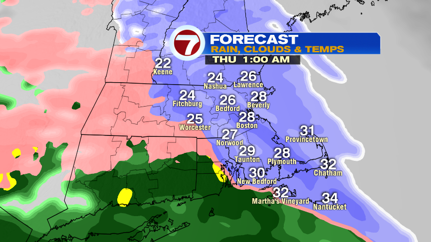
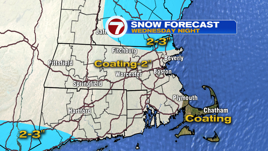
Clouds increase tomorrow afternoon as the next storm approaches us from the southwest. That storm will bring a mix of everything in here tomorrow night from snow to ice to rain. Snow breaks out after 9pm, and will change to sleet, freezing rain or rain by 2am for most towns and cities. Snow totals won’t be impressive, an inch or two, but throw some ice on top of ice, and we’ll have slick travel for several hours overnight. By the Thursday morning commute, main roads should be just wet, but secondary roads northwest of I-95, still could be slick early. By the afternoon, we dry out and temps spike into the 40s, so the evening commute won’t have any weather woes.

Have a good day and enjoy the sun.