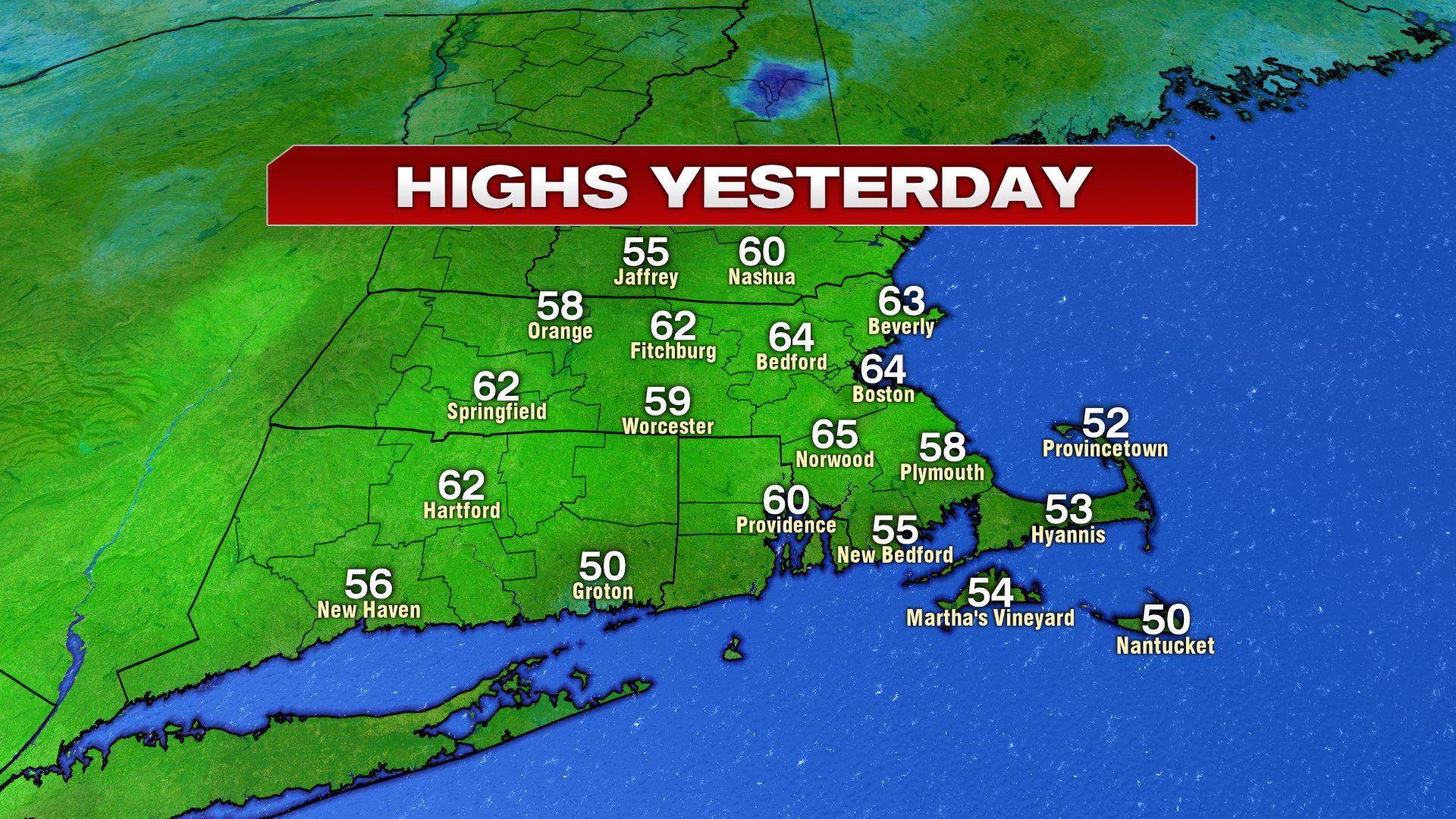
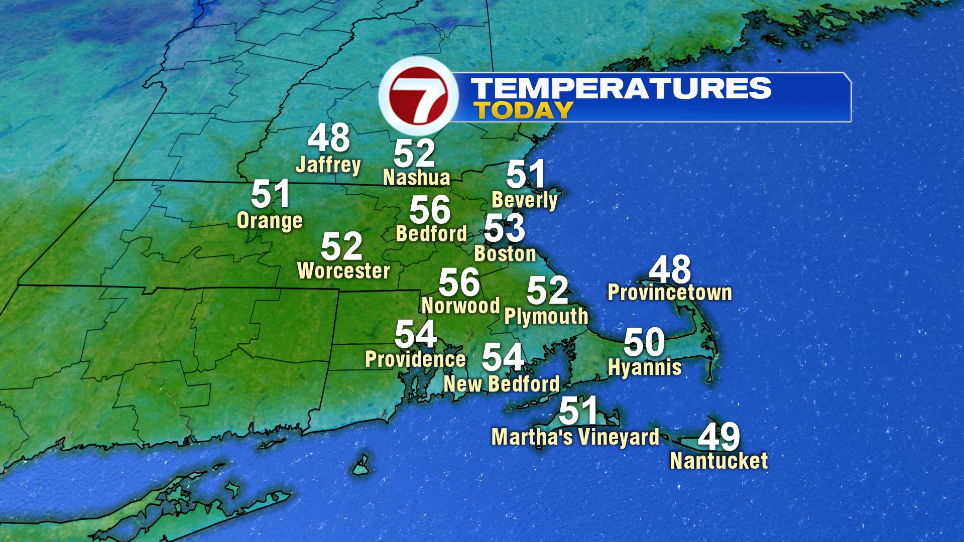
Wow! What a day we had yesterday with highs in the 60s, tons of sunshine and light breeze. While it’s hard to top that weather, today won’t be too bad overall with highs in the low to mid 50s. More clouds will be around with a few showers occasionally near the south coast.
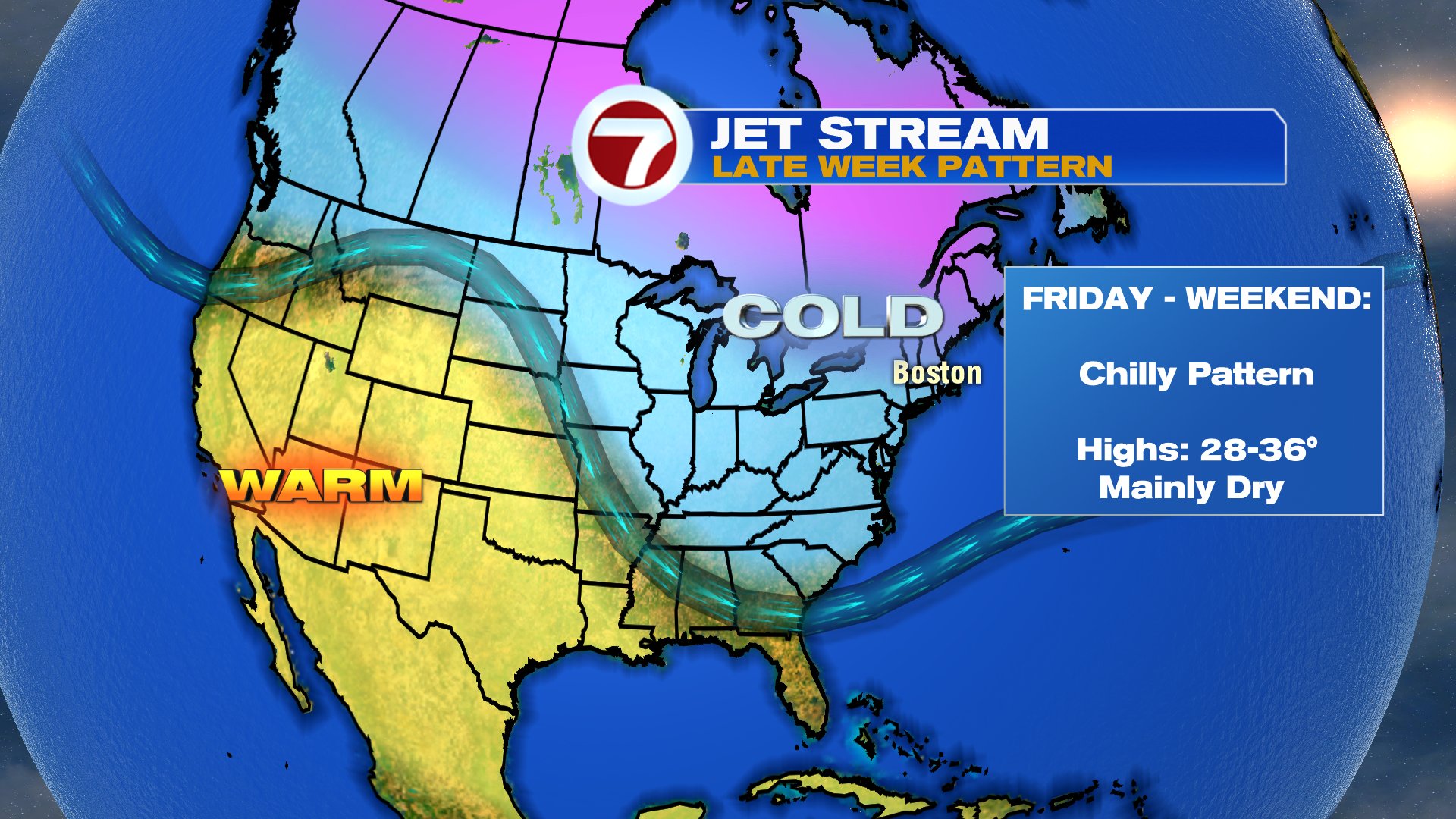
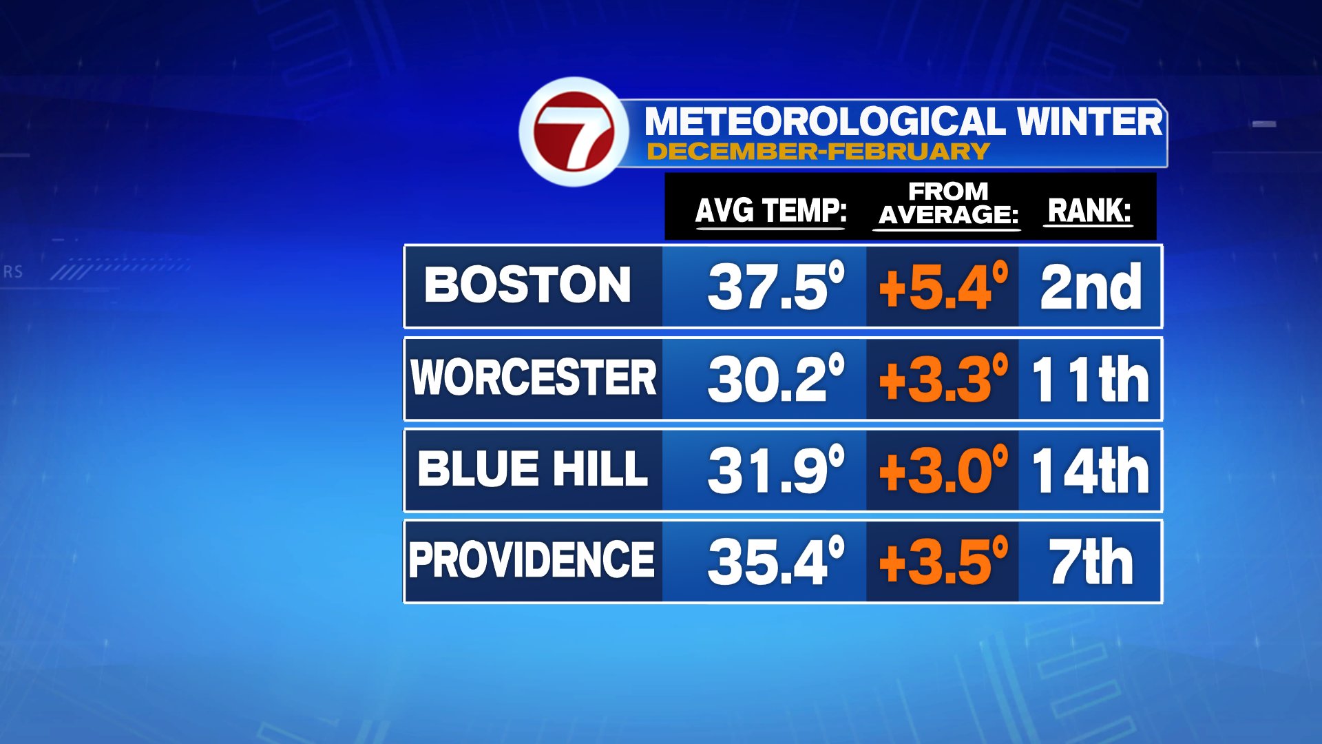
It has been quite a mild winter overall with meteorological winter (Dec-Feb) running top 15th warmest for much of southern New England. With such a strong polar vortex this year, locking up the deep cold across the arctic, many of our cold shots have been transient, for a couple days, then back to above average. The next cold shot will be just that too, transient, focusing a few chilly days, Friday-Weekend, before warming back up next week. It’ll be dry too, with partly sunny skies this weekend.
Scattered light showers/drizzle do work in tonight and hang through the day tomorrow with areas of morning fog too. Temps fall to near 40 tonight, and stay there through tomorrow.
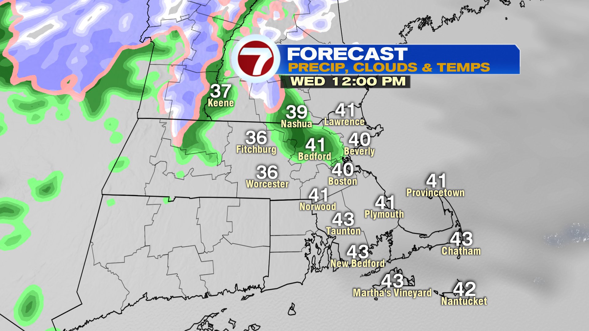
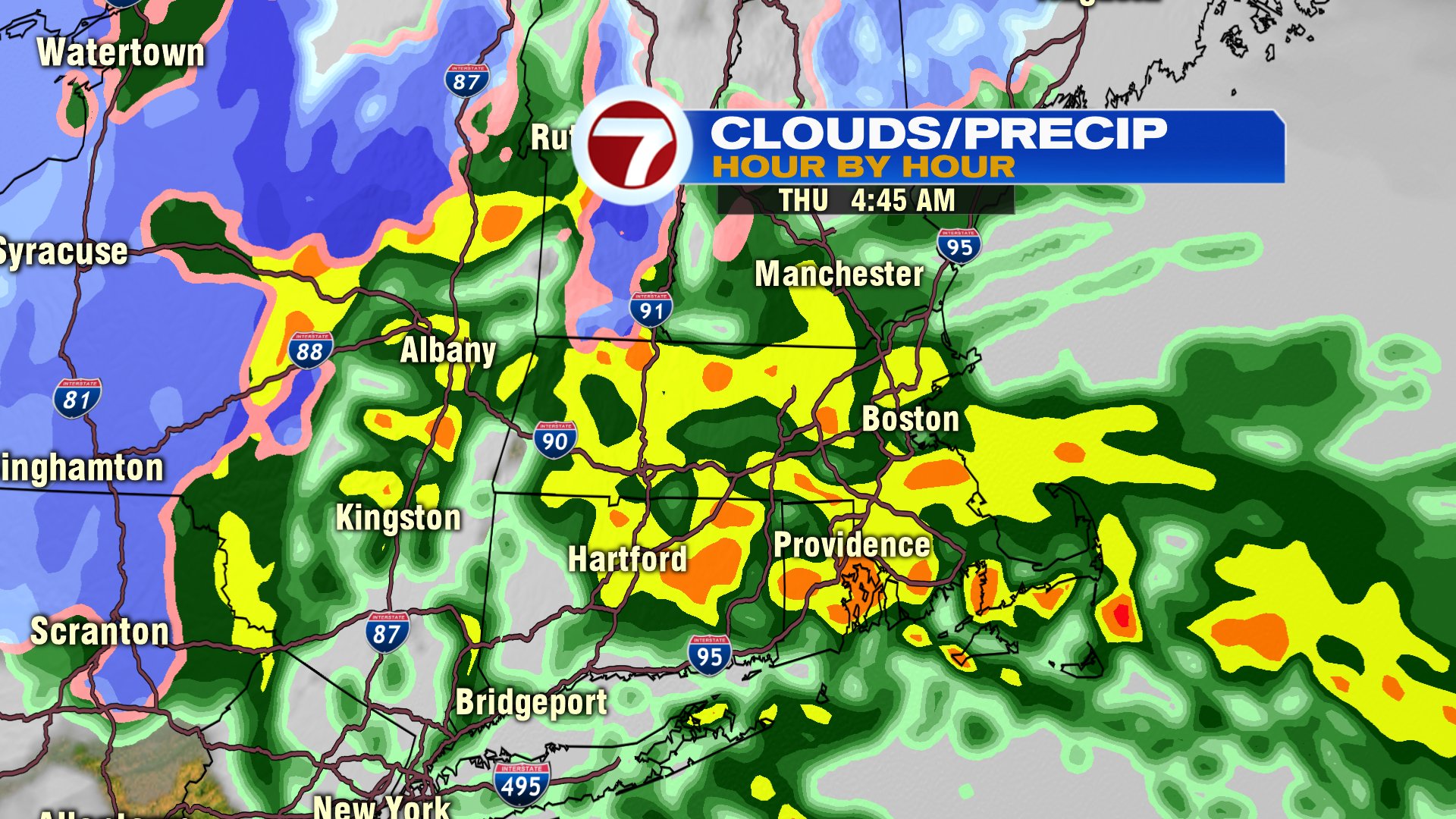
The heaviest rain this week is early Thursday morning (between 2-8am), before tapering off, allowing for the cool and dry weekend to follow. Winds will be gusty Thursday and Friday too.