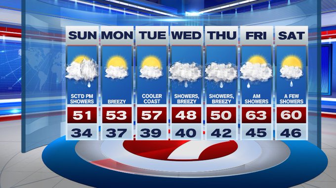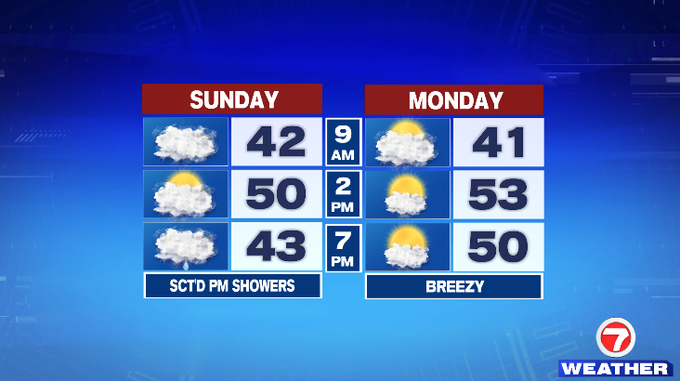
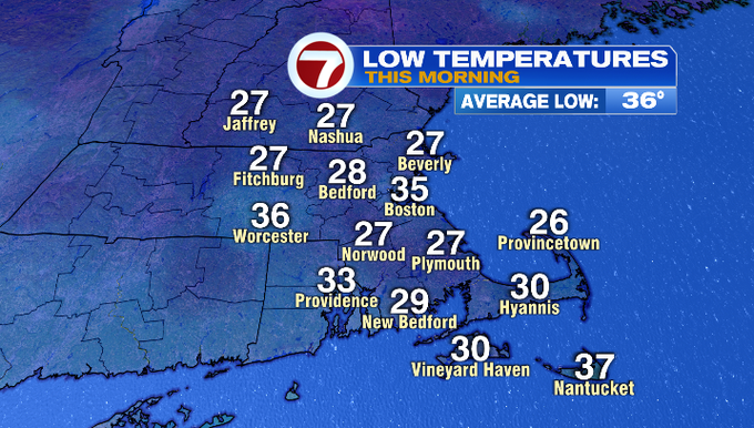
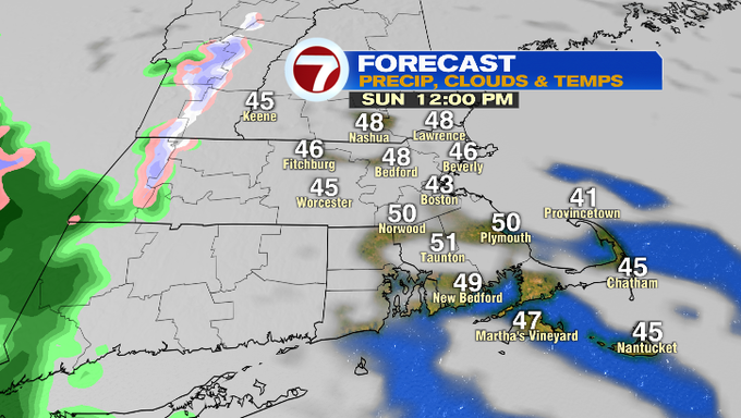
It was a chilly start to our Sunday with lows in the upper 20s to low 30s. After a colorful sunrise, clouds have thickened and those clouds will stick around for much of our Sunday.
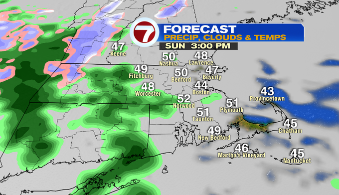
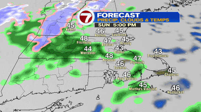
Scattered showers start to stroll in mid-afternoon and will continue to linger through sunset. The showers start to break apart and become more isolated tonight.
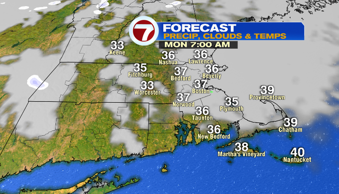
Tonight temperatures will only dip into the upper 30s under mostly cloudy skies.
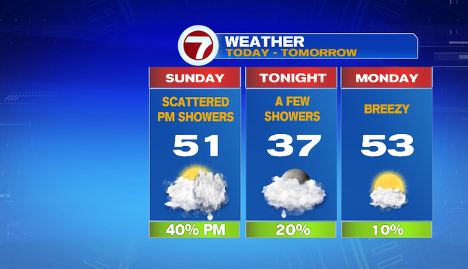
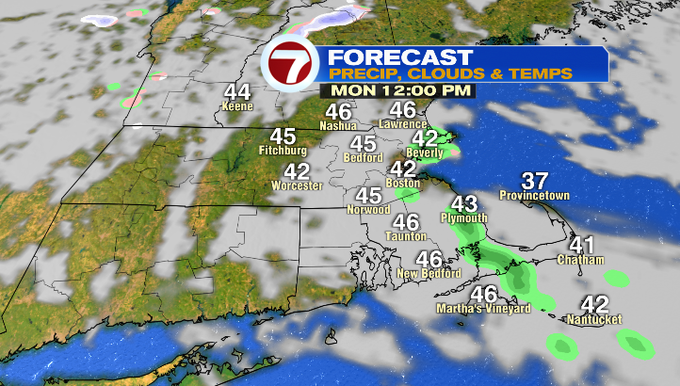
We start off Monday morning with some clouds for eastern MA which could produce a few sprinkles, otherwise we’re looking at a dry start to the week.
Those dry conditions continue into Tuesday ahead of our next system that slides in for midweek. Tuesday will be warmer inland with highs in the upper 50s, an onshore breeze will keep temperatures cooler at the coast Tuesday afternoon, likely near 50°.
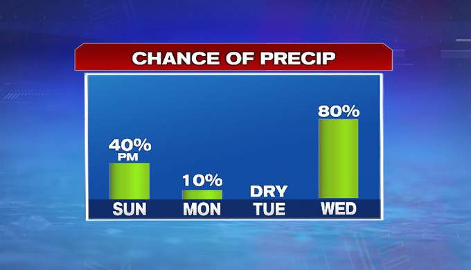
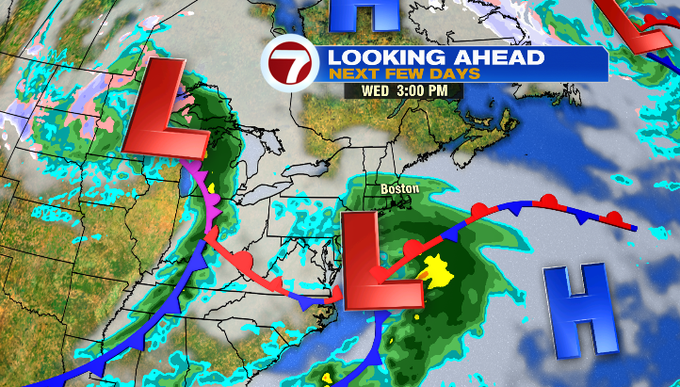
Wet weather arrives Wednesday morning and that wet weather will linger through Wednesday as well as Thursday. The rain slides in by midday Friday, allowing for temperatures to rise back into the low 60s Friday afternoon as skies begin to clear.
Saturday features highs near 60° under partly cloudy skies. We can’t rule out a few showers.