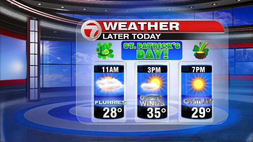
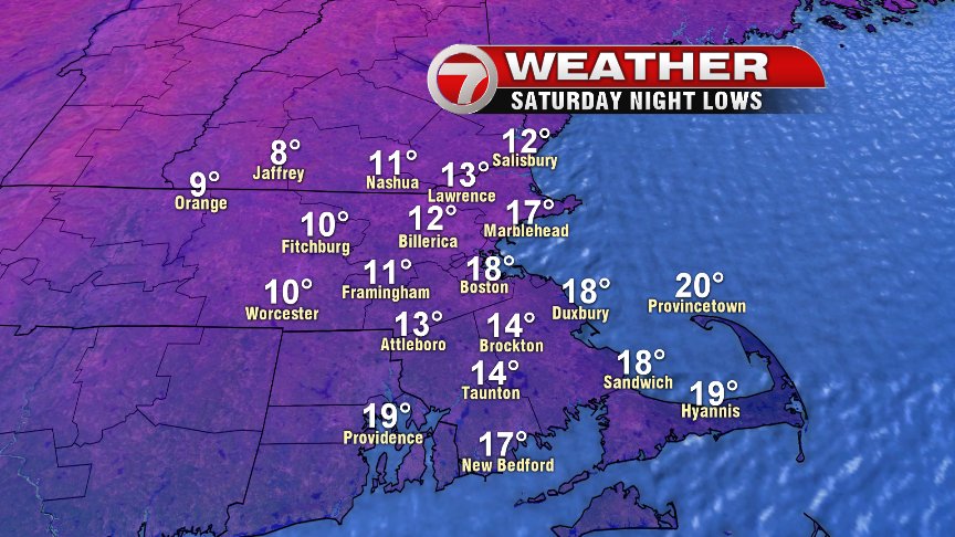
No luck temperature-wise for us on this St. Patrick’s day as a January chill is in the air with high temps running in the mid 30s and lows tonight dip into the mid teens! Yikes, I hope that green jacket is winterized! Factor in the breeze, and wind chills run in the 20s this afternoon under a mix of sun and clouds with a passing flurry or stray snow shower in some towns. Not much will change through Monday, with sunshine, few clouds and cold temps.
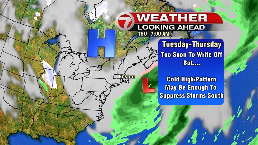
Alrighty… on to the mid-week potential we go.
The pattern is a complicated one, with perhaps not one, but two lows developing off the mid-Atlantic coastline. One low on Tuesday, the second one Wednesday night and Thursday. Both lows we’ll need to be watched to see if they’re close enough to throw snow and wind back in across southern New England. However, if indeed, two separate lows form, then it will also lead to the possibility of the southern branch of the jet stream being suppressed far enough south, that either a glancing shot or a miss to our south is possible with these storms, as high pressure tries to protect New England.
There are a lot of different moving pieces to the atmosphere that need to be resolved over the next couple of days timing-wise and strength-wise, so it’s too early to write this storm off for sure, but I did want to update you on how I could see a possible solution working out that would have most impacts from these storms staying south of us. Anyhow, keep checking back with us the next couple days for updates.
Stay warm and stay safe this weekend and have fun out there!
@clamberton7 – twitter