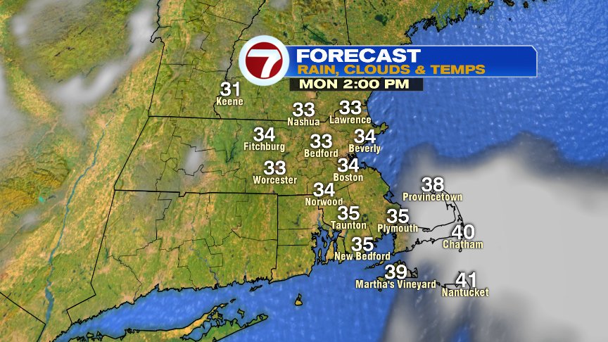
The chill is in the air this morning, although, in December, we’d expect some of that. At least the winds aren’t all that strong and many of us will see a decent deal of sun through the day. More clouds will be prevalent across coastal SE Mass/Cape and Islands. Temps rebound into the mid to upper 30s this afternoon, a good 6-8 degrees below average for this time of year.
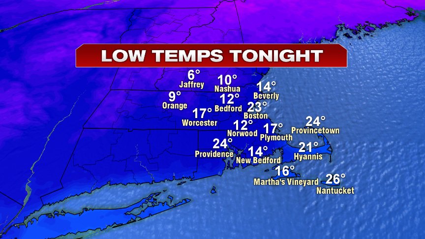
Mainly clear and cold conditions prevail tonight as temps fade back into the low to mid teens in the burbs to low to mid 20s in Boston.
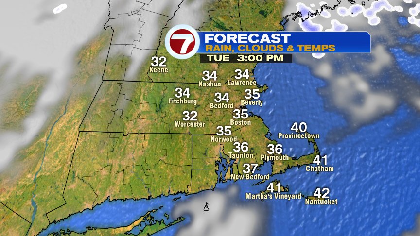
Tomorrow, temperatures are almost a carbon copy of what we see today.

The best chance for a bit of snow will arrive Wednesday into Wednesday night, as some instability combines with cold air passing over the relatively warm, creating ocean effect snow showers. Coastal Plymouth County to the Cape may even see a bit of accumulation, with the best chance for an inch or two across the outer Cape.

Milder air works in by Friday, but we’ll likely track rain in here by Friday night/Saturday.
Have a good day.
@clamberton7 – https://twitter.com/clamberton7