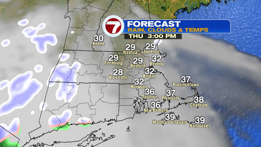
One more time… as in one more day of colder than average air, and mainly dry weather, that will prevail today. Highs run near 30 degrees this afternoon as clouds fade out the sun with occasional flurries/light snow showers flying. Out in Worcester County, a dusting of snow is possible, but the best chance for an inch or so will be across western New England.
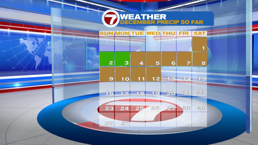
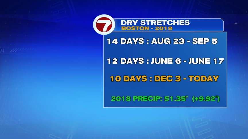
Winds of change are in the air tomorrow as a light southerly breeze kicks in and highs moderate back into the 40s for many towns and cities around Boston and points south and west. While I can’t rule out an afternoon sprinkle, much of the day will be dry. Any wind we have is light too, so it’ll be an overall comfortable day. Beyond tomorrow, our dry stretch ends as we’ll track the chance for showers over the weekend. It has been nice to string together 10+ days of dry air though as it’s the longest stretch in Boston without measurable precipitation since late August/early September.


The weekend forecast is a bit of a challenge, to be honest. We’ll have showers trying to work in from our southwest overnight Friday into Saturday morning, then have dry air with a front, trying to push back in Saturday afternoon and night. If that’s the case, most of Saturday afternoon and evening turns dry. That dry air could linger through Sunday morning before an area of low pressure wobbles back close enough to throw more showers toward us Sunday afternoon – Monday. How close that low comes and how strong it gets will dictate timing/how much precipitation we get. Certainly a forecast to keep tabs on into the weekend for rain timing/amount changes.


Have a good day.
@clamberton7 – https://twitter.com/clamberton7