Watch your step this morning as any snow melt we had yesterday has refroze and icy spots are plentiful on some driveways and sidewalks to start today. With all the snow and ice on the ground, it doesn’t look like Spring is around the corner, and with plenty of cold air in place the next few days, it won’t feel that way either. Highs the next several days run 10-15 degrees below average, giving us a more January type feel to the air. While the snow in the sun may melt a bit each day, we should still have a solid snow pack that lingers into the weekend if you have any ski/sledding plans coming up.
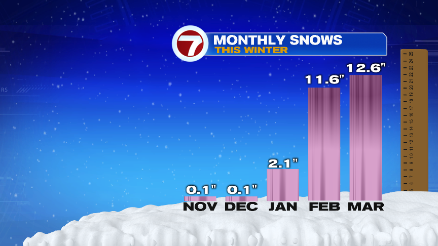
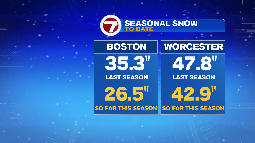
The recent snows in Boston, about 2 feet in the last few weeks, has allowed the seasonal totals to play catch-up a bit. Although, the numbers still run behind last years, they certainly have closed the gap. Especially in places like Worcester, where over 40″ of snow has fallen this winter.
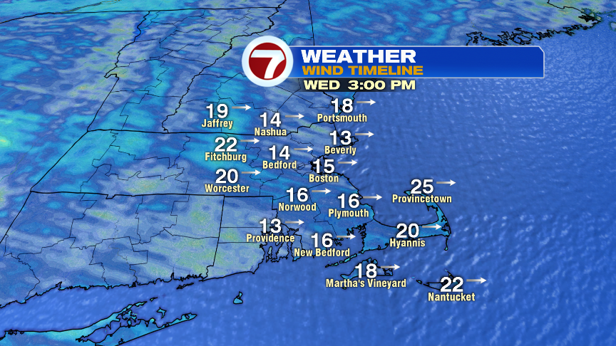
We won’t catch much more snow this week, but a few scattered flurries and snow showers are possible overnight tonight and perhaps a passing flurry drifts through tomorrow as more clouds arrive for Wednesday and a busy breeze through the day drives wind chills down into the single digits and low teens through much of the day.
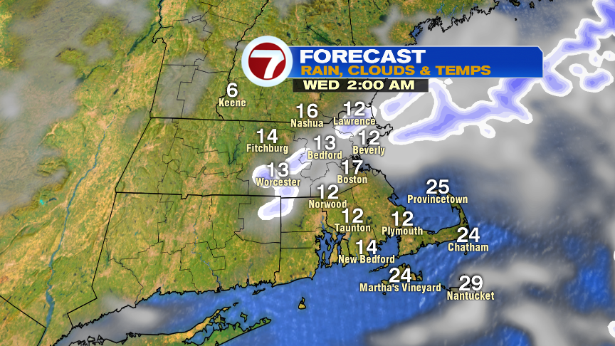

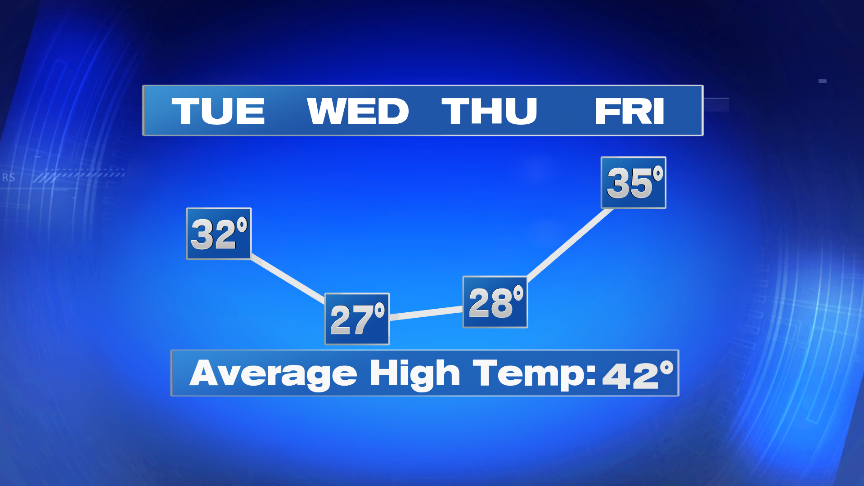
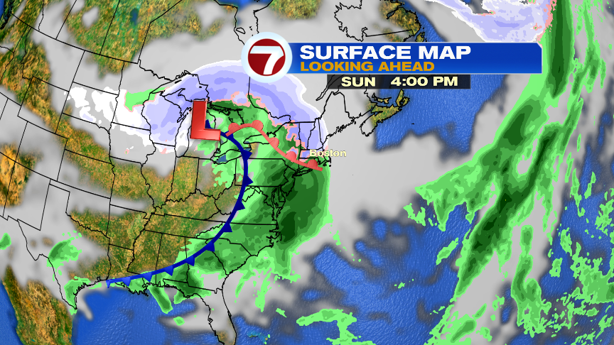
Temps turn more seasonable by the weekend, low 40s, but we’ll also track the next potential batch of rain and snow by Sunday afternoon. The best chance for some minor snow accumulations Sunday afternoon/evening will be near and northwest of 495, before rain showers take over. Although precipitation will be widespread, it doesn’t look like a major storm.
Clocks also go forward 1 hour this weekend as we Spring Forward. 7pm sunsets aren’t far off!

Have a good day.
https://twitter.com/clamberton7