Winds of change are certainly in the air this morning as strong westerly breezes have ushered in colder Canadian air. That cold dry air gets entrenched across New England over the next 36 hours, setting the stage for the season’s first widespread snow/sleet event for tomorrow evening.
Temperatures don’t change much through today as morning temps in the upper 20s in the Worcester Hills and mid 30s in Boston will only rise a couple degrees by mid afternoon. Factor in a strong wind, and wind chills stay in the upper teens in the Worcester Hills to the mid 20s in Boston. Winds gust today 35 to 45mph, strongest northwest of Boston, where a wind advisory is in place.


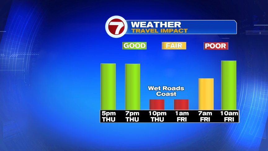
Clouds advance on in tomorrow afternoon and snow breaks out from south to north between 6pm-9pm (earliest south coast, latest southern NH). With an east wind kicking in off 50 degree ocean water, the change to rain will be quick, including in Boston. Across the interior, the change to sleet then to rain takes more time, and that’s where a widespread 1-3″ will fall. Locally higher amounts are possible, especially northwest of 495 (see snow map below).


By Friday morning, it’s generally a cold rain for the morning commute, so the roads at that time will be more wet than white. A cold rain continues for much of Friday. We dry out for the weekend.


@clamberton7 – twitter