Chilly air is back in place today and tomorrow. Highs top off in the low to mid 20s on average today with sunshine back as well. Temps fall into the single digits tonight and rebound into the upper 20s tomorrow. The coldest wind chills will be tonight, with it feeling like -5 to -10 early tomorrow morning.


Ok, now that’s out of the way, let’s get to the weekend storm.
There’s no doubt that an area of low pressure that develops off the mid-Atlantic and New England coast becomes a powerhouse ocean storm. It’s likely that it bombs out (bombogenesis) as the pressure will drop more than 24mb in 24hrs. What’s more of a challenge is to pin down the exact positioning of the low 3 days out. That exact positioning of that low will determine who gets the most snow and how much falls.
Light snow starts late Friday night, but through the evening, snow totals will likely be an inch or less through midnight. After midnight, the snow increase from south to north with many of us seeing steady snow by daybreak. The intensity of the snow increases Saturday morning, especially near the coast. Winds start to pick up through the morning too as the storm intensifies. We’ll likely be in and out of bands of heavy snow and gusty winds through the day Saturday as blizzard conditions are possible at times across eastern Mass with the combo of blowing snow/snow falling creating visibility under a 1/4mile as well as winds frequently gusting over 35mph. The snow tapers off Saturday evening, leaving a dry but chilly Sunday.
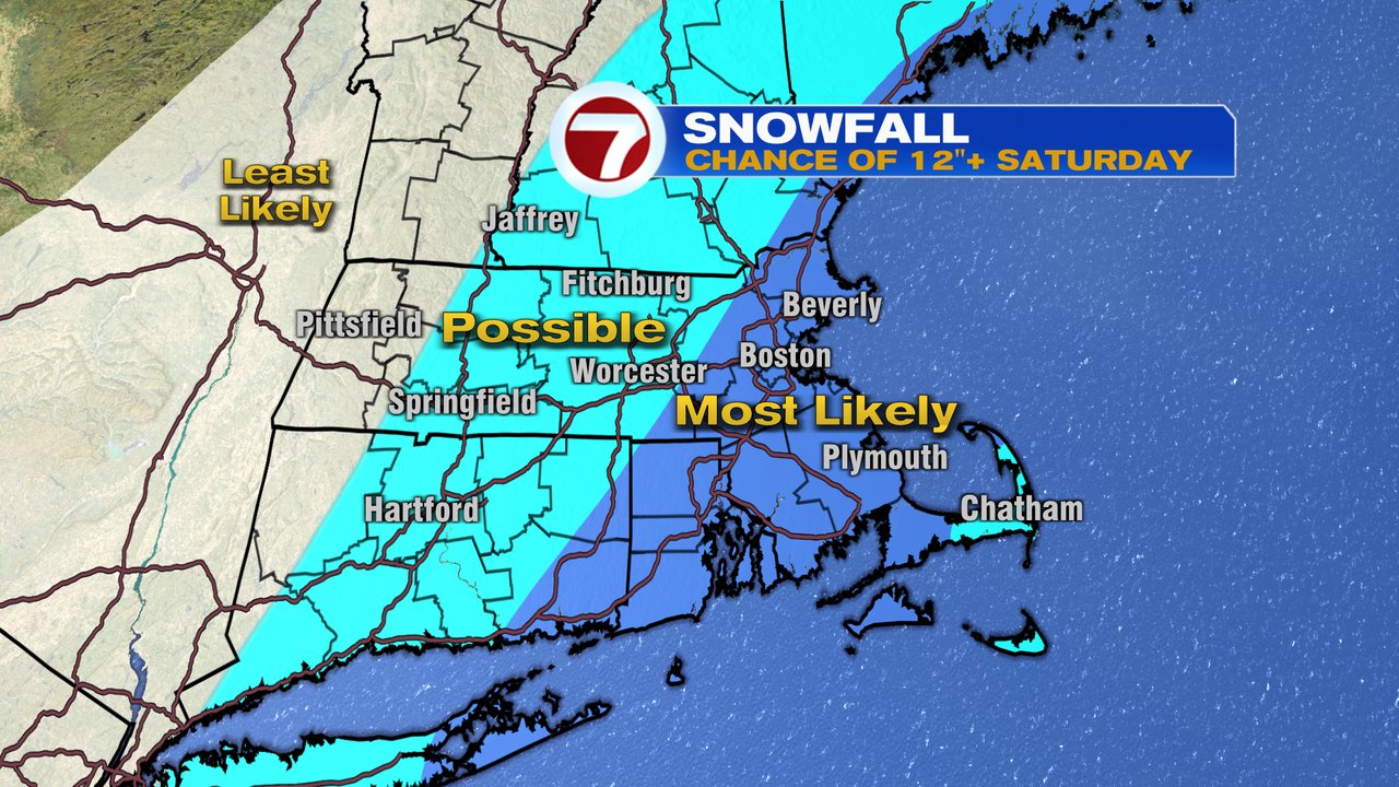
Snow totals in excess of a foot are possible across the eastern half of southern New England. Below is a current snapshot of where it’s most likely at this time. Keep in mind, a track a bit farther west brings that potential farther inland, and any adjustment farther east confines that level of snow more toward Southeast Mass with lighter snows inland.
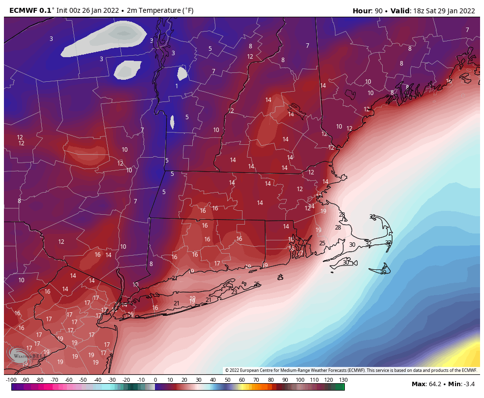
It does look like mainly a snow event as any mix/changeover is likely confined to the outer Cape/Nantucket, if any mixing at all. It’s a dry snow, as opposed to heavy wet/pasty stuff, too with temps in the teens to low 20s for most. Below is a temp snapshot midday on one the models. There also is a hint of a coastal front, which can help enhance snow totals along and just west of it.
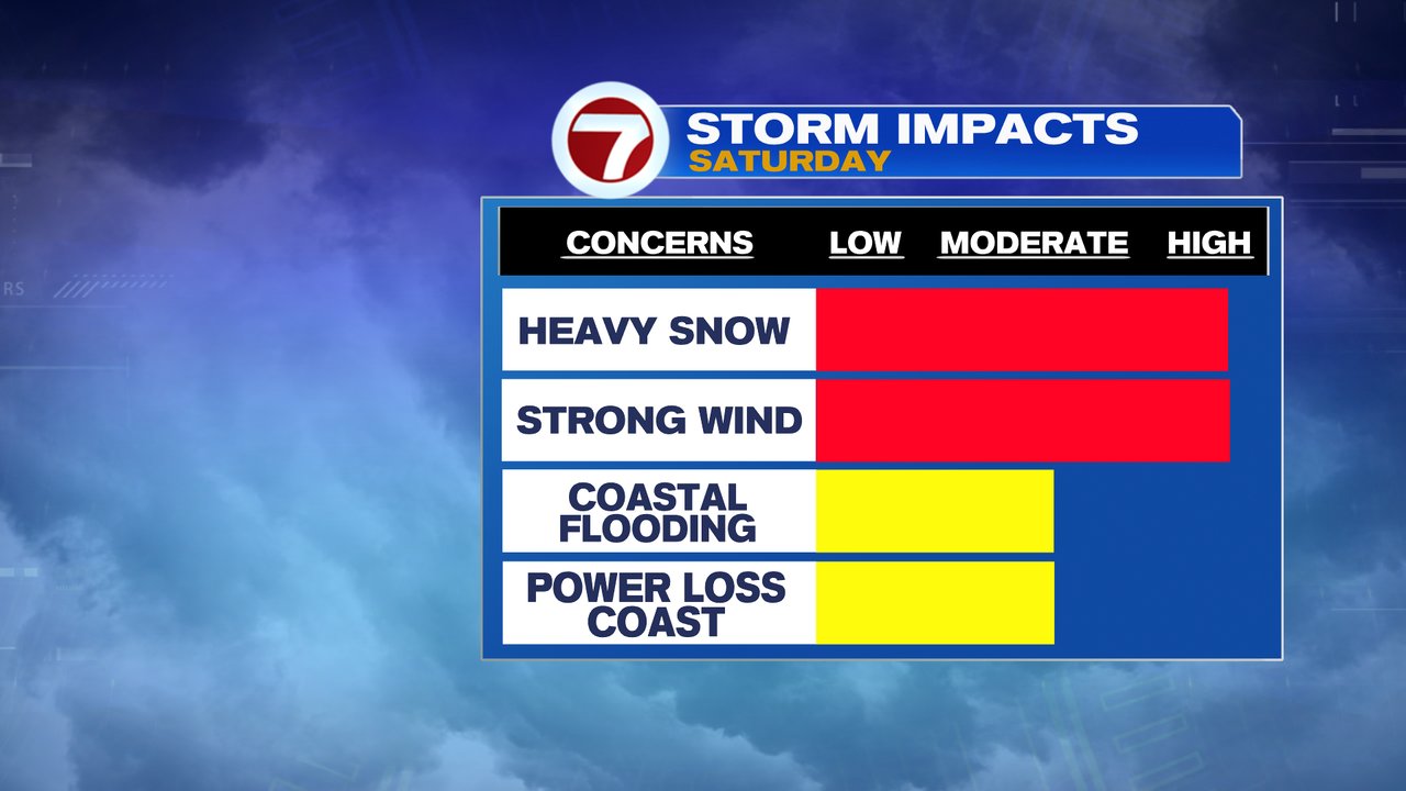
Winds ramp up Saturday as well, gusting past 50mph at the coast midday – early evening. Gusts to 60-70mph are possible across the Cape/Nantucket too. Minor to moderate coastal flooding and beach erosion is expected, however the strongest winds will likely occur after the astronomical higher tide of 8am, which will help mitigate against the full potential of the storm’s coastal flooding.
