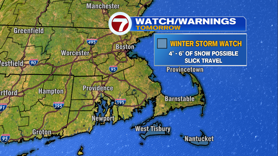
It looks like the northern edge of a storm system will reach the Cape & the Islands tomorrow. A Winter Storm Watch is in effect for tomorrow for Martha’s Vineyard and Nantucket.
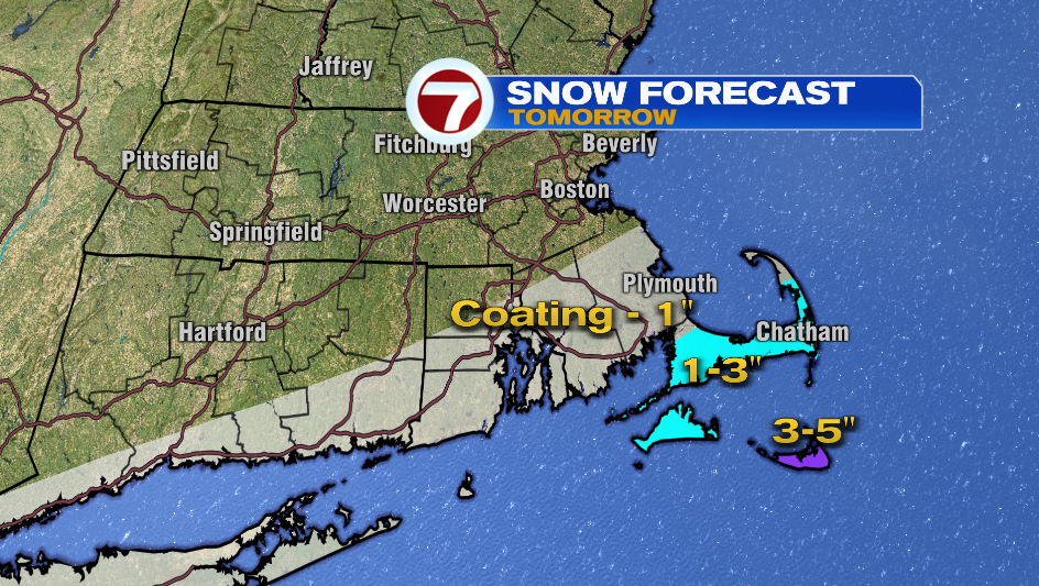
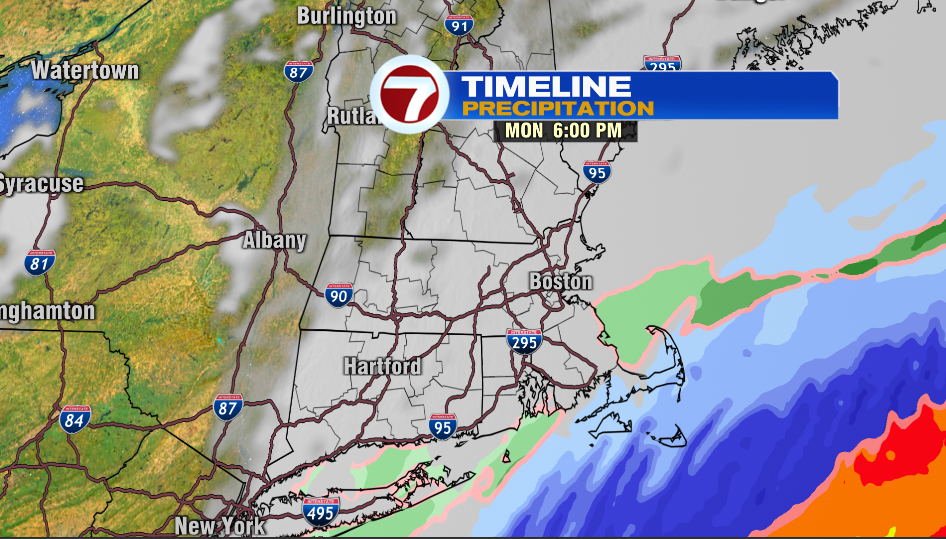
The steadiest snow will fall between 2-7 PM. Forecast: Coating -1″ for Bristol & Plymouth Counties, 1-3″ of snow for the Cape & Martha’s Vineyard, 3-5″ for Nantucket.
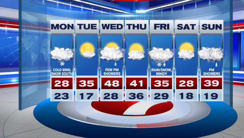
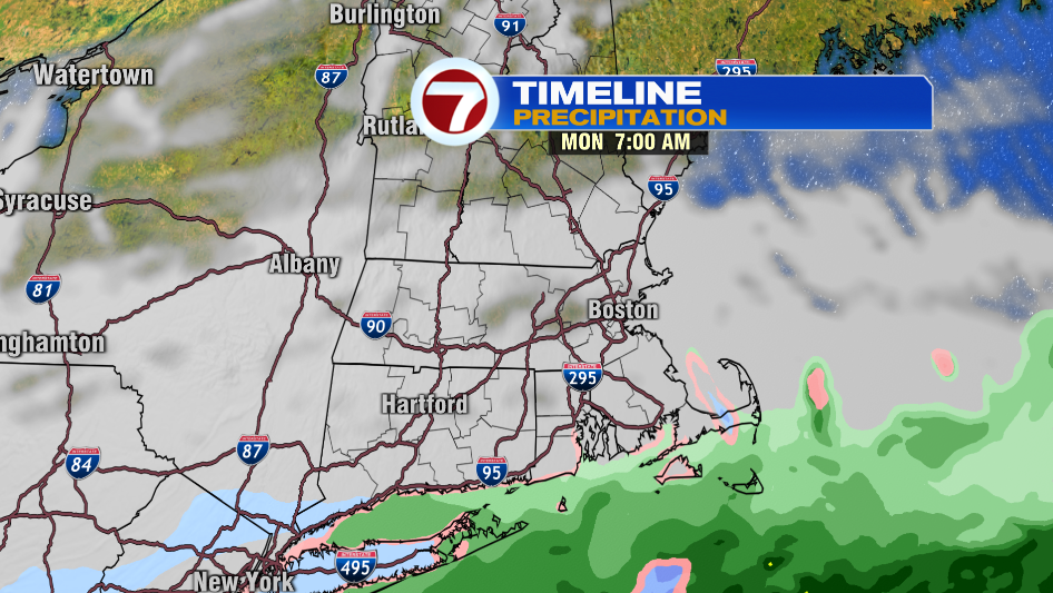
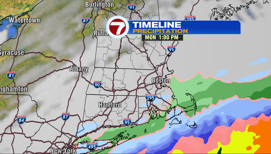
Precipitation starts as light rain in the morning for the Cape & the Islands, and then it flips to snow mid-day. The rest of the area is cloudy and cold. Highs only reach into the 20s. A cold wind will make it feel like the teens. We might see a few flakes in Boston but that’s it!
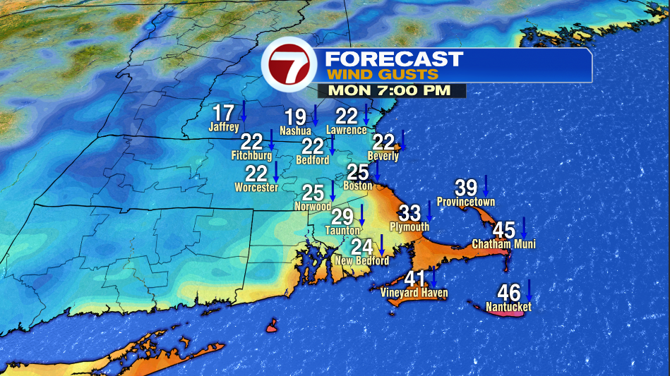
It will be breezy inland and windy along the coast tomorrow. Gusts will be between 30-40mph with the windiest window between 3PM – Midnight.
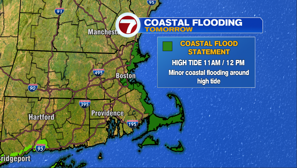
The combination of astronomical high tides and a northeast wind could result in minor coastal flooding during high tide tomorrow.
High Tides Tomorrow:
- Newburyport- 11AM
- Revere- 11AM
- Boston Harbor- 11AM
- Scituate- 11AM
- Chatham (east coast) – 12PM
- Vineyard Haven- 11AM
- Nantucket Harbor: 12PM
We’ll finally get some sun on Tuesday and it won’t be as cold with highs in the mid 30s. The clouds are back on Wednesday. There will be a few showers around as a warm front lifts in the afternoon. Temperatures jump into the upper 40s.
Thursday is partly to mostly cloudy with highs in the low 40s. We’ll be keeping a close eye on the track of a storm system on Friday that could bring rain, snow and windy conditions to southern New England.