7Weather- The cold air is back the next two days, and then our attention turns to a potential snow storm Saturday.
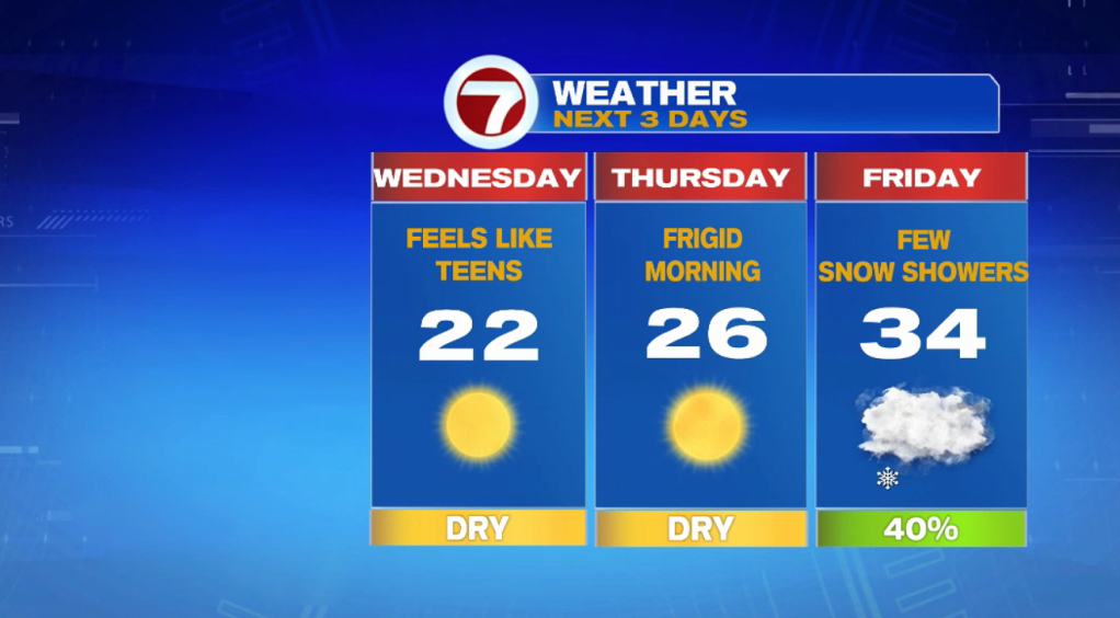
It will be cold when you walk out the door tomorrow with temperatures in the teens, but a cold breeze will make it feel like the single digits to below zero. That cold breeze sticks around the rest of the day. It will be sunny but the best we’ll do for our feels like temperatures will be in the low teens.
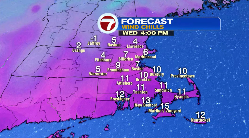
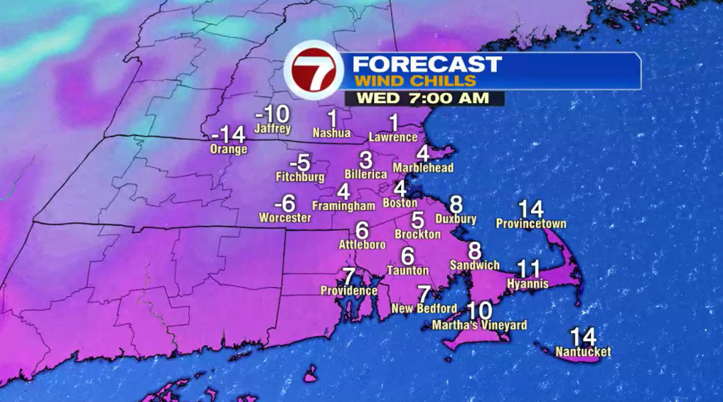
Thursday starts frigid with temperatures in the single digits. There will only be a light breeze but just that light wind will make it feel like subzero. Temperatures rebound into the mid 20s in the afternoon and there will be plenty of sunshine.
A cold front approaches the region mid-day on Friday. This will spark up a few snow showers throughout the day that will only amount to a coating of snow. Highs reach into the mid 30s.
A low pressure system will be offshore near the Carolinas Friday morning. It is expected to rapidly intensify, race up the East Coast, and get to us by Friday night. Heavy snow could start as early as midnight Friday night.
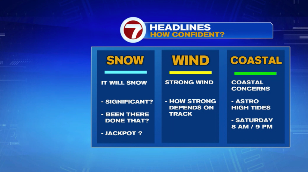
This could be a big one, but we’ll have to iron out the details as we go through the next few days.
For now, plan/prepare for a snow storm that could bring significant snow, damaging wind, and coastal flooding.
For planning purposes, it looks to be a 24 hour storm where we get the most of the accumulation from midnight Friday – midnight Saturday. There could be power outages with the combination of snow weighing on trees and winds gusting to 50mph.

If things line up, this is a storm that is capable of producing more than a foot of snow. For now we are keeping it generic (the low pressure system hasn’t formed yet).
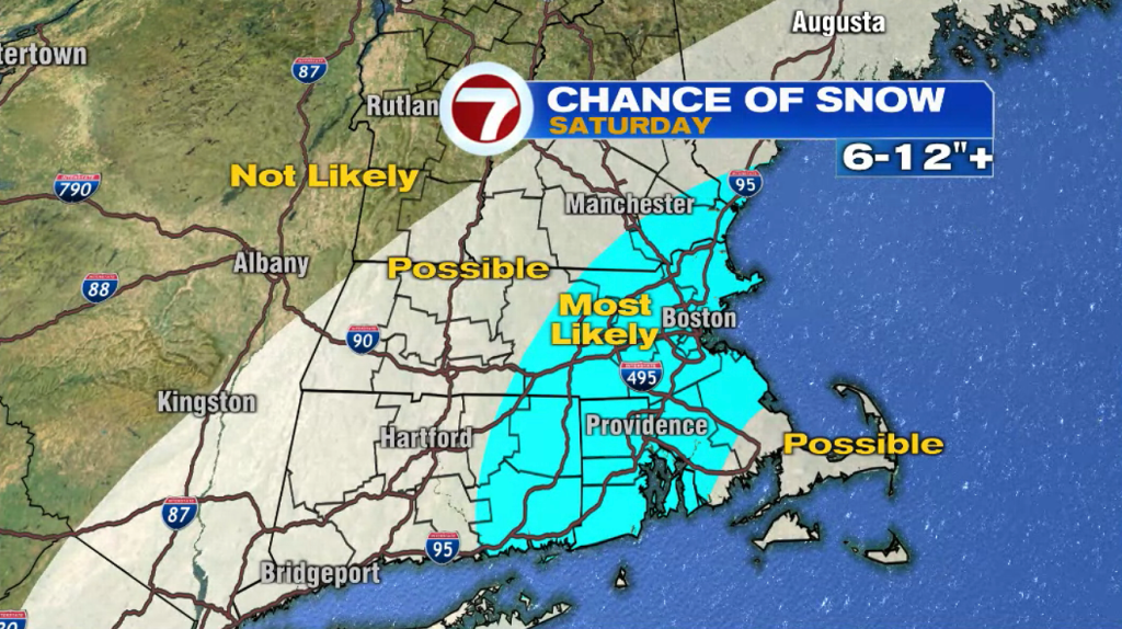
The locations in the blue color below are more likely to get 6-12″, perhaps more. Snow totals will be dependent on the track of the storm and whether or not we have a changeover to rain along the coast.
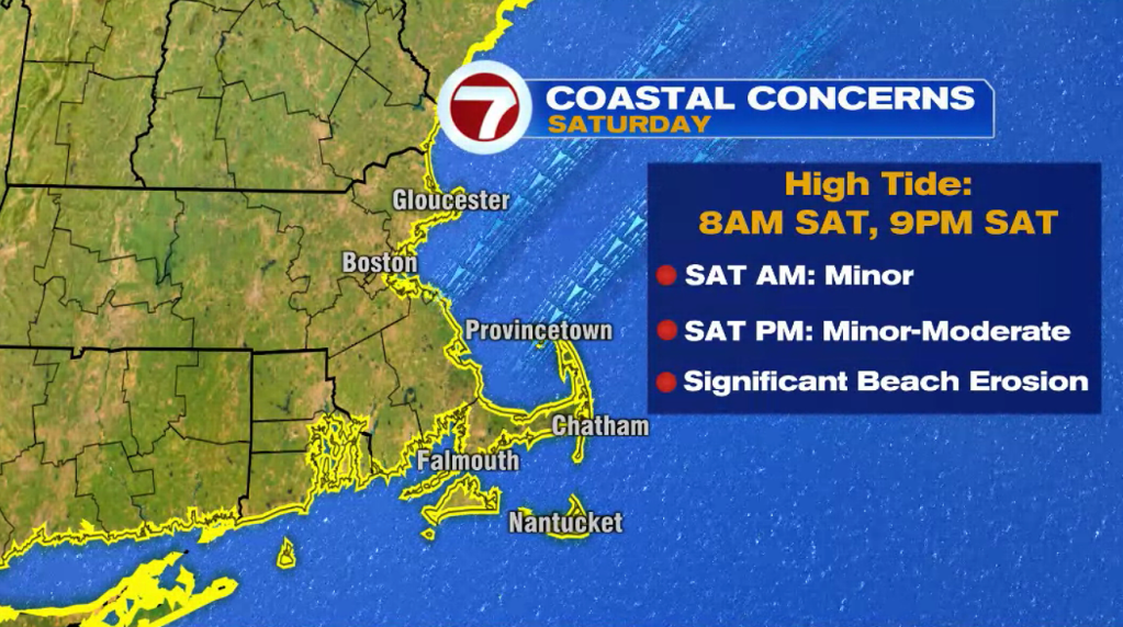
We will be dealing with astronomical high tides this weekend, so coastal flooding will be a concern, regardless of the storm track.
There will be a persistent, strong northeast wind Friday night – Saturday night. Minor coastal flooding is likely for the Saturday morning 8AM high tide, and minor to moderate coastal flooding is likely throughout the 9PM Saturday evening high tide.
Expect to wake up to significant beach erosion Sunday morning.