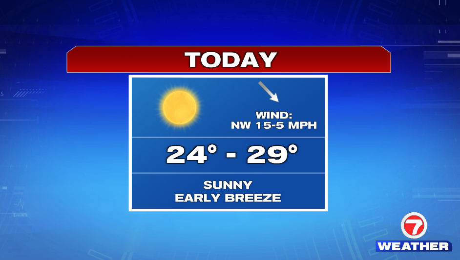
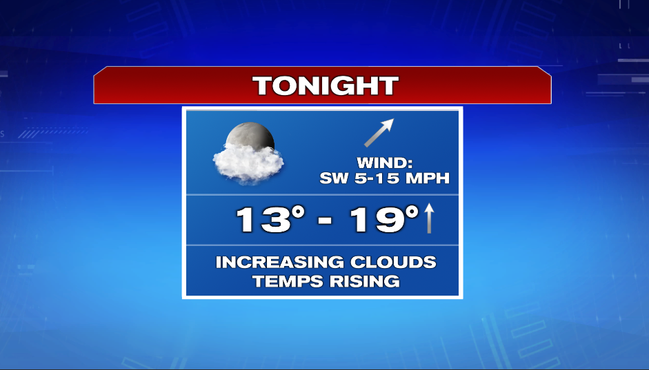
Today is sunny and cold. The day starts with a breeze, but wind fades into the afternoon. Highs reach into the mid and upper 20s. We dip down into the teens this evening, but temperatures rise overnight into the mid and upper 20s.
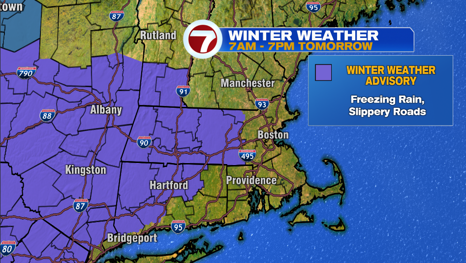
A Winter Weather Advisory is in effect from tomorrow for Worcester County and northwest Middlesex County. Light freezing rain will make for slick spots on untreated surfaces.
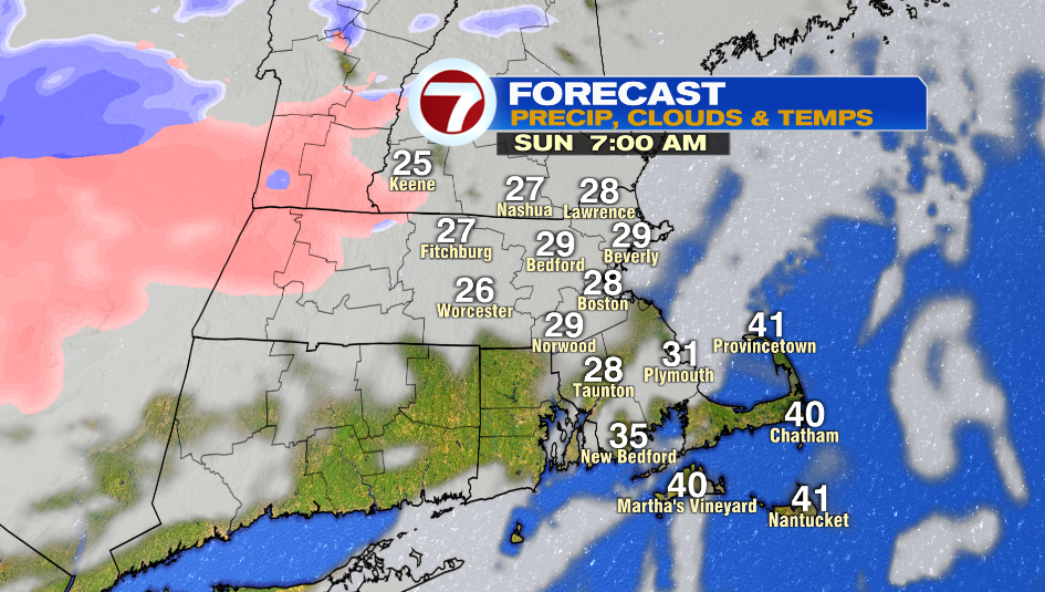
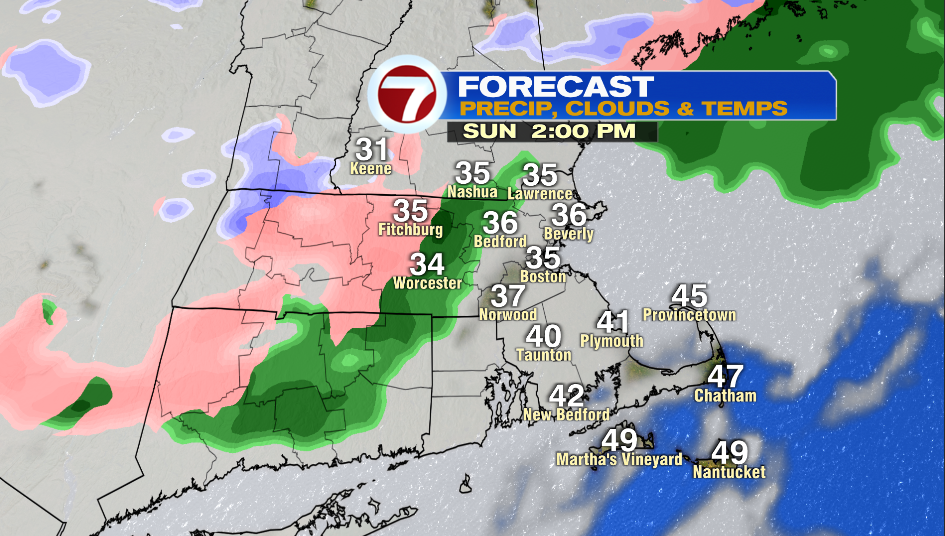
Sunday morning will be mainly cloudy with temperatures in the mid and upper 20s. We’ll jump into the mid 30s by lunch time, but some inland areas might get stuck near freezing and this is when we could see ice.
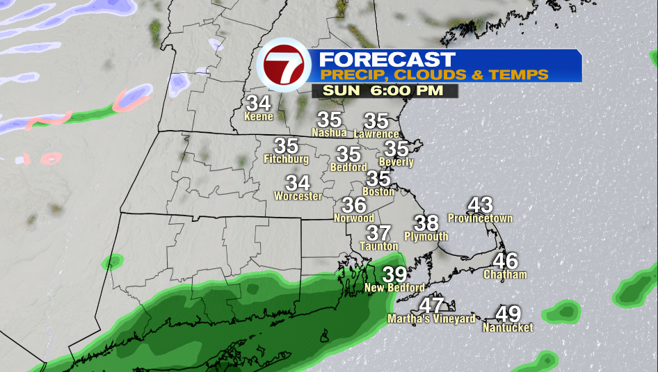
Areas inside of I-495 will see a few rain showers in the early afternoon, and then spotty rain in the evening. It is not a washout. Highs reach into the mid and upper 30s and it is breezy with winds are 10-20 mph.
We’re back to cold and sunny weather to kick off the week. Highs are in the low and mid 20s, but a cold breeze will make it feel like the teens.
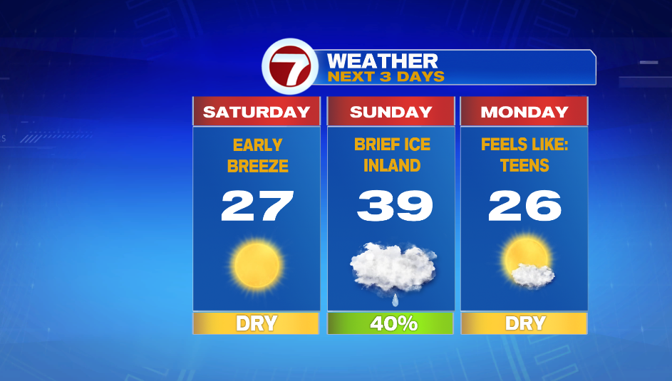
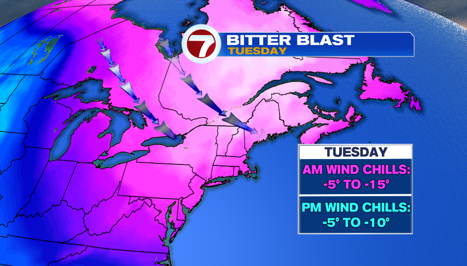
We’re talking dangerously cold wind chills on Tuesday. It looks like it’ll feel like 5 to 15º below zero in morning with little to no improvement in the afternoon.