

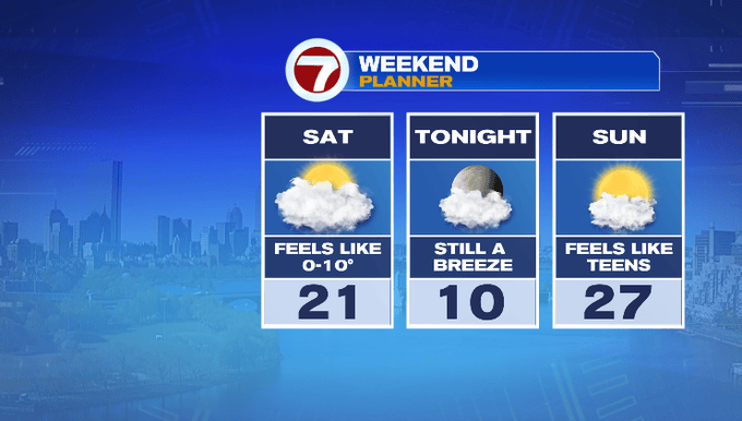
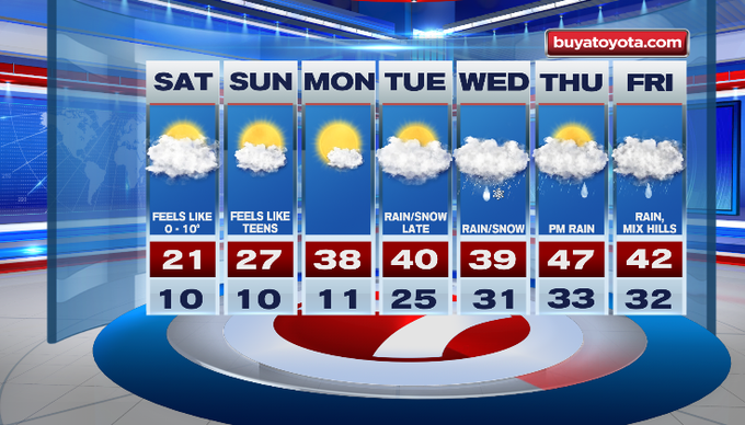
It’s the coldest morning of the season so far! The colder air is with us for the weekend. It’s going to feel much colder with a gusty northwest wind. Our mornings start off with some towns below zero. Temperatures eventually rebound to the 40s next week with an unsettled pattern.
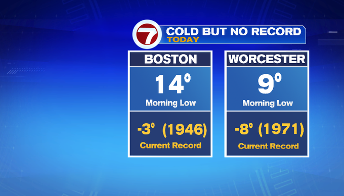
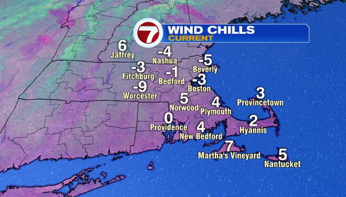
It’s cold, but not record cold this morning. Air temperatures have fallen below zero on this date in history for Boston and Worcester. Still, you’ll want the thick winter coat, gloves, scarves and maybe even hand warmers if you have them! Our wind chill values feel like it’s below zero and the single digits. These were your wind chill values as of 7 a.m.
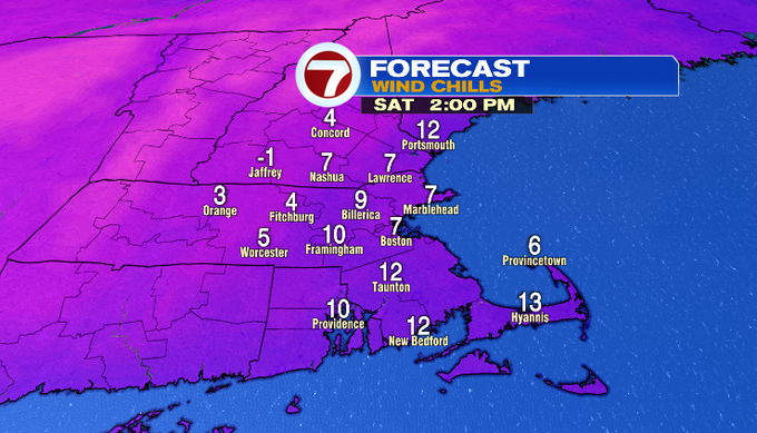
Today’s temperatures are starting off in the single digits and teens. Through the day, we’ll see mostly clouds as we continue to bring in colder air with a breezy northwest wind. Temperatures will struggle to get higher than the low 20s for a lot of us. It’ll be in the teens for Worcester County. Just like in the morning, it’ll feel colder, more like the single digits.
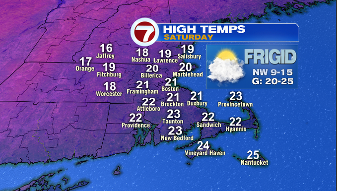
A trough will rotate in a chance for flurries this afternoon. It shouldn’t amount to anything outside of a dusting in the Berkshires. More ocean-effect snow showers will occur across the Cape this evening and tonight. A coating to 1″, localized 2″ is possible for the Mid to Outer Cape.
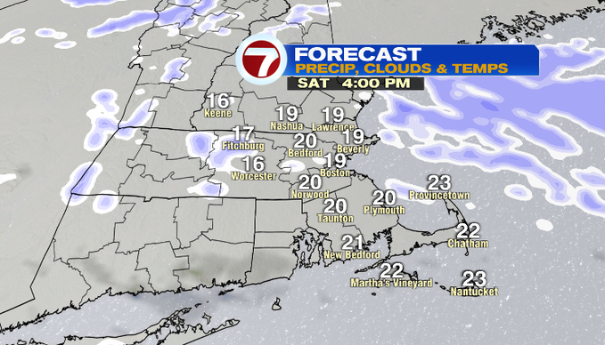
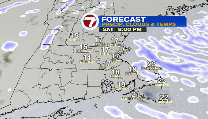
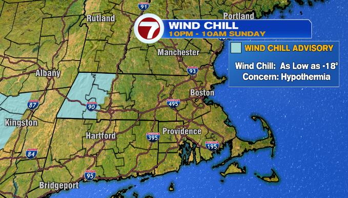
Tomorrow morning will be similar to Saturday, if not a degree or so colder. We’ll have mainly clear skies overnight and that’ll easily drop temperatures. Once again it’ll feel like it’s below zero for areas north and west of the region. A Wind Chill Advisory is up for the eastern slopes of the Berkshires from 10:00 tonight through 10:00 am tomorrow. That’s where wind chills could be as low as -18. If you know someone who lives out there, check on them to make sure they take the proper precautions to prevent hypothermia if outside.
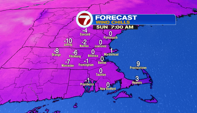
Sunday afternoon air temperatures improve by a few degrees with highs in the upper 20s. The wind will still be with us, so count on it feeling like the teens. We should see a fair amount of sunshine though!
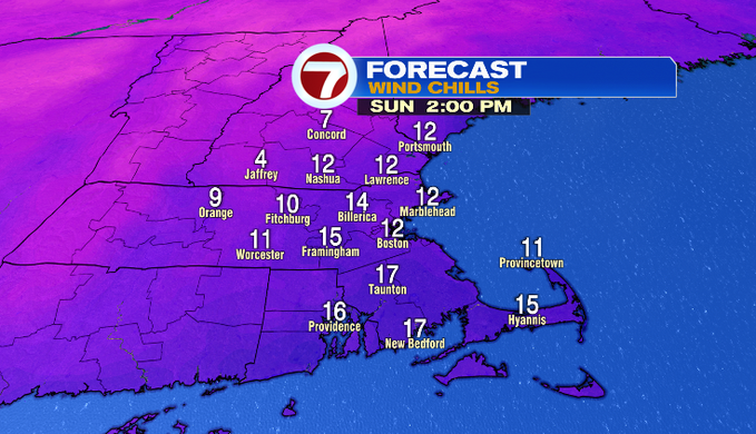
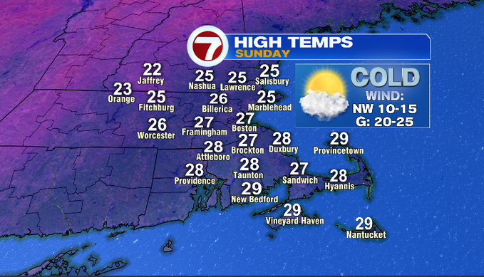
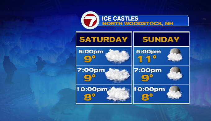
In a nutshell, yes, it will be a cold weekend. Maybe that won’t stop you from getting outside. Here’s your forecast to check out the ice castles in New Hampshire or walk around the city before/after tonight’s Bruins game.
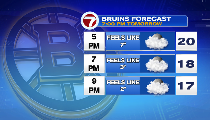
A bit more sunshine returns for Monday. Temperatures will be closer to average. We’ll get some days near/in the 40s next week. It’ll come with an unsettled pattern at least through next Friday.
Stay warm this weekend!
Meteorologist Melanie Black