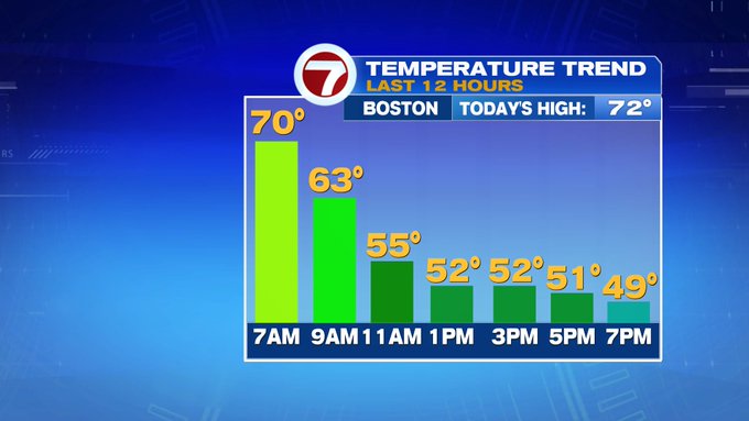
Highs today reached into the low 70s earlier this morning before they fell through the afternoon and evening with a gusty northeasterly wind off the cooler ocean waters.
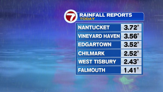
Plus, we saw a gradual clearing of the skies from north to south, but soaking rain continued across portions of the Cape and the Islands, flooding some roadways. Between 1.5″ to 3.5″ of rain fell over less than a 12 hour period. Thankfully, drier conditions prevail for the rest of the holiday weekend.
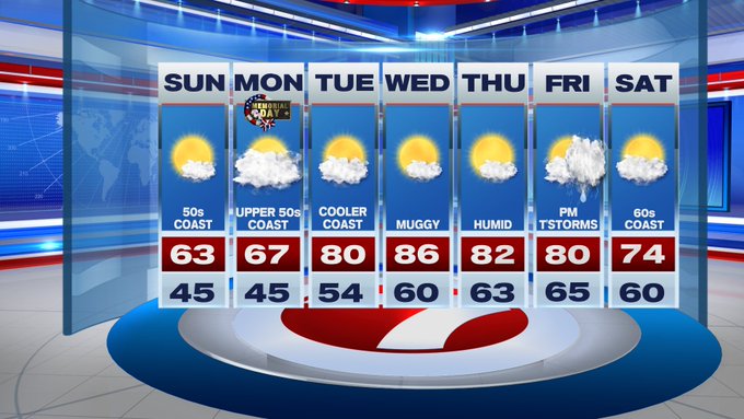
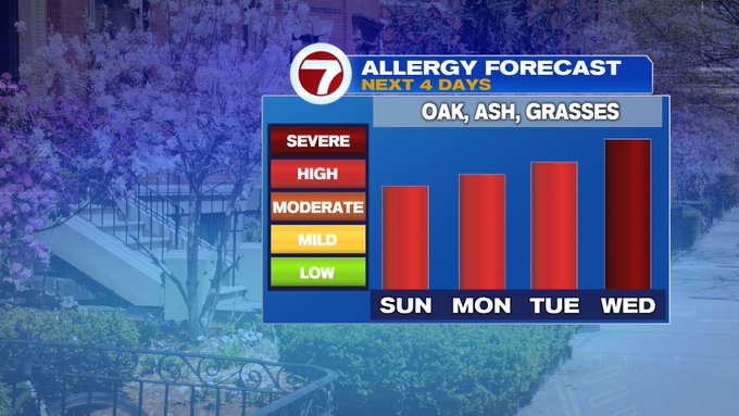
With those drier conditions, expect the pollen count to climb. By Wednesday, coupled up with highs in the 80s and rising humidity, the pollen count will peak.
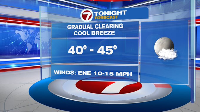
Overnight tonight, temperatures will continue to drop back into the low to mid 40s with a cool breeze.
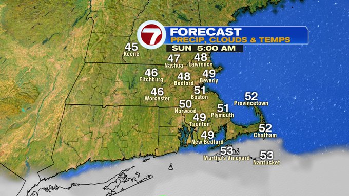
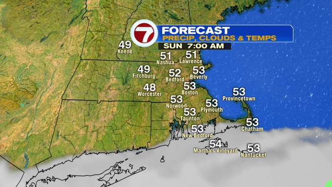
After a cool start, temperatures rebound into the low 60s inland, 50s at the coast Sunday under mostly sunny skies.

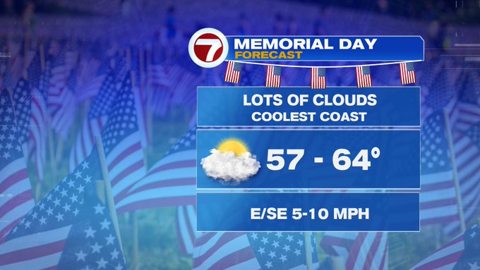
Clouds return for Memorial Day with some peeks of sun at times with highs into upper 50s at the coast, upper 60s inland.
The humidity returns next week along with the 80s! A line of thunderstorms moves in ahead of a cold front midday Friday, kicking out the humidity just in time for next weekend.