While rain totals varied quite a bit across the region yesterday, the amounts near and south of the Mass Pike were beneficial with most locations picking up between 0.50-1.50″ there. In fact, parts of southern Plymouth County, including Plymouth picked up near 2″.
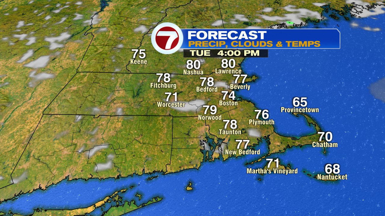
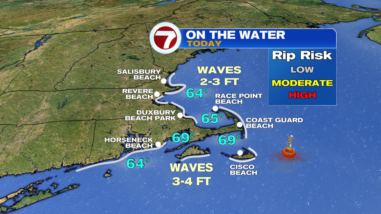
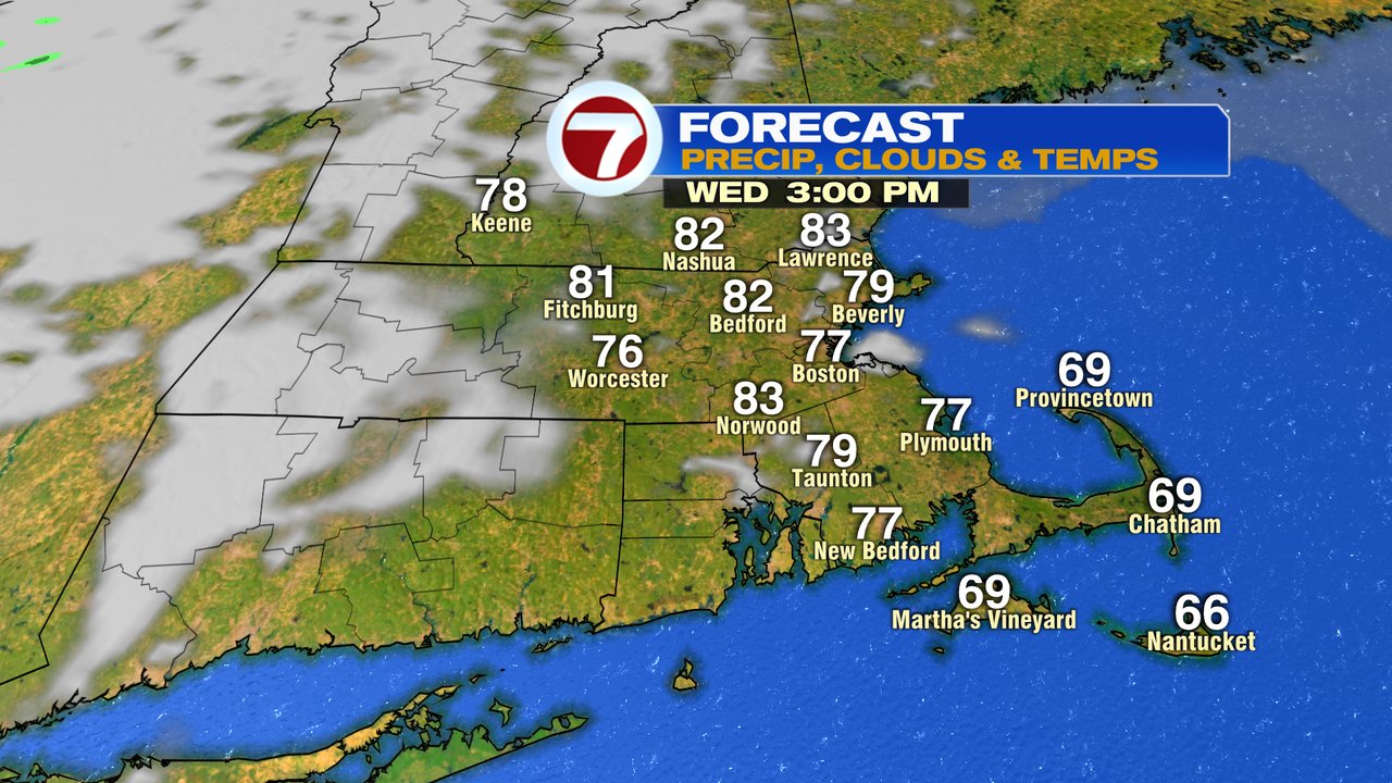
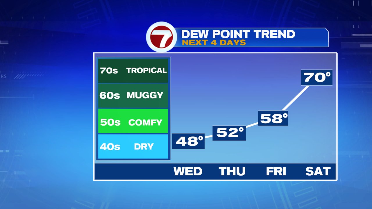
That rain has moved offshore this morning and in its wake, we’re drying out nicely. Not only in terms of the rain ending, but also the low humidity moving back in. With dew points back into the 40s and low 50s today, it’ll be a fantastic June day. Temps run in the low to mid 70s at the coast, low 80s inland.
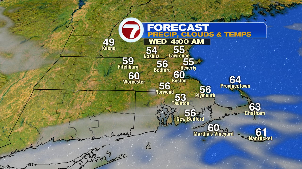
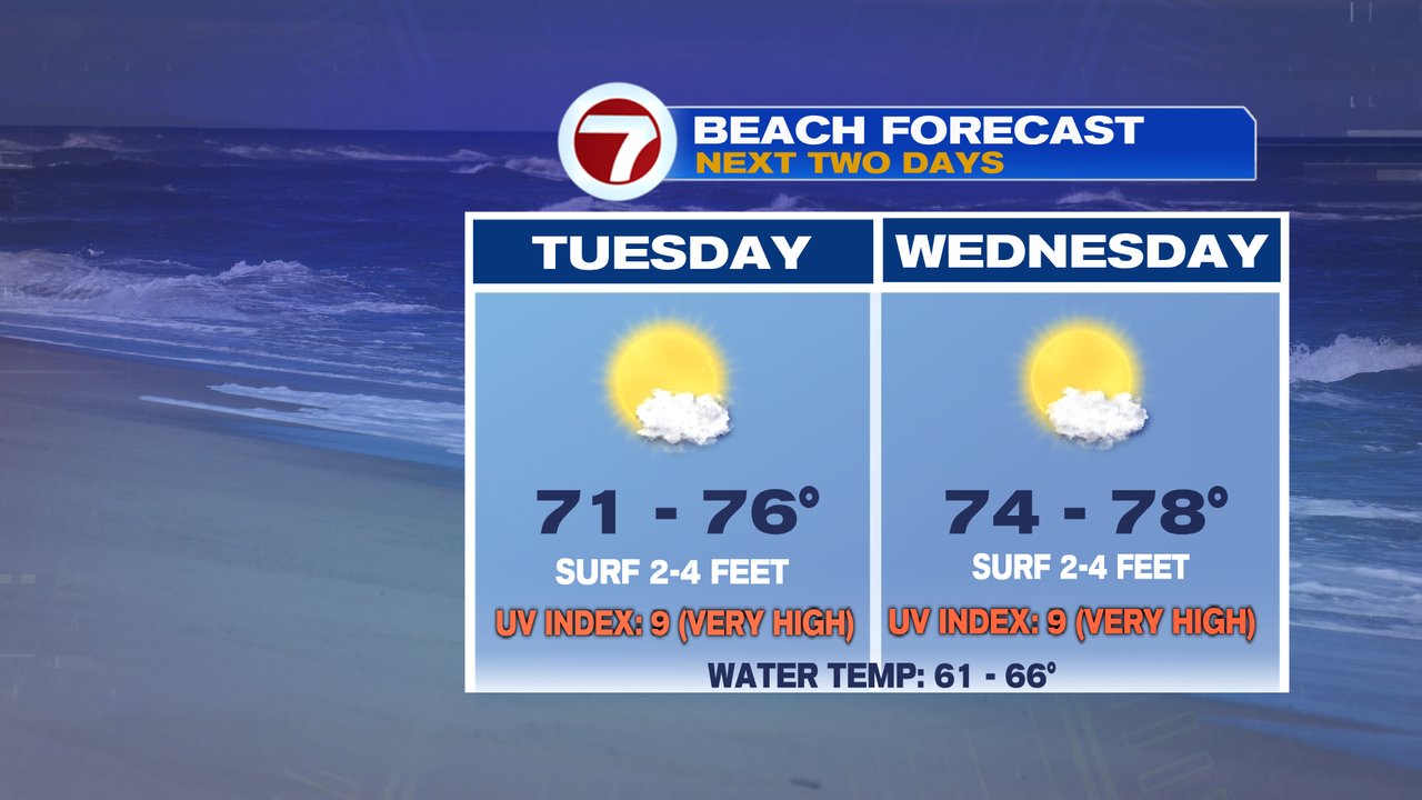
With low humidity in place, it’ll be very comfortable overnight with low in the 50s to near 60. With more sunshine for tomorrow, temps bounce back up to the mid to upper 70s at the coast, low to mid 80s inland. Temps continue to climb toward the end of the week with highs pushing into the low to mid 90s by Friday.

Humidity ticks up toward the end of the week too, and really jumps up Friday night into Saturday. With high humidity, warmth and an incoming cold front, scattered storms develop Saturday, with the highest chance Saturday afternoon, into Saturday night.
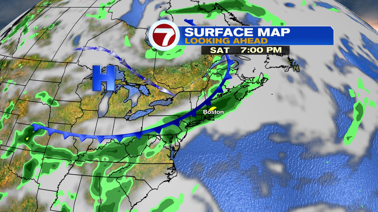
On the other side of that front, humidity lowers a bit, but we stay seasonably warm with highs in the 80s Sunday and Monday as we dry out heading into the 4th.