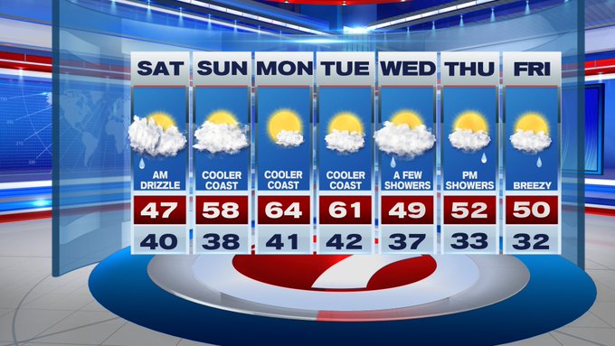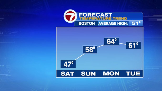
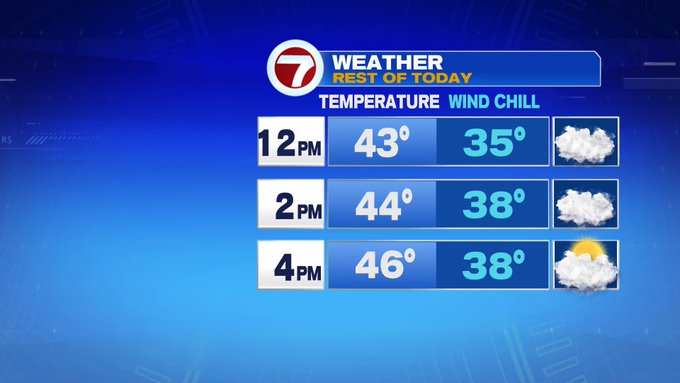
Cloudy with some sunny breaks for our Saturday afternoon, but it will come with a bit of chill in the air. Highs today will only stretch into the upper 40s, with wind chills likely in the mid to upper 30s as winds remain out of the northeast at 10 to 15 mph.

Tonight, lows only dip into the 30s under partly to mostly cloudy skies and calmer winds.
Sunday is the pick of the weekend, due to a warm-up with highs into the upper 50s inland, low 50s at the coast under mostly cloudy skies. A spot shower may pop up by the evening, but overall, the daytime hours are dry.


Monday and Tuesday are the nicest days out of the next 7 as 60-degree highs return both days under mostly to partly sunny skies!

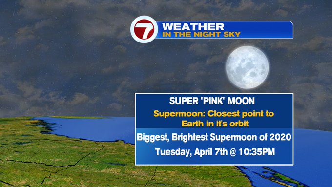
Speaking of Tuesday, don’t forget to look up at the night sky to see the Supermoon! It’s considered the Super “Pink” moon, but it will not be pinkish in hue, it’s named that due to a pink wildflower that typically blooms this time of the year. It will be the biggest and brightest supermoon of the year, but it will not be the last. The next one will be May 7th.
Wednesday turns cooler with clouds and a few showers in through midday. Thursday and Friday also bring a chance for showers, but all three days do not appear to be washouts. Both Thursday and Friday feature high temperatures around normal, low 50s.