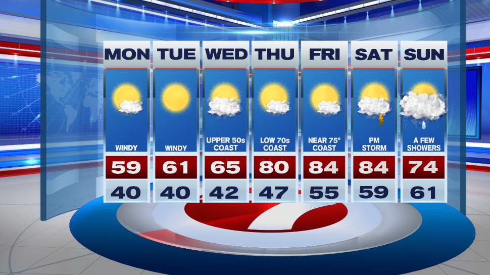
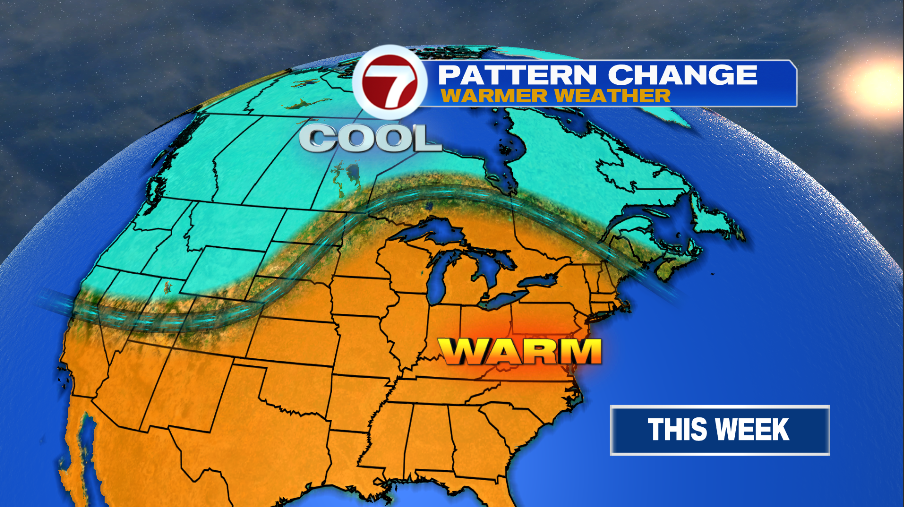
7Weather- We are still stuck in this cool and windy pattern to kick off the week, but it gradually warms up as we end the week.
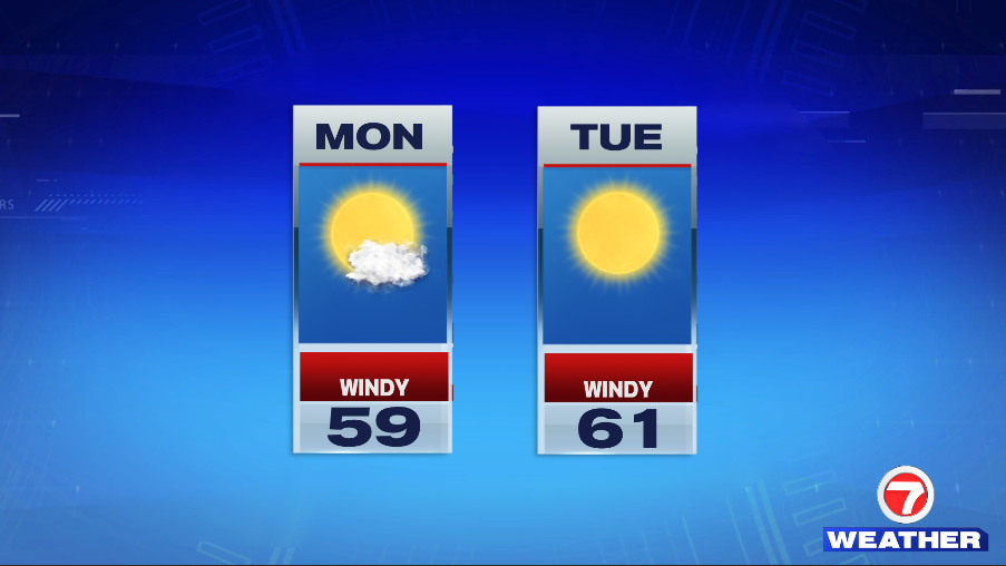
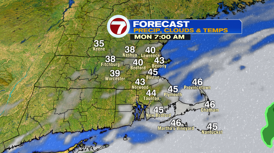
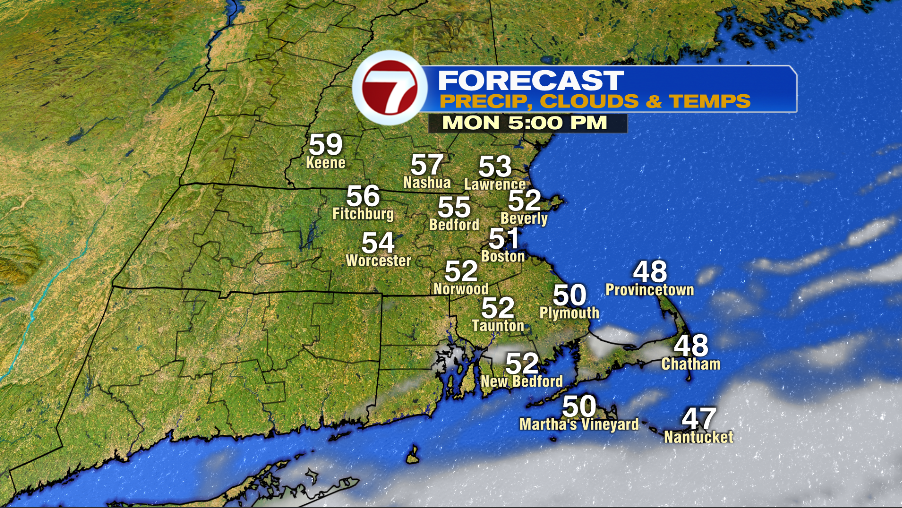
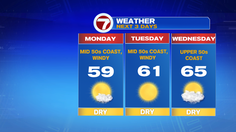
Monday morning is bright for most locations and temperatures are in the low and mid 40s. Highs are close to 60º inland, and in the mid 50s along the coast.
Once again, it is windy with with a northeast wind at 15-25mph, gusting to 30mph.
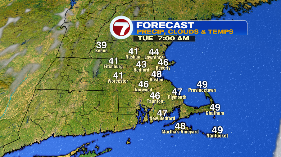
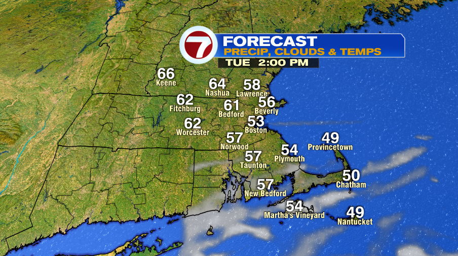
Tuesday morning is sunny and cool with temperatures starting off in the low and mid 40s. We keep a gusty wind around and highs make into the low 60s inland. An onshore wind keeps the coast cooler in the mid 50s.
Wednesday is tricky. We’ll have to see how close a low pressure gets to us. For now we’ll go with a mix of sun and clouds and highs in the mid 60s inland, upper 50s at the coast. It breezy in the morning, and then wind dies down throughout the day.
It’s time for a pattern change. We’ll been stuck with cool weather, but now it looks like we’ll change things up starting Thursday.
Thursday still has a very light onshore wind so Boston and areas along the coast get stuck in the low 70s. Inland areas make it into the upper 70s and low 80s.
There’s a chance we have lots of clouds on Friday. That could make it a bit cooler. For now we’ll keep it warm with highs in the mid 80s inland and in the mid 70s along the coast.