Well, that was certainly a dramatic drop yesterday as winds kicked northeast and temps tumbled 15-20 degrees within about 15 minutes. Overall, it was a refreshing breeze inland and a chilly one at the coast.
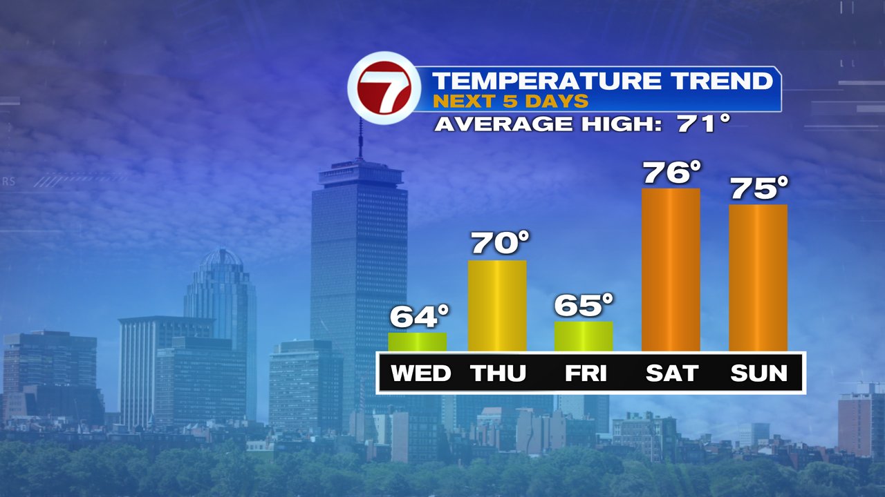
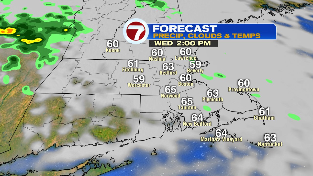
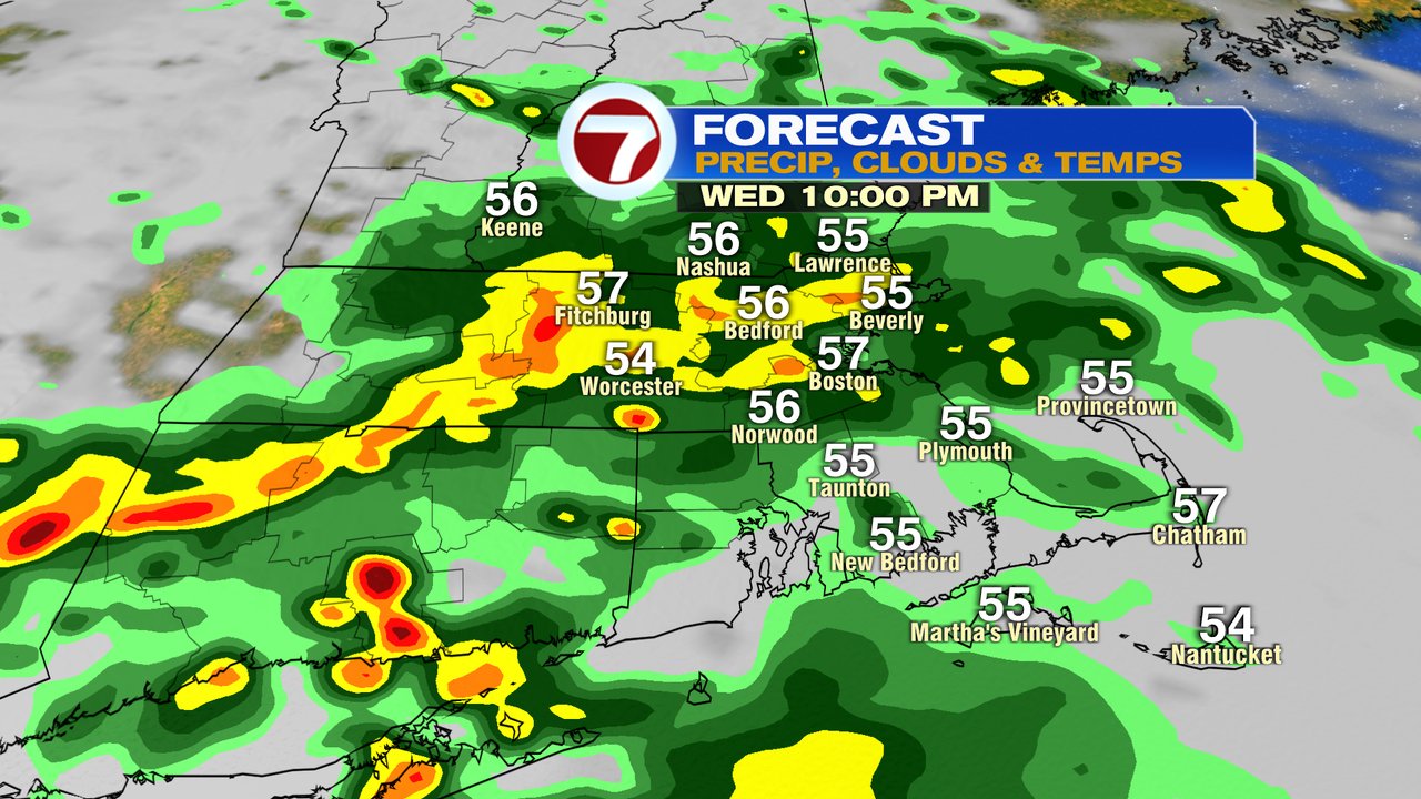
In the wake of that front, we’re on the cooler side today with temps running in the 50s this morning, rebounding into the low to mid 60s this afternoon. Expect a few isolated showers from time to time this morning, into mid afternoon, but also a lot of dry stretches. Late this afternoon and especially this evening, shower coverage area does increase, so I would expect more wet weather by then. Widespread showers this evening will taper off early tomorrow morning.
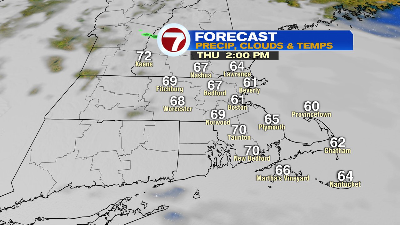
Clouds start the day tomorrow with breaks of sun in the afternoon. Highs tomorrow run near 70 inland, 60-65 at the coast.
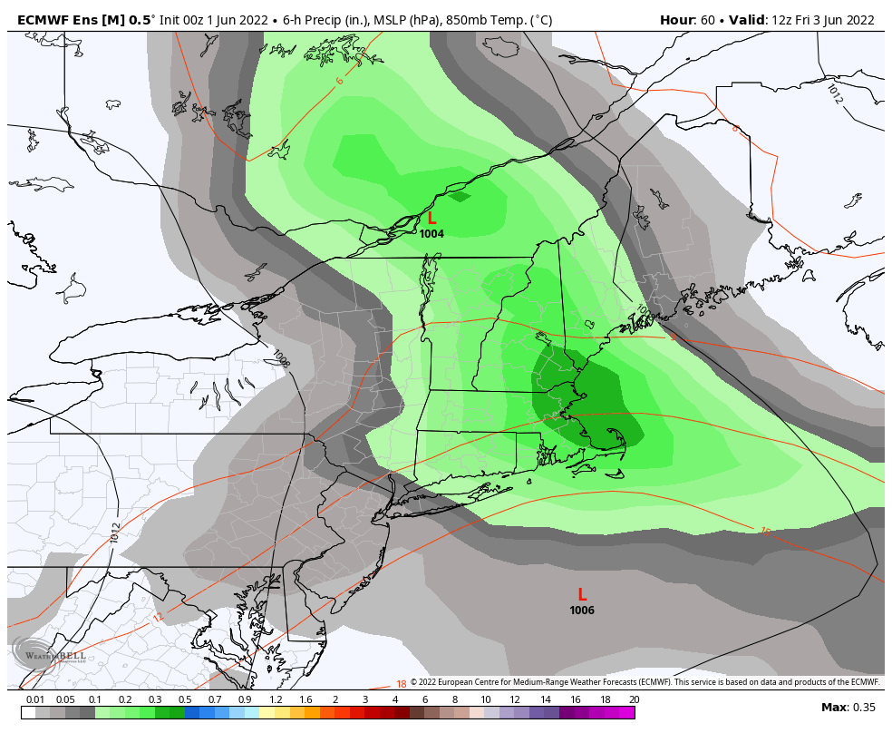
A renewed chance of steady rain moves in Thursday night, into early Friday. Friday will be a cool day with some leftover isolated showers through the afternoon, a lot of clouds and temps stuck in the low 60s.
Fortunately, that unsettled weather gets kicked off to the east of us for the weekend, allowing for a seasonable Saturday and Sunday for early June with temps in the 70s by afternoon, 40s/50s at night and mainly dry conditions to prevail.