Once again, we’re waking up to a fantastic start to the day with temperatures in the 50s and 60s early on. Initially, sunshine warms us up and highs recover to near 80 inland, 70-75 at the coast. Across the Cape, it’ll turn a bit breezy and cloudy this afternoon as a developing storm to our south starts to get closer to Southern New England.

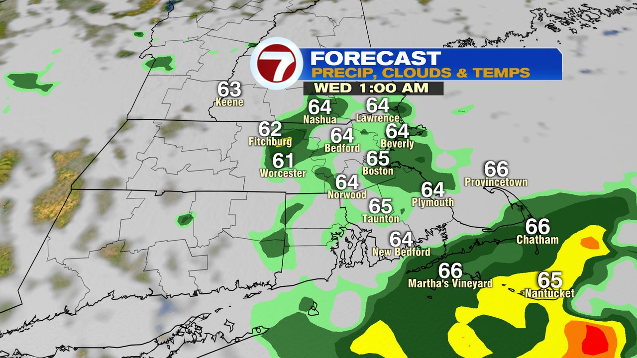
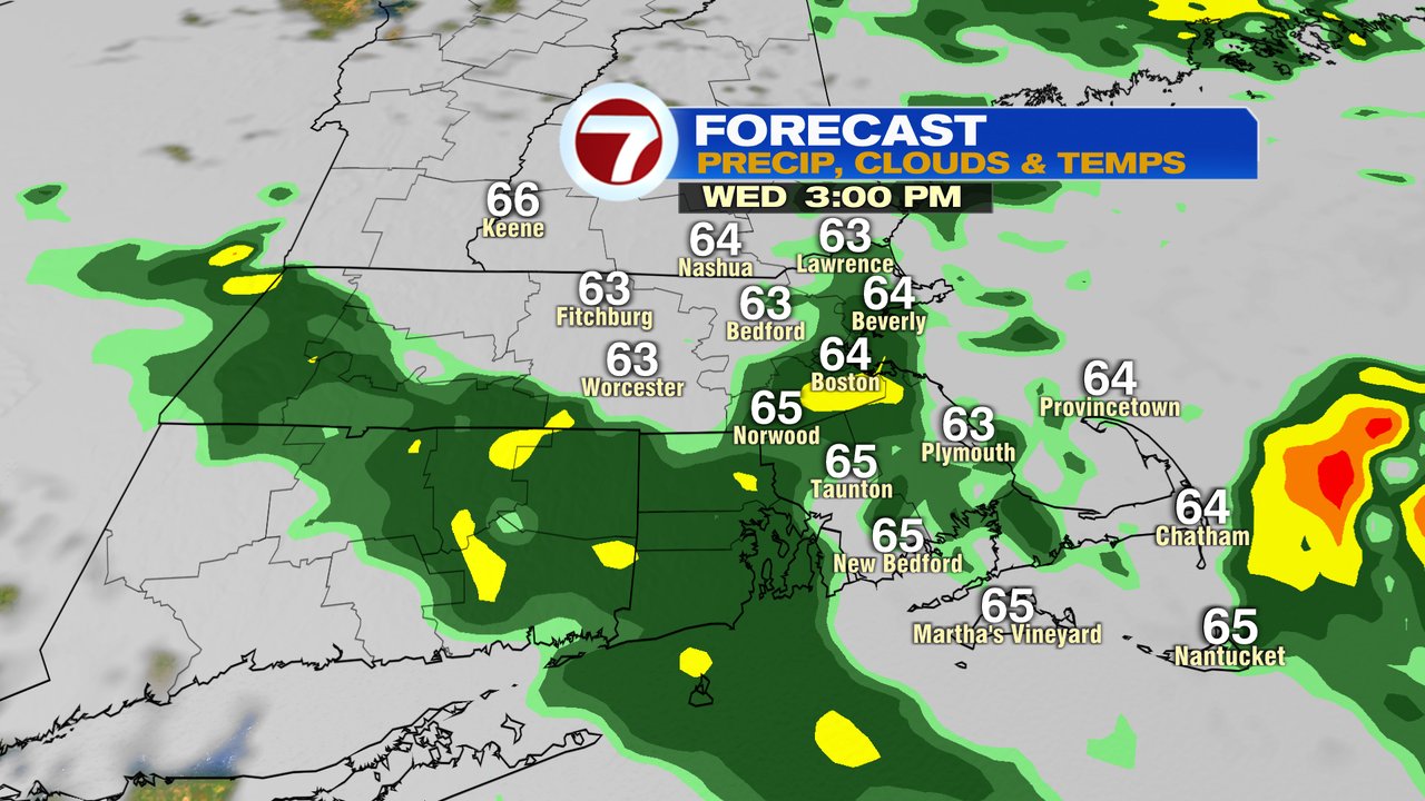
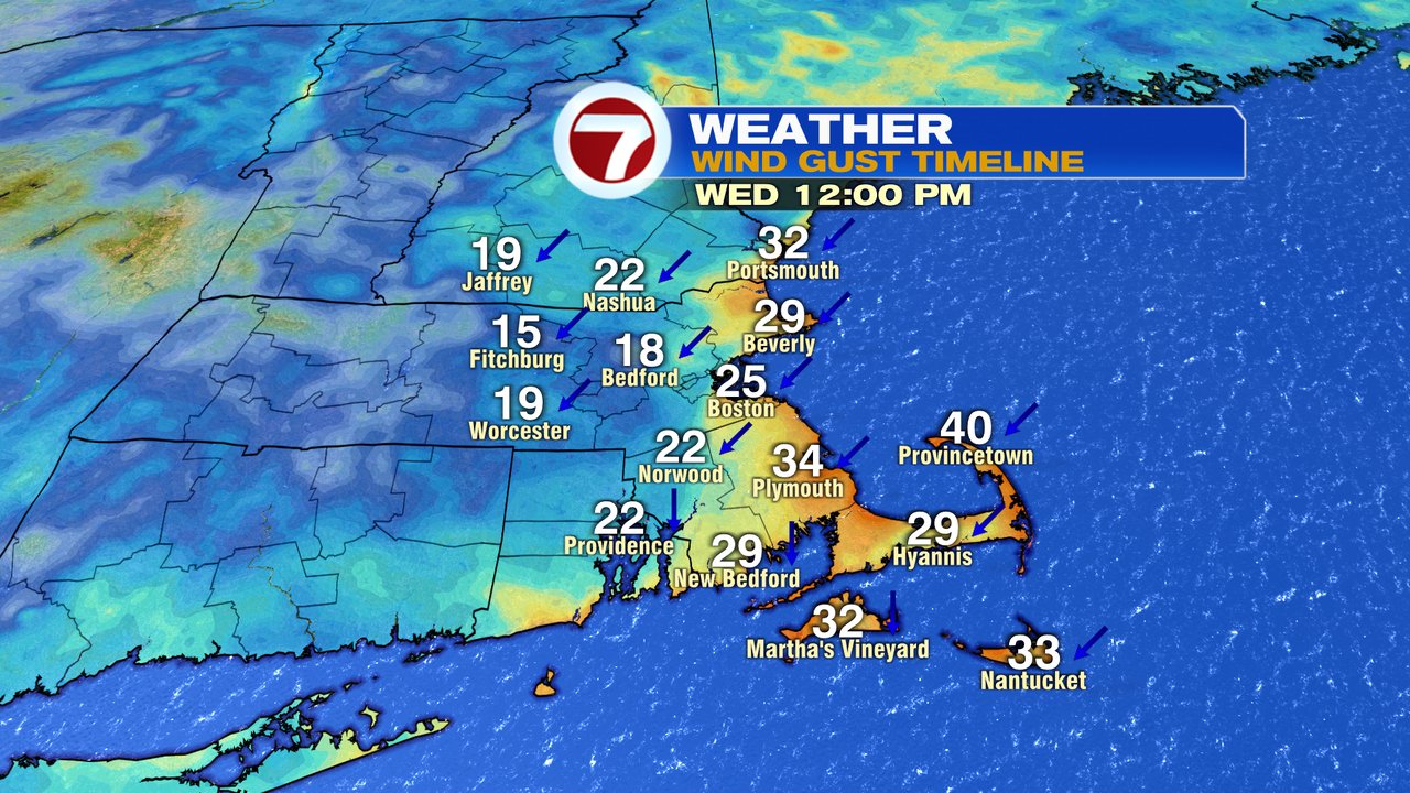
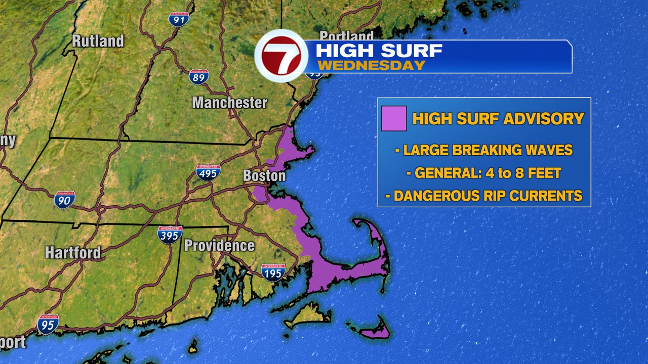
That storm is what we’re watching for tomorrow as it gets closer to our coastline, spreading in showers late overnight tonight and periodic rain tomorrow. With clouds and showers in place tomorrow, it’ll be a much cooler day with temps in the 60s to near 70. The wind increases too with gusts 20-35mph at the coast, strong across the Cape. Seas are turned up too with waves breaking at 4-8 feet, prompting a high surf advisory for the day. The rip current risk will be high too.
Clouds break for some sun Thursday and full on summer mode returns Friday – weekend with highs back into the mid 80s to near 90 then. Friday, Saturday and most of Sunday look dry, aside from a few isolated storms possible Sunday afternoon/evening.