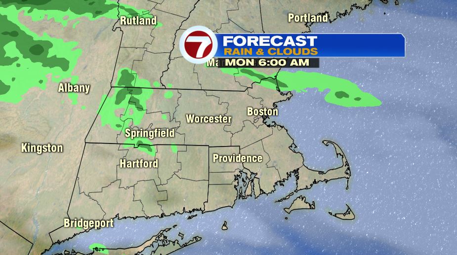
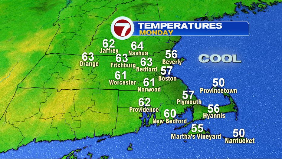
7Weather- The start of the week will be cool, after a warm weekend. Monday. It will be overcast the first part of the day, but then there will some clearing, especially north, late in the afternoon. This clearing will allow us to get into the low 60s inland. A northeast wind keeps the coast in the 50s.
A high pressure system likely keeps clouds out of the area on Tuesday. This system blocks two low pressure systems from bringing clouds and rain, but it does give us a breezy onshore wind. This means it will be another cool day, even cooler than Monday. Highs inland will be in the mid and upper 50s, but the coast gets stuck in the low 50s. Overall, it is a nice day with sunshine.

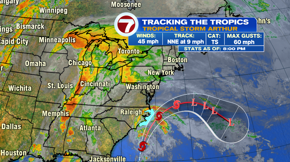
The first named storm of the 2020 hurricane season formed Saturday evening. It will remain a tropical storm Monday, and then it becomes a post-tropical storm by Tuesday. It will be off the cost of North Carolina on Monday, where there is a Tropical Storm Warning in effect. Tropical storm-force wind and periods of heavy rain are likely Monday. The system continues to move northeast, and then takes a quick turn east, and out to sea.
Wednesday looks mainly sunny with highs in the low 60s inland, and in the upper 50s along the coast. Thursday is warm in the mid 70s, and there will be a mix of clouds and sun.
