After feeling the heat yesterday, to the comfortable and sunny skies today, it will be a big shift as we head into the holiday weekend as cooler temperatures and rain chances return to the region.
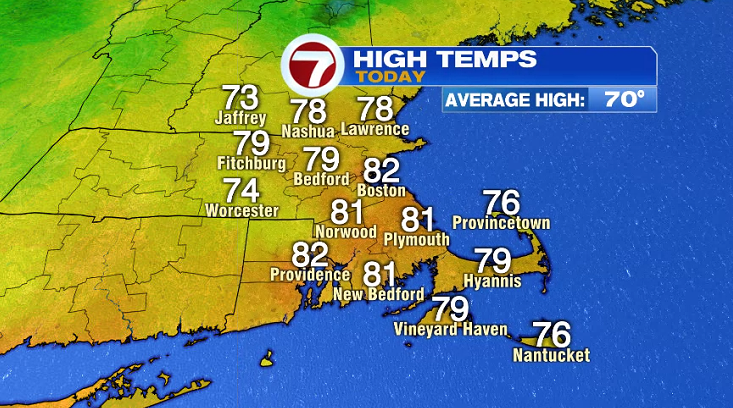
Today, highs stretched into the 70s to low 80s, but it was accompanied by lower dewpoints compared to yesterday’s soupy heat.
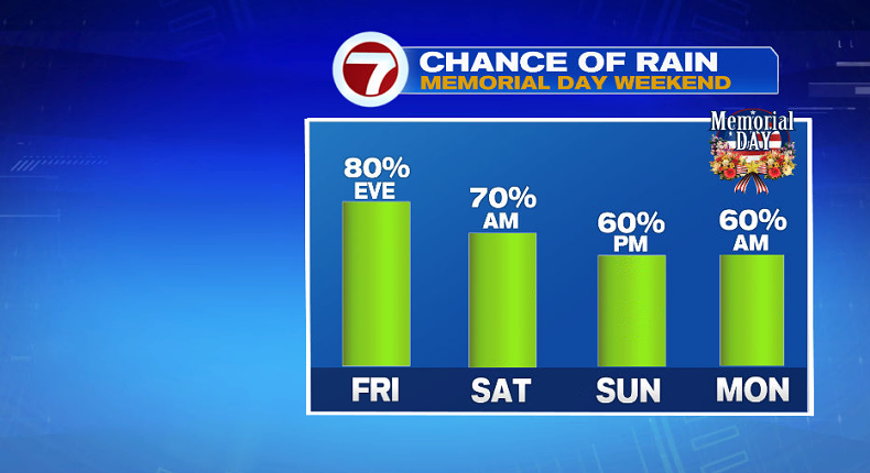
A cold front pushed in late last night, sparking off those thunderstorms that did bring rain, but we’ll likely see rounds of showers this weekend beginning as early as tomorrow evening.
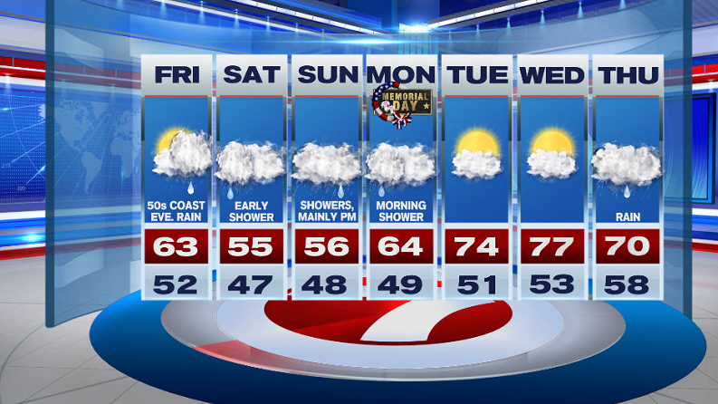
Tonight, we’ll see partly cloudy skies with overnight lows in the 40s to low 50s.
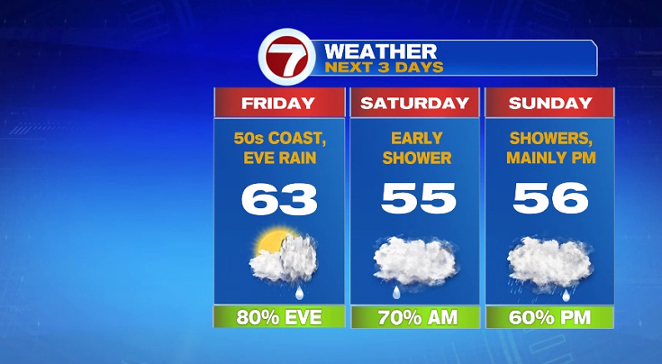
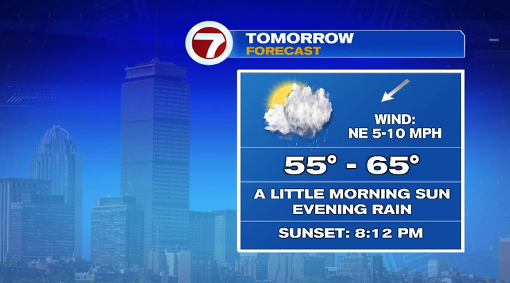
Tomorrow, we start off with sunshine in the morning, with clouds increasing through the afternoon ahead of the rain that builds in by the evening.
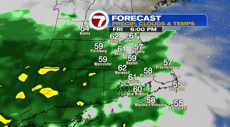
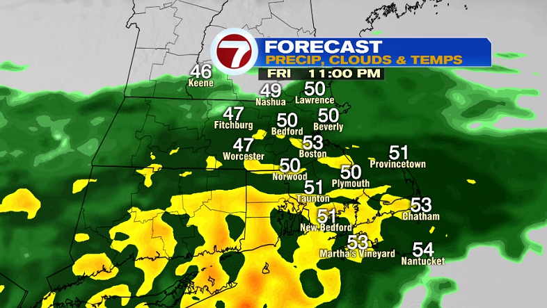
Showers build in by Friday evening, turning more widespread with some pockets of heavy rain south of the Boston Friday night.
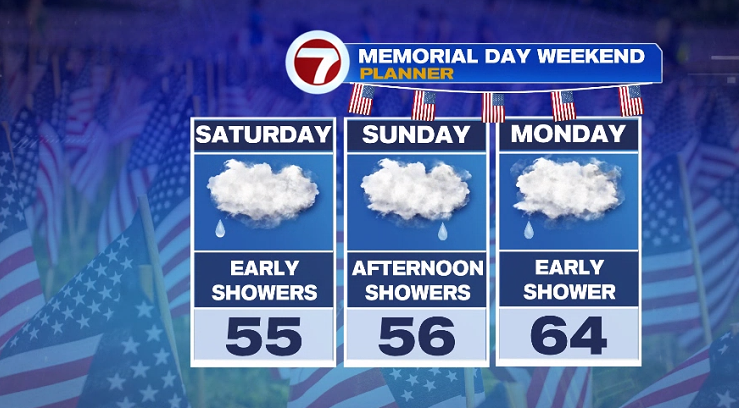
A few lingering showers are with us early Saturday morning before we get a break, but the clouds will linger for Saturday afternoon along with the cooler temperatures with highs in the 50s.
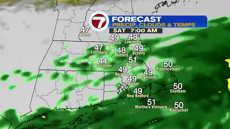
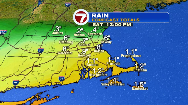
The higher rainfall totals will be SE MA and the Cape through mid-day Saturday.
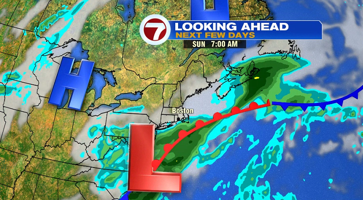
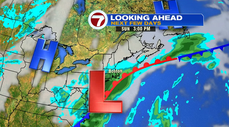
Sunday also brings rain, mainly in the afternoon, moving south to north.
After Sunday’s showers, Memorial Day Monday also features a few showers, but these will mainly be in the morning, followed by mainly cloudy skies with highs a little bit closer to normal, in the low to mid 60s.
After the holiday weekend, a warm-up greets us through midweek along with the sunshine until Thursday.