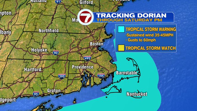
A Tropical Storm Warning has been issued for the Cape and the Islands through Saturday afternoon. This means that tropical storm force winds (sustained at 35-45 mph, gusts to 60 mph) could be felt as early as Saturday morning.
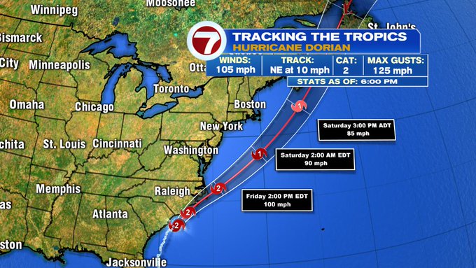
As far as the track of Hurricane Dorian, as of 6PM on Thursday evening, at Cat. 2 strength, it is about 45 miles of the coast of Myrtle Beach, SC, moving NE at 10mph, with sustained winds at 105 mph. The track hugs the coastline of NC over the next 12 hours, with possible landfall between Wilmington, NC to the Outer Banks, NC. By tomorrow evening, the track brings Dorian offshore along the Mid-Atlantic, with a glancing pass off the coast of southern New England by Saturday morning.
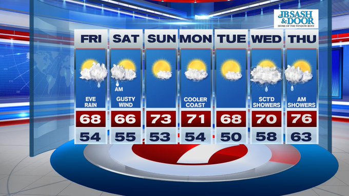
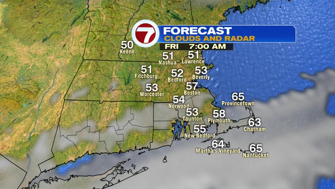
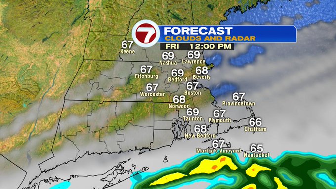
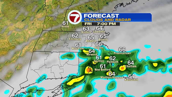
For us here in Southern New England, rain showers could push in as early as Friday afternoon between 3-5pm for the Cape and Islands, between 5-7PM south of the Mass Pike into SE MA. The rain bands will continue to fill in from the south Friday night into early Saturday, with the heaviest of the rainfall early Saturday morning.
Less than an inch is expected along and north of the Pike, south of the Pike, say from the South Shore to the Cape Cod Canal could bring upwards of 1-3″ with Nantucket possibly getting more than 3″ of rainfall.

For the wind gust forecast locally, similar to the rainfall forecast, weaker gusts to the northwest, stronger over coastal areas of SE MA and the Cape and Islands.

Dorian quickly exits towards Nova Scotia by Saturday evening, providing a much nicer forecast for the second half of the weekend.
For Friday and Saturday though, high temperatures will struggle to make it out of the upper 60s for most locations.
Sunday features a bright spot in the weekend forecast since we’re tracking sunshine and highs into the 70s and overall pleasant at Gillette for the Patriots game.

The next work week starts off dry with highs around 70, with the next best chance for scattered showers by Wednesday into early Thursday.