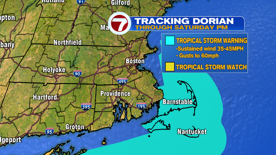
7Weather- We’ve been tracking Dorian for some time now, and now it’s our turn to get some impacts from the storm. The greatest impacts will be on the Cape & the Islands. Gusts will be over 40 mph, and scattered downpours continue into early Saturday morning.
WIND:
Winds will start to pick up after 11 PM tonight, and it will remain windy through Saturday afternoon.
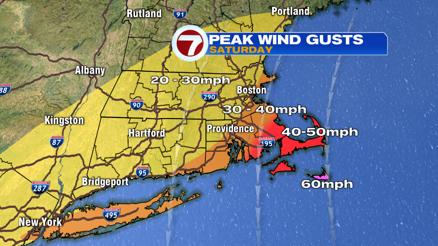
The window for the highest wind gusts is mainly between 2-11 AM Saturday. This is the time when we think we will have the gusts on the map below.
It will remain windy the rest of Saturday, especially on the Cape & the Islands, just not as windy as the peak wind gusts map below.
RAIN:
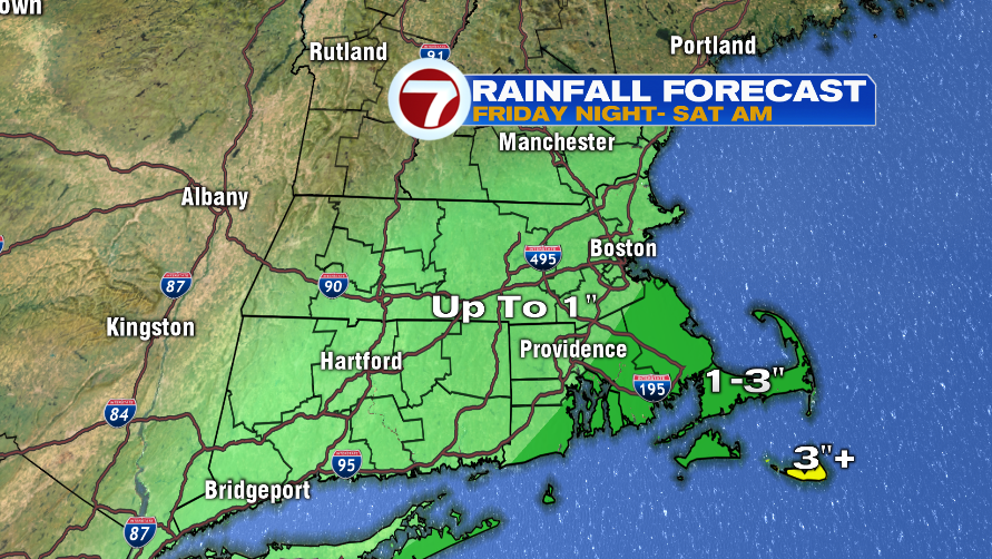
The outer bands of Dorian will bring scattered downpours tonight. SE Mass and the Cape & the Islands will have steadier and heavier bands of rain, which is why this area will see the high rainfall amounts.
Steadier rain pushes into our area this evening, mainly after 7 PM. The first round of rain looks to bring scattered downpours for most of the area.
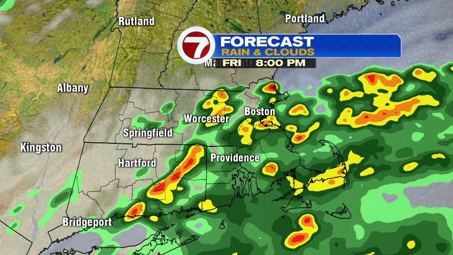
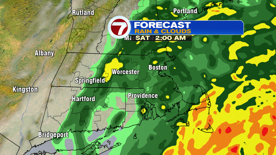
After 11 PM- midnight, most of the heavy rain likely falls over the Cape & the Islands. The rest of the area will see light showers, with isolated heavier rain.
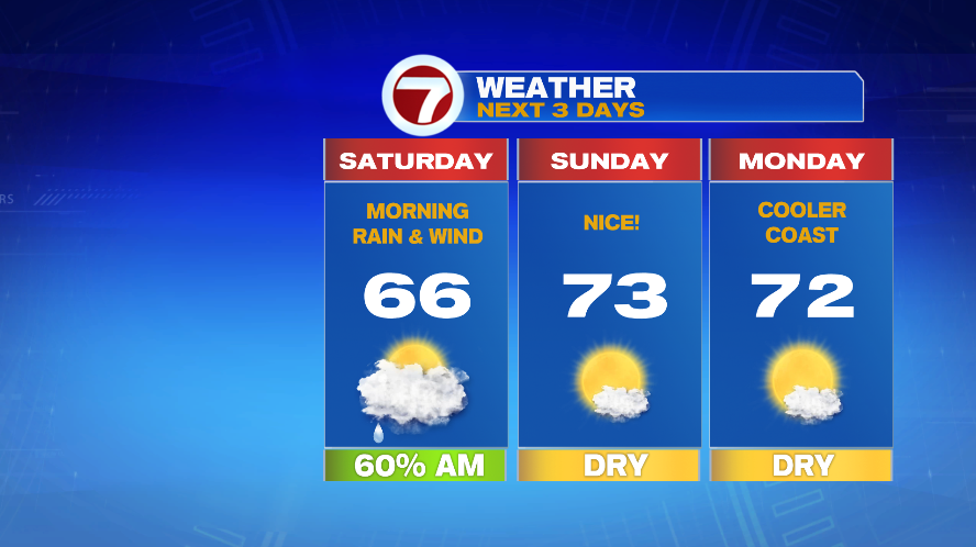
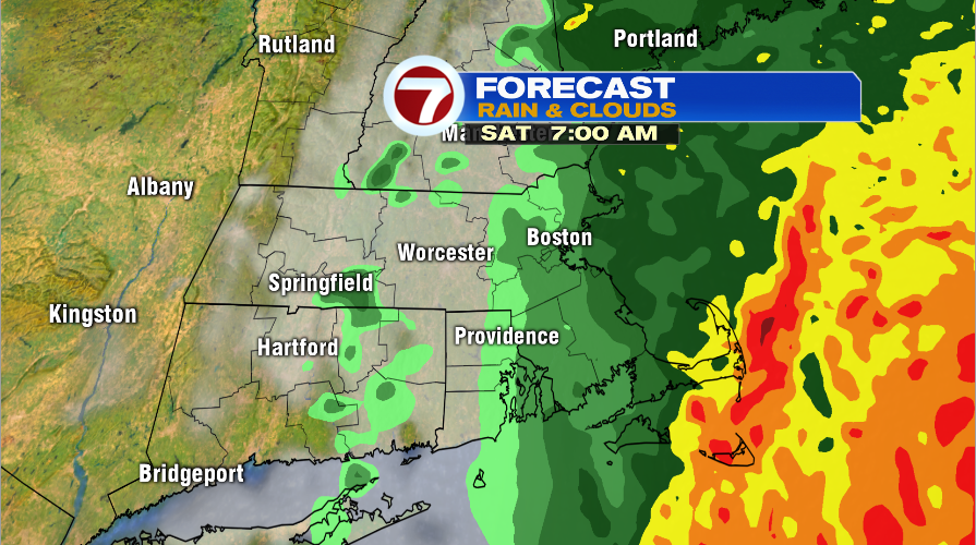
Dorian will be moving out of here Saturday morning. The heavy rain moves out around 9 AM, and we’re left with gusty wind.
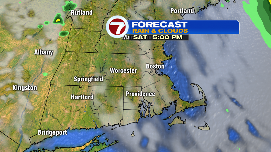
We might actually see the sun late in the day Saturday. We go from windy to breezy Saturday evening.
Things clear up on Sunday, and it is shaping up to be a beautiful day. Highs are in the low 70s and there will be some sun.