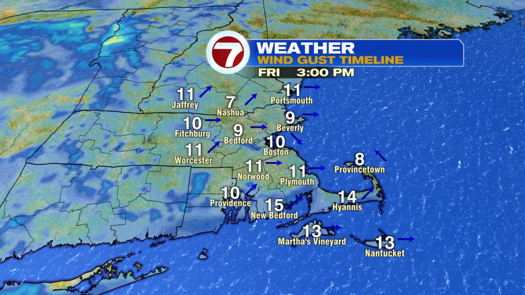
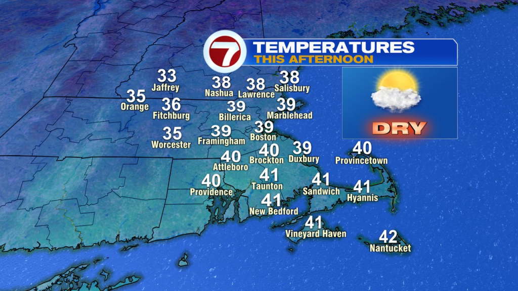
Sure, it’s a bit chillier outside this morning, but at least it’s dry and looks like it’ll stay that way today as intervals of sun and clouds prevail and highs top off in the upper 30s. The breeze will be lighter today too, so all and all, a nicer, seasonable January afternoon.
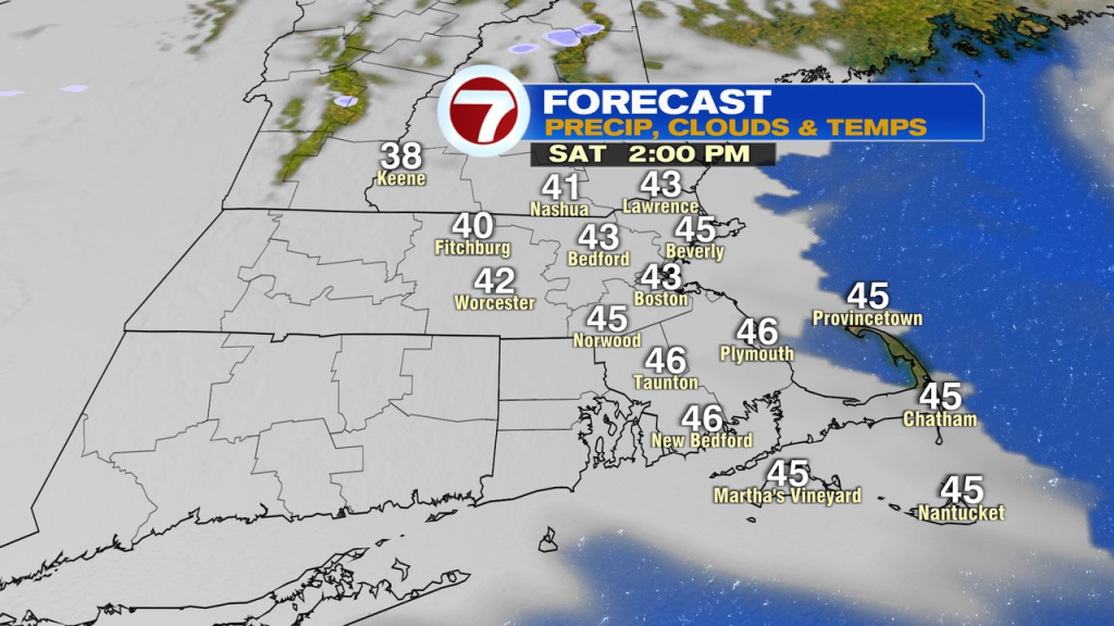
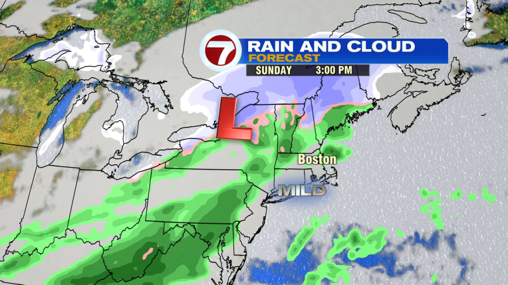
The weekend forecast looks mostly dry too with just a few late-day/evening sprinkles or a light shower moving in Sunday. It’ll be a bit milder too with highs in the mid 40s Saturday, upper 40s Sunday. The breeze does pick up Saturday, so it’ll feel a bit cooler with a wind gusting 20-30mph.
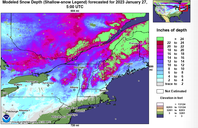
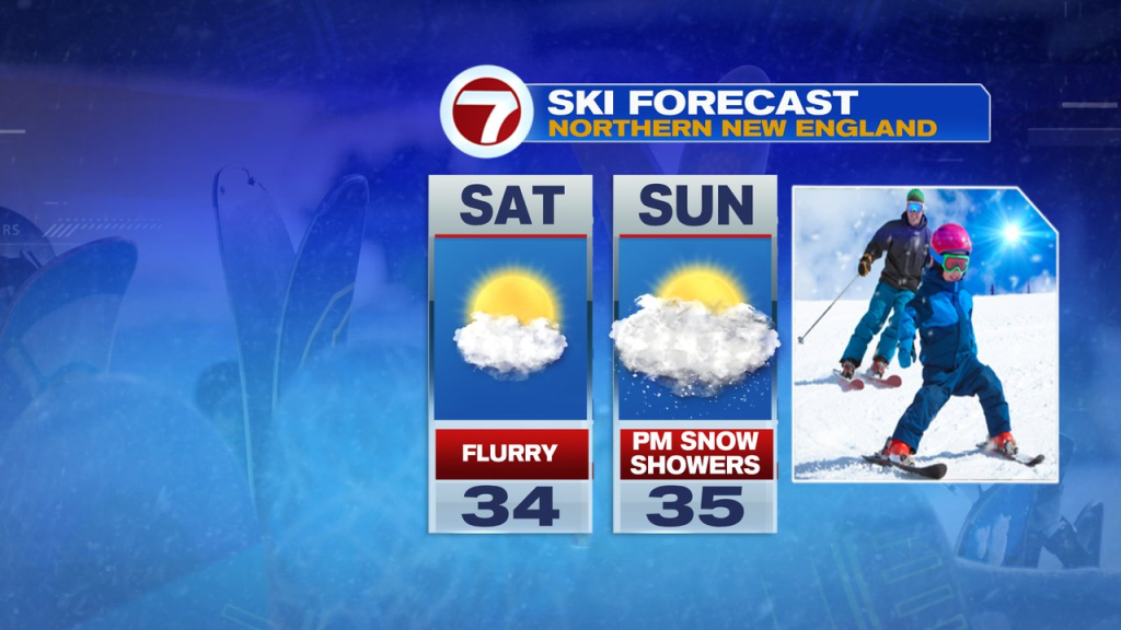
Skiing up north? There’s a solid natural snowpack now and temps run in the 30s up there over the weekend. A few flurries are possible Saturday with a better chance of snow showers moving in Sunday afternoon.
In southern New England, the next chance for snow arrives Wednesday. This far out, it’s just a chance for it, as it’s possible that an area of high pressure to our north, suppressed that system farther south too. Something to keep an eye on.