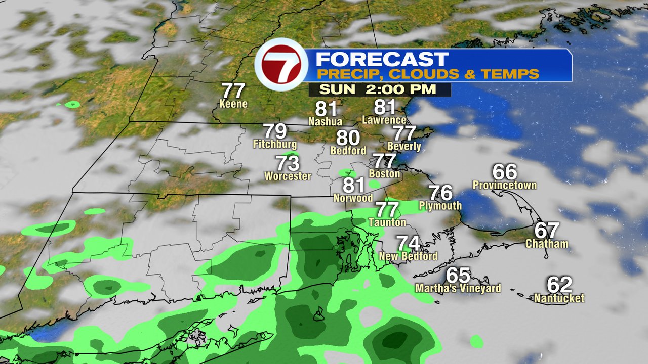
After a fantastic start to the weekend with Saturday temps near 80 and skies remaining dry, we start this Sunday morning off, dry and comfortable again. With that said, the clouds that do increase today will provide the opportunity for a few isolated showers this afternoon, although a good chunk of the day still feature dry weather.
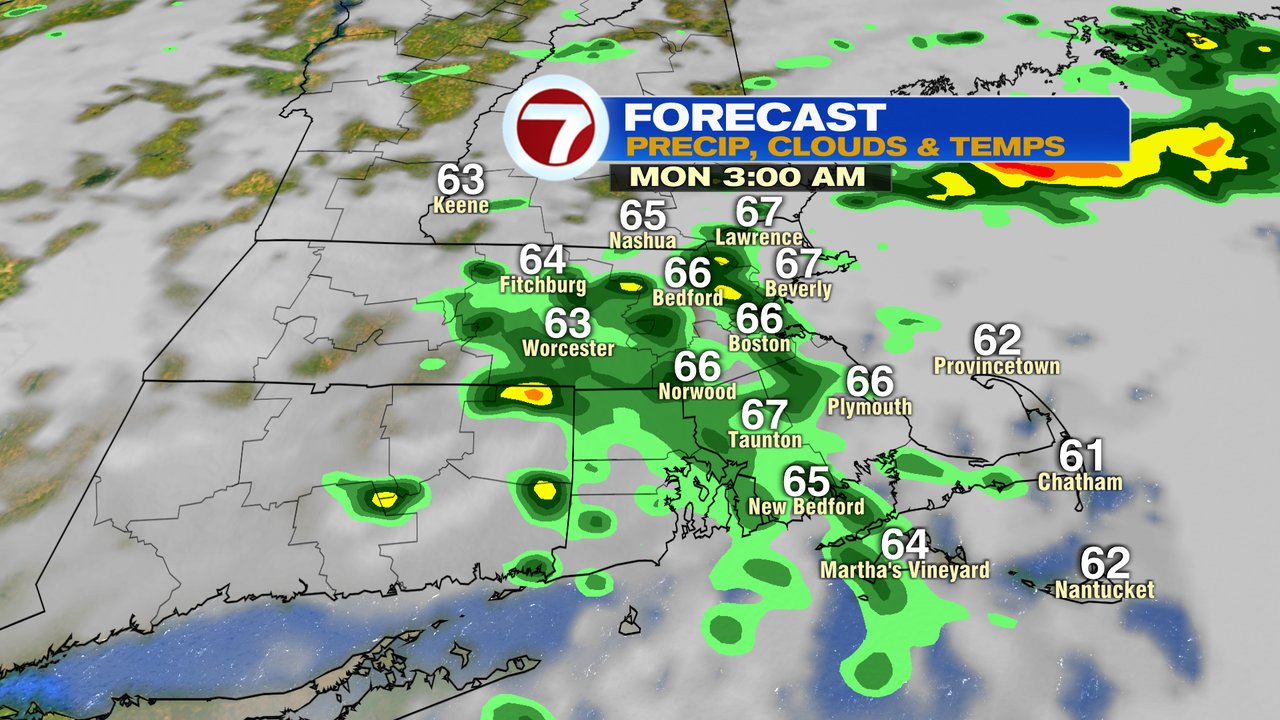
Showers and rumbles of thunder are more widespread overnight tonight and predawn tomorrow as it’ll remain mild and even muggy overnight.
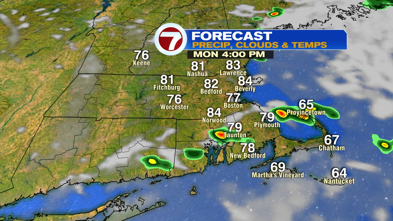
Showers tend to taper off by mid morning with sun breaking out midday. That sun will send temps up into the low 80s and with humidity near the surface, combined with the warmth near the ground and cold air aloft, there will be enough instability to drive isolated pop-up storms in the afternoon. The main risk from any stronger storm will be cloud to ground lightning, small hail and a downpour.
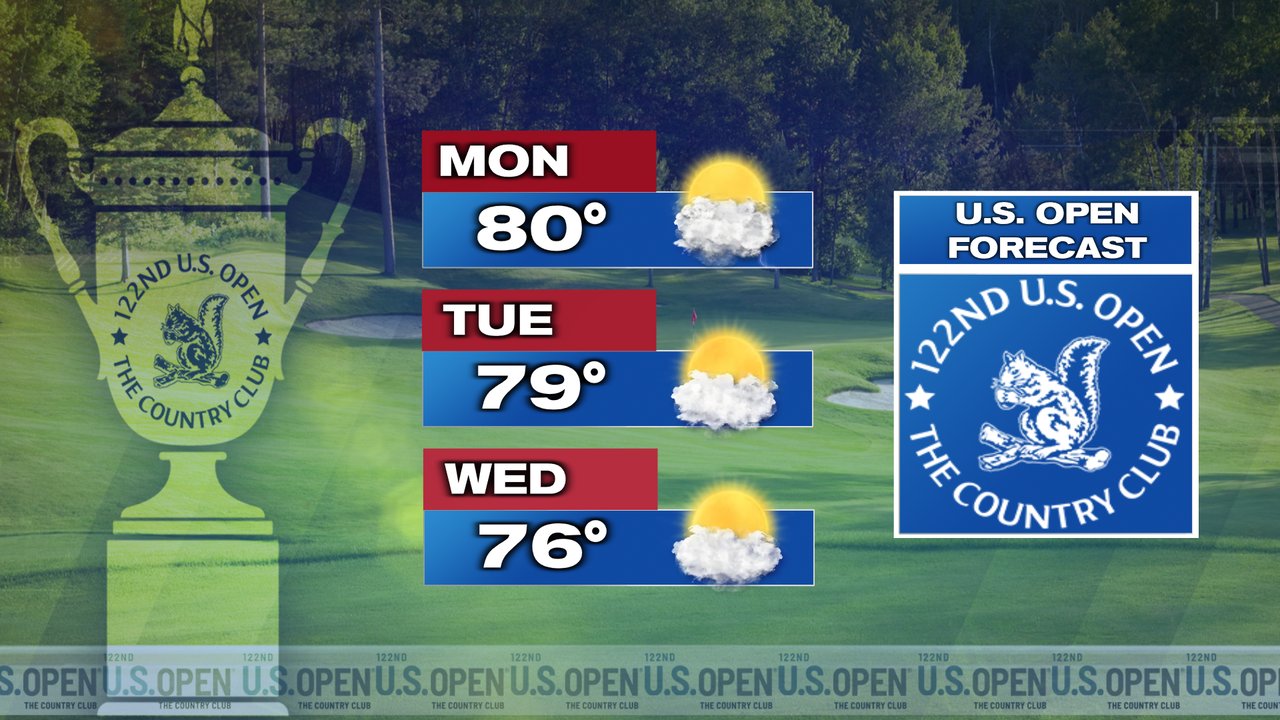
We’ll keep any eye out for those isolated storms for any interruption of the practice round for the U.S. Open at The County Club. Tuesday and Wednesday look good for practice rounds and the 1st round will likely be dry Thursday. We’ll likely track some scattered afternoon storms for the 2nd round on Friday with higher heat and humidity in place as a cold front approaches.