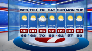
Today the heat returned, but with low humidity, it was most certainly a bearable heat for everyone. Tonight, it’s another quiet night under mostly clear skies, and lows slip into the 60s.

We can almost rinse and repeat today’s weather and bring it back tomorrow with highs into the upper 80s to 90, with a few local seabreezes setting up again. It will be the fourth day in a row of hot weather, but still little humidity.

The temperature trend over the next several days are above normal with a a few 90+ degree highs in the 7-day.

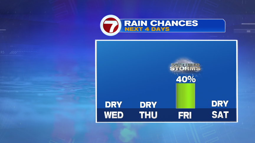
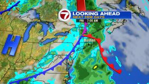
We’re dry tomorrow and Thursday…it’s not until early Friday that we see the returns of scattered storms. It appears that Friday will not be a washout. With the storm threat early Friday, these should be cleared out by the weekend as the cold front exits out to sea, and high pressure takes over.

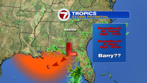
Since it’s been quiet over New England since Saturday’s severe storms, the activity by the Gulf is starting to heat up. It’s most certainly the summer season, which also means it’s hurricane season. In July, climatologically-speaking, the tracks/formation of tropical systems hug the warm waters of the Gulf, the Lesser Antilles, and along the SE Atlantic Coast.
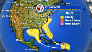
The Gulf is where the next possible storm could form over the next 48 hours (this would be the second named storm of the 2019 Hurricane Season). According to the National Hurricane Center, the formation of a tropical storm in the next 48 hours is at 70%. If these cluster of storms come together, this would become “Barry”.
In the 7-day, we stay relatively quiet for the month of July, with highs above normal, and just one day with a threat of thunderstorms…Friday.