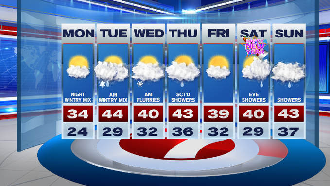
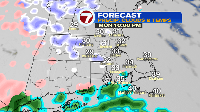
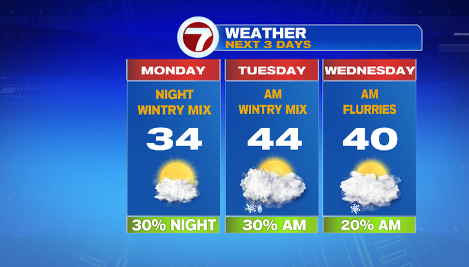
It’s a quiet start to our Monday and the final week of 2021, but that changes tonight as a batch of wintry mix slides into southern New England.
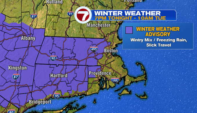
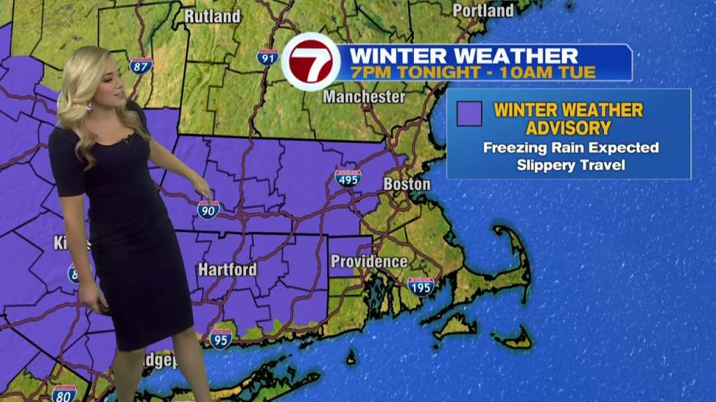
A Winter Weather Advisory has been issued for Middlesex and Worcester County from 7pm tonight through 10am tomorrow morning due to a period of freezing rain that could lead to slick travel overnight and into Tuesday morning’s commute.
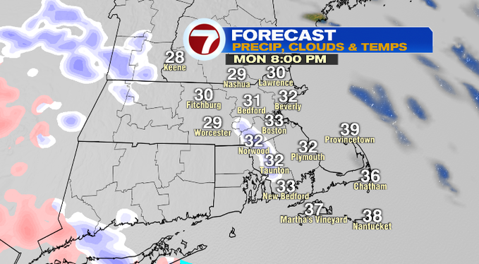
As for timing, the wintry precipitation will start off as snow before flipping to a mix and freezing rain around midnight. For most of SE MA and the Cape and Islands, this will just be scattered plain rain showers. The precipitation should be out of here by mid-morning, but a few slick spots could linger.
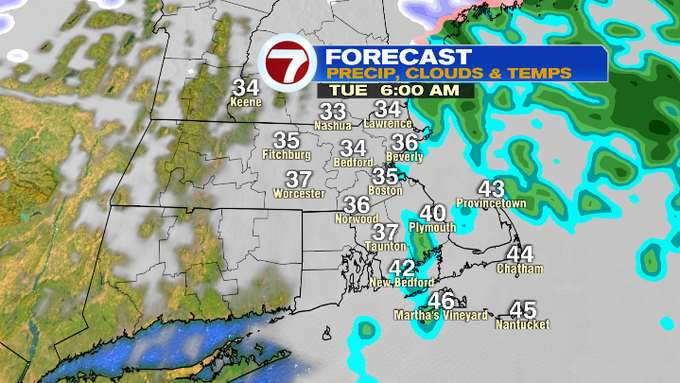
Drier conditions prevail through Tuesday afternoon before some flurries pop-up for Wednesday morning.
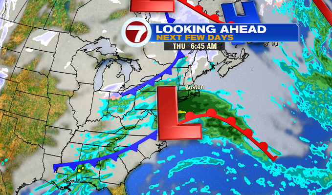
Another system slides off the mid-Atlantic states and could bring us some showers Thursday depending on the track (it could miss just to the south). As of today, the showers are still in the forecast for Thursday morning.
Friday, the final day of 2021, is dry under partly cloudy skies and highs into the low 40s.
For your New Year’s Eve plans, temperatures will dip into the upper 20s to low 30s as we countdown to 2022.
For New Year’s Day, we’ll see increasing clouds and a threat for showers in the afternoon/evening. Those showers then stick around into the second half of the weekend.