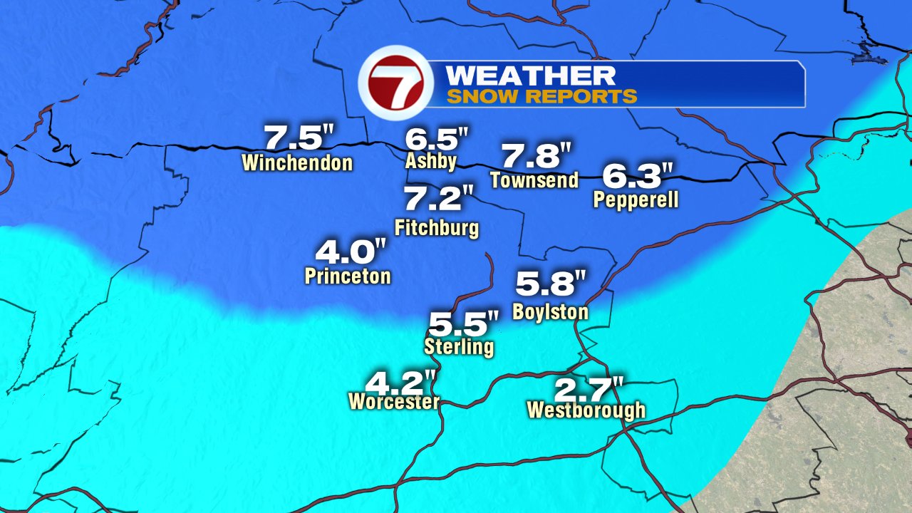
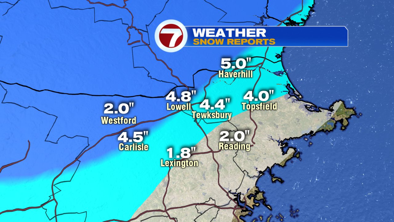
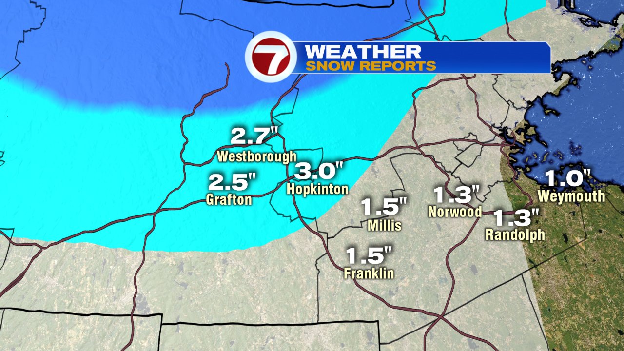
With air just cold enough to support snow, we certainly saw a good deal of it across the area yesterday afternoon as snow broke out and remained mainly snow across the interior into the evening. The highest snow totals came out of northern Worcester County, where 4-8″ of snow fell, 3-6″ across the Merrimack Valley, and then lower totals farther southeast.
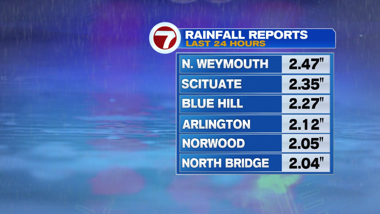
Not only did we have heavy, wet snow, we also had quite a bit of rain with this storm as some locations past the 2″ mark.
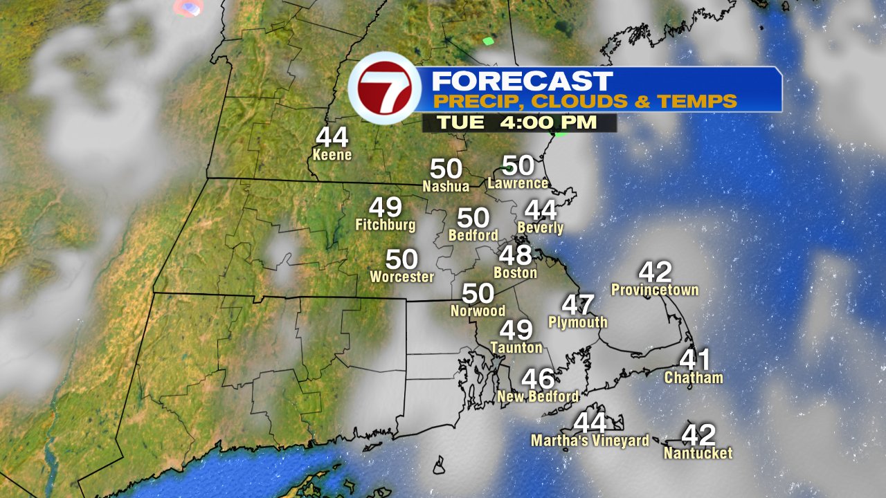
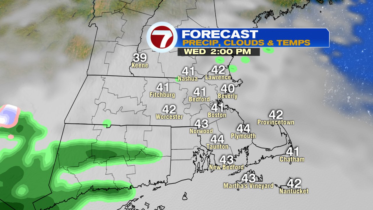
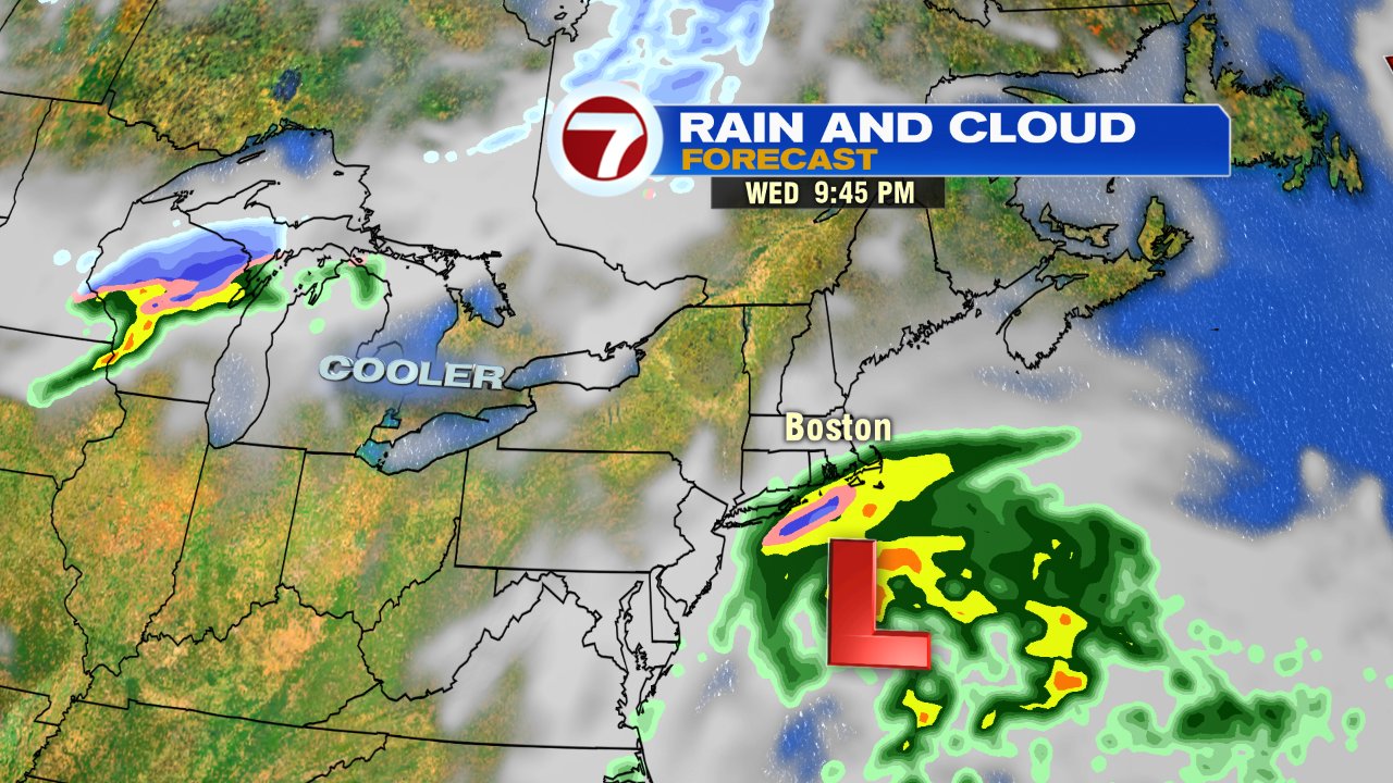
We dry out today as temps head into the 40s to near 50. More clouds roll in tomorrow and temps hold in the low to mid 40s. While we won’t get a lot of rain, we won’t get much sun either. A few sprinkles/light showers are scattered about as a chilly east wind prevails. The highest risk for steady rain will be across Buzzards Bay/Cape and Islands late tomorrow and tomorrow evening.
We dry out Thursday with highs in the 40s under a mostly cloudy sky. Friday looks great, mid to upper 50s and sunshine.