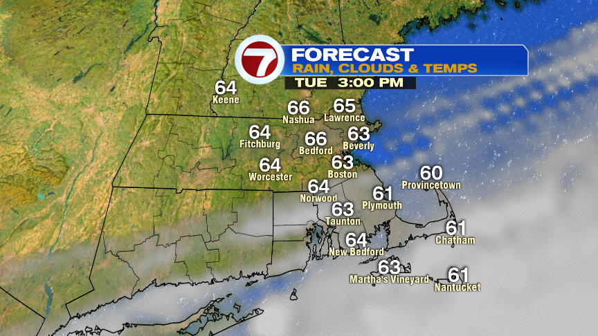
After a bit of morning light rain, this afternoon will turn out dry with temps hovering in the mid 60s. Some sun returns, with the brightest skies, the farther north and west you go. Overall, a solid finish to the day.
We’ll start tomorrow off dry and end the day with a few light showers and sprinkles. Highs hover near 60, as onshore breeze increases.
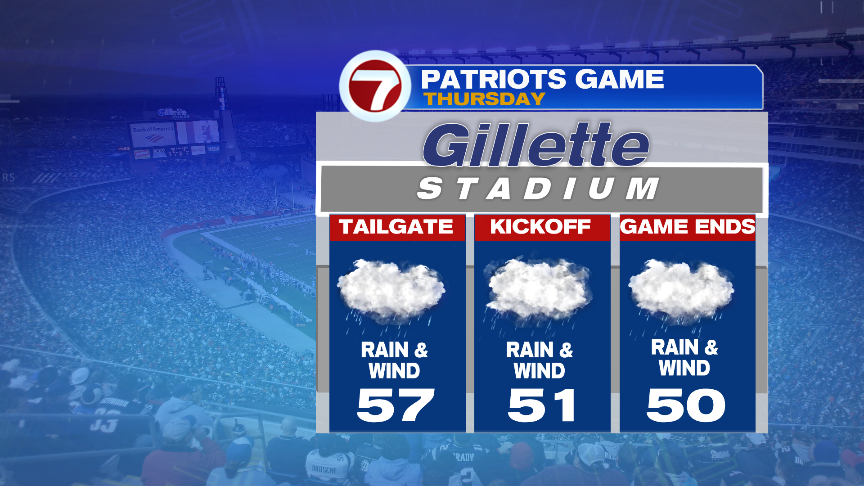
Wet weather and wind increases Thursday, and that includes for the Pats game. Expect a gusty northeast wind and steady rain from tailgate to final whistle.
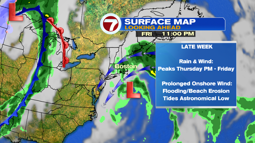
While exact track will dictate wind/rain impact, it does appear we’ll catch a solid hit from an ocean storm that develops to our south. While there will be some tropical characteristics with this storm, it’ll act much like a nor’easter for us, whether it has a name or not. Wind and rain peaks Thursday into Friday. Gusts 40-50mph along the coast is plausible (strongest Cape/Islands) with perhaps 3-5″ of rain across eastern Mass and 1-3″ inland. The onshore wind is prolonged and strong, so we’ll watch the coastal flood threat and beach erosion too. One thing that will help mitigate the severity/extent of the coastal flooding is the fact that tides are astronomically low. Plenty to watch though, so check back for updates.