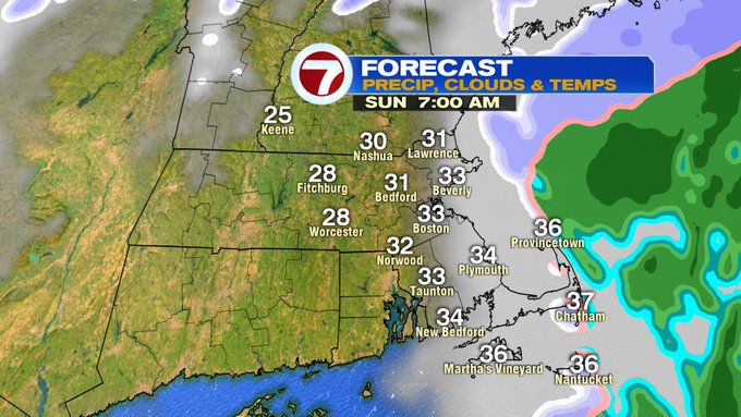
We could see a few slick spots overnight as temperatures slip close or below the freezing mark. We could also see slick spots due to some light snow for portions of eastern MA as the system swiftly exits before sunrise Sunday morning.
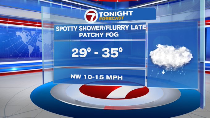
Tonight, a few spotty rain showers will change to snow showers in NE MA and the Merrimack Valley after midnight (by 2AM).


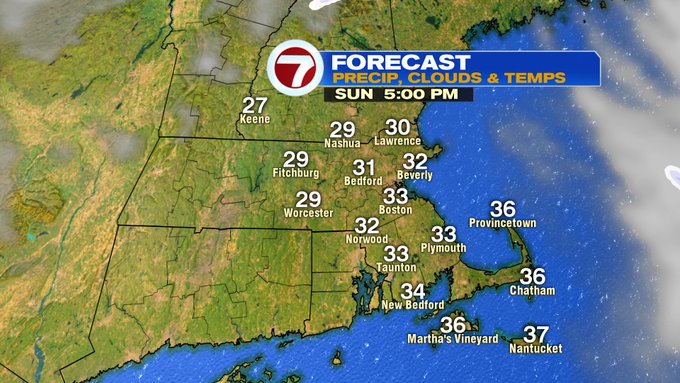
We’re not looking at much of accumulation with these snow showers, but it could make for some slick travel overnight. These showers depart just before sunrise (around 7AM) and we’ll see emerging sunshine as clouds clear from west to east. Even though we see the return of sunshine, colder temperatures take over for the second half of our weekend along with the windy conditions. Highs will be in the mid 30s, with wind chills into the low to mid 20s through most of the day.

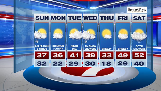
We have an active weather pattern over the next several days. Looking ahead to Monday, another system clips the area to our north, bringing a chance for a spotty snow shower for the interior Monday. Tuesday night into Wednesday, first a wintry mix Tuesday night then changing to snow early Wednesday before departing the region, leaving colder conditions in it’s wake – at least for Thursday. By Friday and Saturday, we warm back up to around 50, but with the warm-up comes unsettled weather, meaning rain showers Friday night and remaining scattered into Saturday, too.
