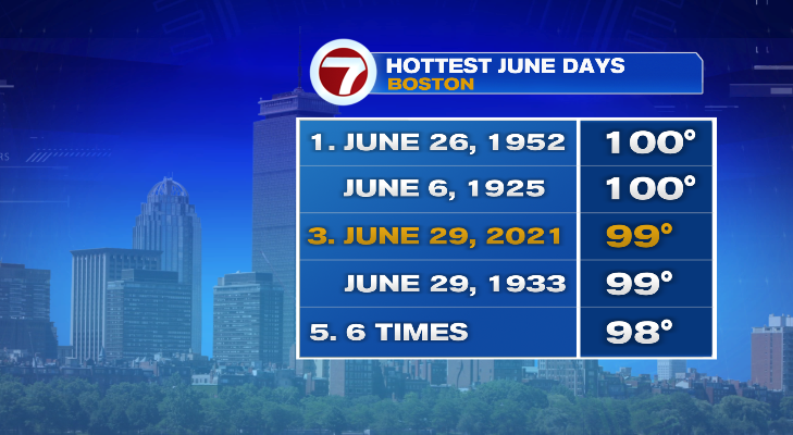
Yesterday was hot. Today was hotter. Heat index values hit the 100s in just about every city today. Boston’s high was 99° — tying the record set back in 1933. But wait! The graphic says 98°. Here’s what happened… So the thermometer at the airport sends data back every hour for the temperature. Then, the National Weather Service looks back in between the hours to see if we had a brief bump. They do this every couple of hours to double check. Today they did that and found that 99° reading. They will send out the manual update to the highs map later this evening. But 99° is what will go down in the record books.
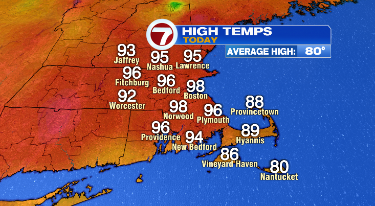
Today was actually one of the hottest June days EVER recorded in Boston. Today’s high of 99° tying for 3rd place on hottest days ever recorded during the month of June
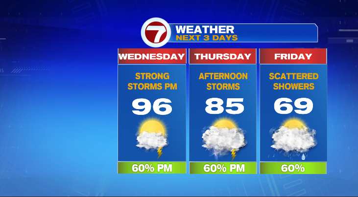
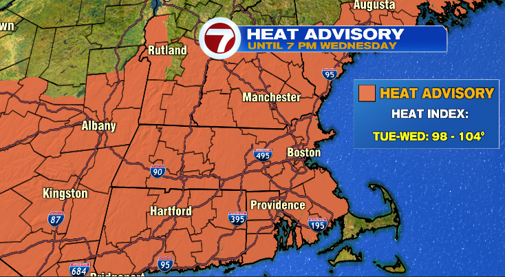
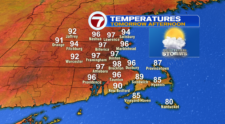
Tomorrow is another hot one. Temperatures back in the upper 90s and again feeling like the 100s. So the heat advisory rolls on for one more day.
Air temperatures will be similar tomorrow. Even if a few degrees cooler, will feel the same with the humidity. Boston’s record high tomorrow is 95° so that’s certainly in reach.
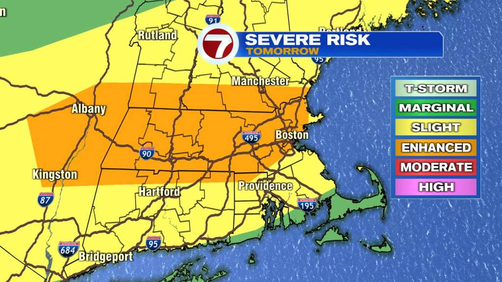
Tomorrow will also produce a few afternoon and evening storms. With the heat and humidity in place, it is very likely a few of those will be strong and severe. The main threat will be strong and potentially damaging winds. Much of Massachusetts is under an enhanced risk of severe weather. Think of it as a level 3 of 5 on the severe weather scale. It’s not too often we get that issued here.
After the storms things stay a little bit unsettled for the next few days and temperatures finally begin to cool heading into the holiday weekend.