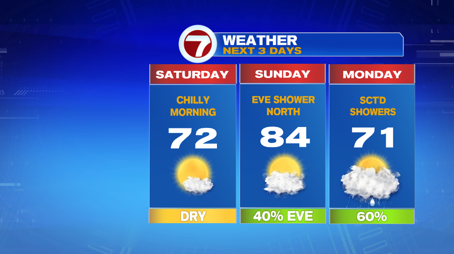
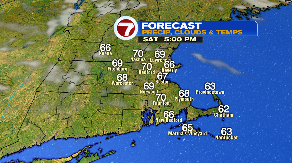
7Weather- The dry, crisp air sticks around Saturday, and then warmer air arrives on Sunday.
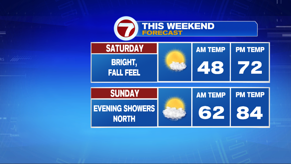
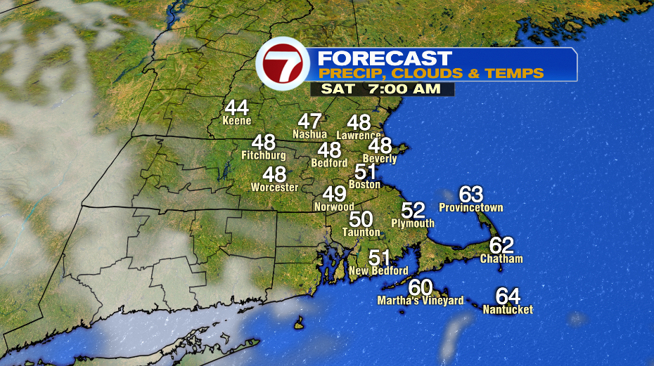
It will be chilly again tonight/early Saturday morning with temperatures falling into the mid and upper 40s. Temperatures rebound into the low 70s in the afternoon and there will be plenty of sunshine. Wind will be light.
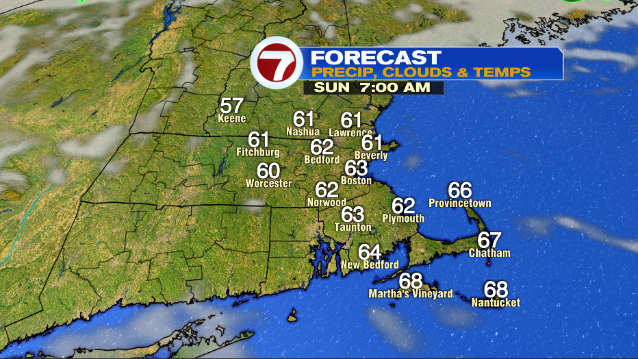
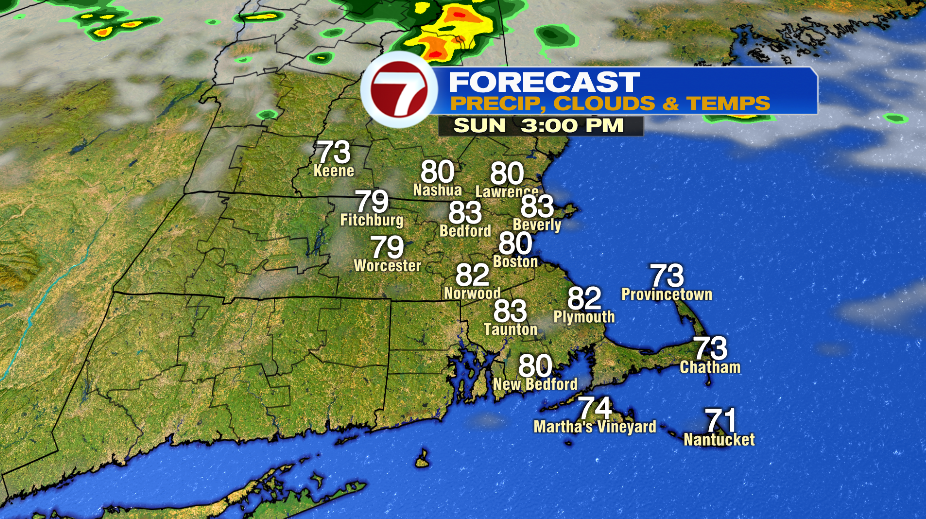
Saturday night into Sunday morning won’t be as chilly with temperatures in the upper 50s and low 60s. Humidity increases and highs are warmer in the low and mid 80s.
The first half of the day is mainly sunny and then clouds increase. There could be a few showers closer to sunset for southern New Hampshire as a front approaches the region.
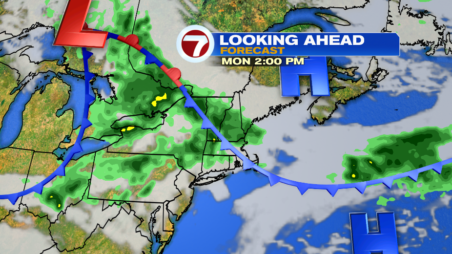
A back door cold front arrives Sunday night into Monday. The tricky part of this forecast is figuring out the timing of this cooler air. This is always the tricky part with these back door cold fronts. Expect falling temperatures with the potential of being cool all day for southern New Hampshire and the North Shore.
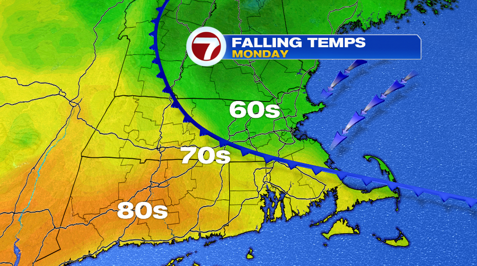
There will be scattered showers on Monday along the front. As of right now it looks like the best chance of rain is in the afternoon and evening as it stalls over us.