Quite a few locations started off our Thursday in the low to mid 30s! Not quite record-breaking cold, but it did prompt a frost advisory to be issued last evening. Thankfully, under plentiful sunshine today, temperatures rebounded this afternoon closer to average, with highs in the upper 60s to low 70s.


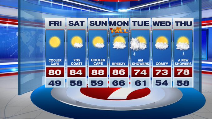
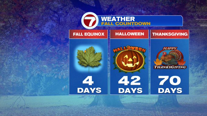
We’re tracking a weekend warm-up with highs reaching into the 80s, ahead of the Fall Equinox Monday morning. Autumn officially begins at 3:50AM on Monday morning, but the temperatures that day will not reflect that seasonal shift. Fall Equinox is when the sun’s rays are directly over the equator, typically marking equal day and night, hence “equinox”.

Before we dive into the forecast details for the weekend, let’s chat about the forecast for your Thursday night. Overnight lows tonight will not be as cold as last night, but it will still feel chilly. Lows are expected to slip back into the low 40s for the suburbs, around 50 for Boston and the Cape.

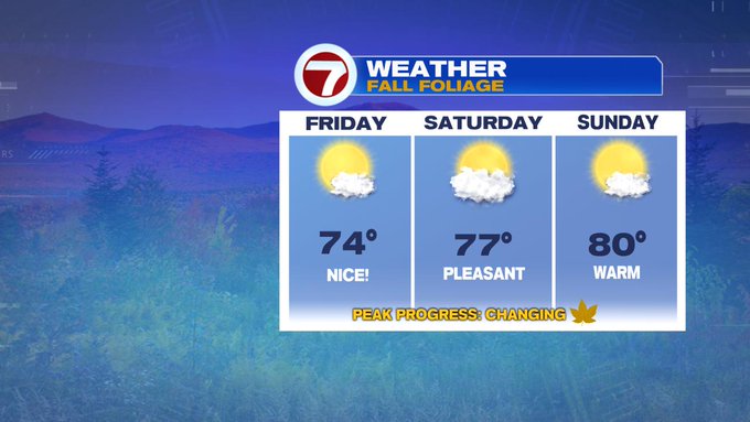
Friday features yet another sun-filled day with slightly warmer temperatures than the day today. Quite a few locations inland will stretch to near 80. If you’re heading farther north to check out the foliage, temps will be in the low to mid 70s.

This is also prime time for hurricane season.
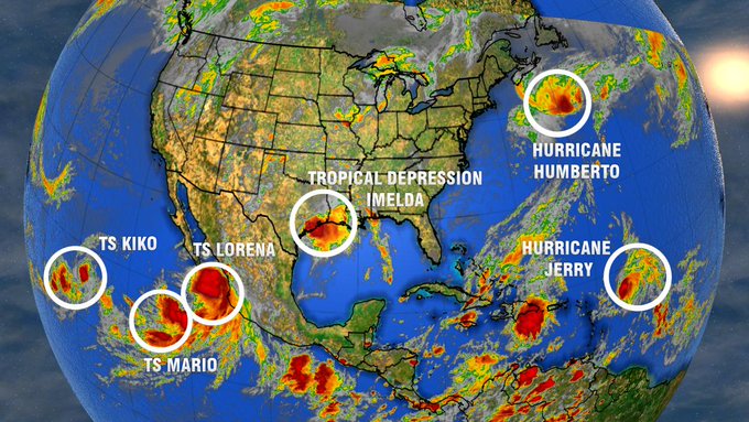
Southeastern Texas has been pummeled with flooding rainfall since early Tuesday when then Tropical Storm Imelda made landfall. We’re still talking about this storm now, because it has brought life-threatening flooding to the Texas gulf coast. Humberto brought whipping winds to Bermuda knocking down power lines there yesterday, and earlier today Jerry became a hurricane. Jerry will continue to slide just north of Puerto Rico and curve north and east away from the Bahamas.

Back here locally, a High Surf Advisory has been issued due to strong rip currents and large breaking waves at the beaches due to Hurricane Humberto. Humberto will remain out to sea away from southern New England, but the swells are what is bringing the rough surf.

Highs stretch into the 80s this weekend, upper 80s by Sunday. This warmth sticks around for the Fall Equinox on Monday before a diving cold front swings in late Monday night, bringing some rain showers Monday night, lingering into early Tuesday morning. Not only will it bring rain showers, but that front will also usher in a cool down…back to more seasonable conditions by midweek.