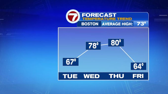
7Weather- There will be a fall feel on Tuesday, but then we warm back up by mid-week.
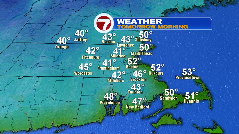
Tuesday morning starts chilly for September! Most areas wake up to temperatures in the low 40s. The coast stays a tad bit warmer with lows near 50º. If you walk out the door around 7 AM, temperatures will be near 45º.
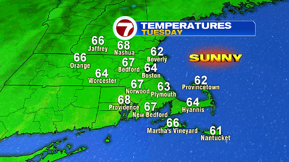
We rebound into the low 60s by lunch time. The coast stays in the low 60s the rest of the day, but inland spots warm up a few more degrees into the mid and upper 60s. The day is sunny, but with smoke moving in from the west coast, we will have hazy, smoky skies.
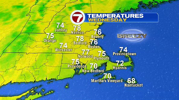
Humidity still remains low on Wednesday, but highs are warmer in the mid and upper 70s. Skies are mainly sunny, but again skies will be smoky. Expect breezy conditions with winds out of the southwest at 10-20 mph.
Thursday remains warm with temperatures near 80º, but there will be extra clouds around. We go back to the fall feel Friday with highs in the mid 60s. It will be partly to mostly cloudy with a 30% chance of a shower in the afternoon.
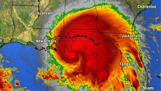
Sally strengthened into a hurricane today. Hurricane Warnings are posted for coastal areas along southeast Louisiana, Mississippi, and Alabama. It is a slow-moving storm that is expected to make landfall Tuesday.
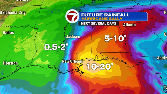
Sally could drop 10-20″ of rain. Flash flooding and storm surge are the main concerns with this hurricane.
5 PM Monday Update:
Winds: 100 mph (Category 2)
Gusts: 120 mph
Track: WNW at 6 mph