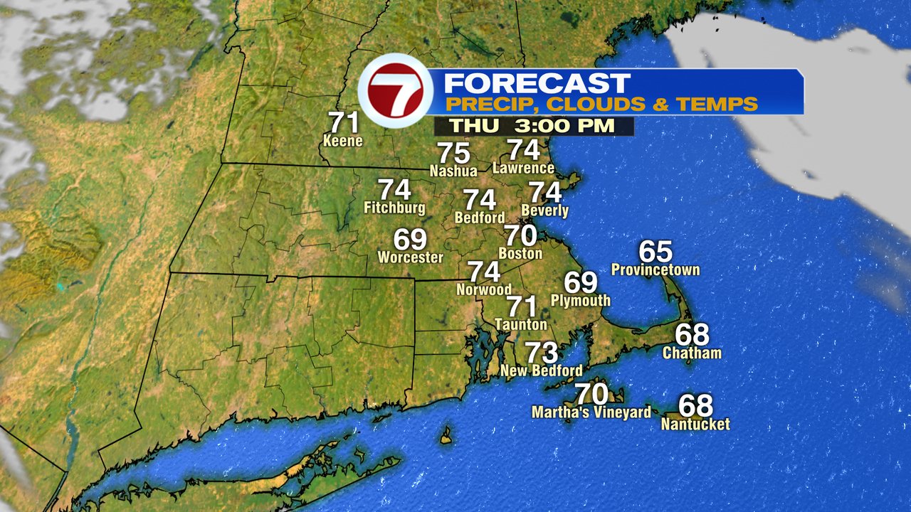
Enjoy yesterday? Good news, we’re pretty much right back there again this afternoon as high temps run near 75 inland and top off in the upper 60s to near 70 at the coast. Any patchy low clouds and fog this morning will once again yield to mostly sunny skies as delightful October weather continues.
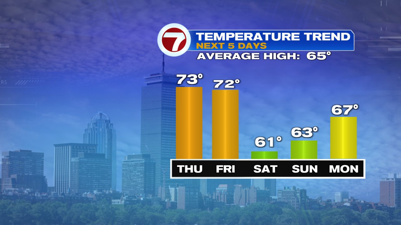
Tomorrow, very similar again.

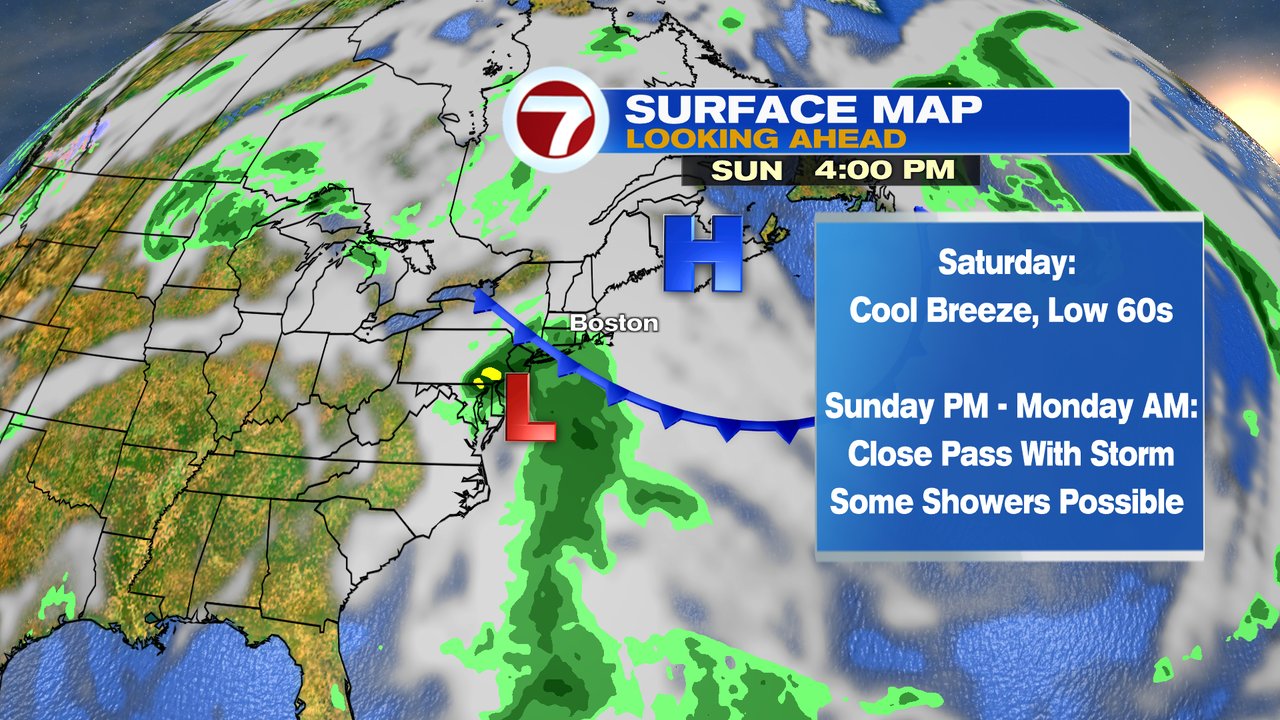
The pattern does cool off heading into the weekend as temperatures back track with a gusty easterly winds. Highs Saturday barely crack 60 as early clouds and patchy drizzle yield to partial sunshine in the afternoon.
Sunday starts dry, but by mid to late afternoon, showers are possible if an area of low pressure gets close enough to throw some moisture our way. The rain chances are highest Sunday evening, but will taper off early Monday morning, hopefully allowing a dry Marathon Monday for the most part. We’ll keep an eye on that weekend forecast… any track adjustment farther south keeps the rain away, a track farther north increases the rain chances.
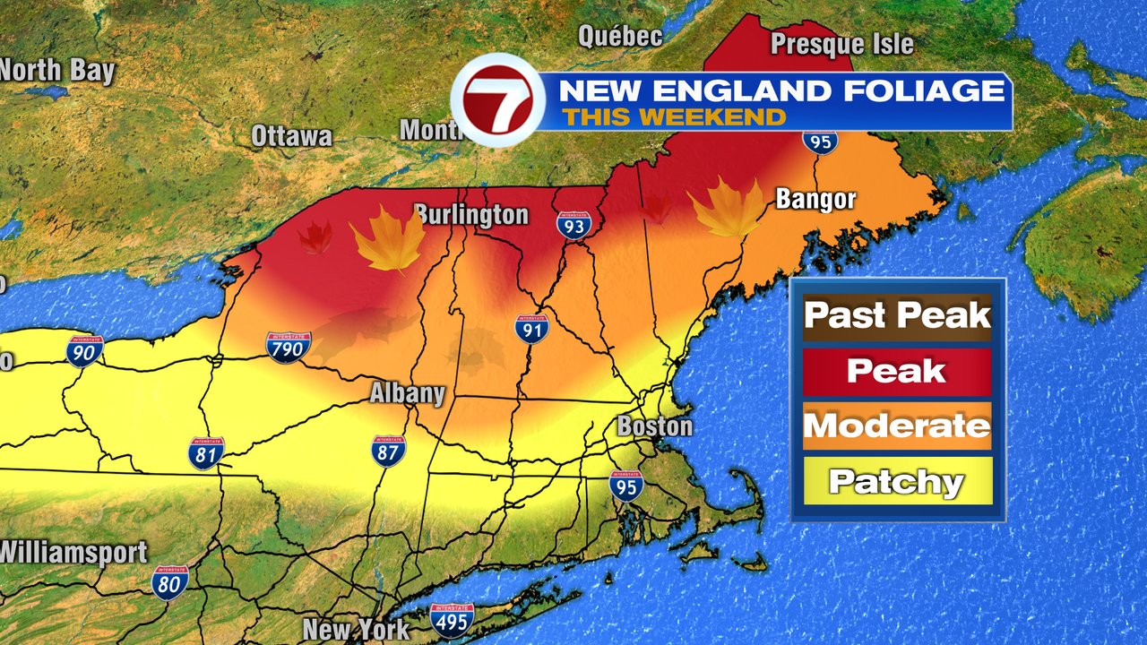
Meantime, central and northern New England have the best chance for dry weather Sunday/Monday. A lot of color is popping too so enjoy those yellows, oranges, and reds if you’re heading up that way!
Tuesday and Wednesday of next week look mild again with highs in the 70s.