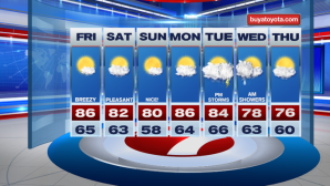
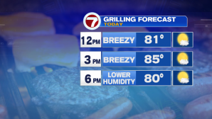
After a stormy and active couple of evenings, we’re tracking drier and less humid conditions for your Friday – picture perfect for grilling or heading to the beach or a baseball game.

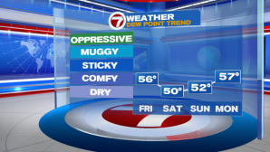
Dewpoints will also continue to drop over the course of the day today, back into the mid 50s by midday! And the dewpoint dive doesn’t stop there- these comfortable conditions stick around through the weekend.
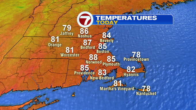
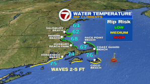
Today, high temperatures will stretch into the mid to upper 80s, with a westerly breeze (keeping the seabreeze at bay), so even local beaches will reach well into the low to mid 80s. Current ocean water temperatures ranging between low 60s to low 70s. Beware – the rip current risk is moderate along the Martha’s Vineyard and Nantucket.
Saturday features slightly cooler conditions than the day today and a few more clouds.

Off to the north, a trough could bring a few spot showers to southern NH in the afternoon. It will not be a washout though!

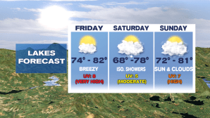
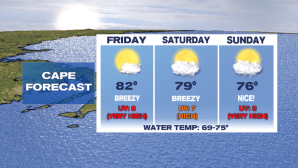
Sunday is the pick of the weekend, sun-filled, low humidity and highs around 80. That’s all thanks to high pressure sliding in.

Monday brings some of the heat back with highs into the mid to upper 80s, followed by the humidity and the chance for soaking rain in some thunderstorms Tuesday afternoon and evening. Lingering showers stick around into early Wednesday, before clearing out and cooling off – back into the 70s Wednesday and Thursday.