The winds of change are with us this morning as chillier air has moved in from the northwest. With a breeze kicking around 10-15mph this morning and temps back into the 40s and low 50s, it’s a much cooler feel to the air this morning vs. what we had yesterday. In addition, we’ve scoured out the humidity and the showers and storms that went along with it.
While sunshine wins out this morning through early afternoon, more clouds mix in late-day as some colder air/disturbance aloft, drifts down into southern New England. With it, a few sprinkles, passing showers are possible overnight.
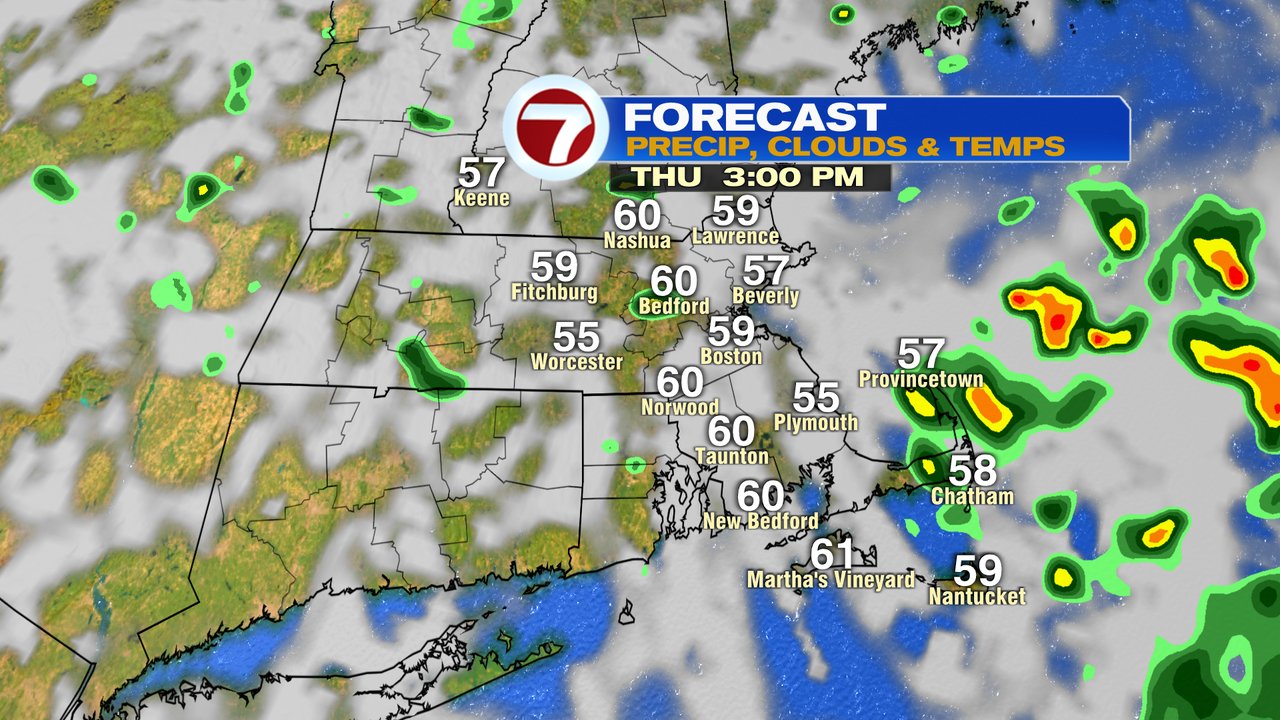
Tomorrow will be the coolest afternoon we’ve seen for September as highs struggle to hit 60 in Boston and stay in the mid to upper 50s out through the Worcester Hills. Partly to mostly cloudy skies prevail with a few passing sprinkles inland, and even a few isolated showers near the coast. With the core of the cold air aloft across and near the Cape, even a brief thunderstorm is possible there. With all that said, still, most of the day turns out to feature dry stretches of weather as any rain takes up limited amounts of time.
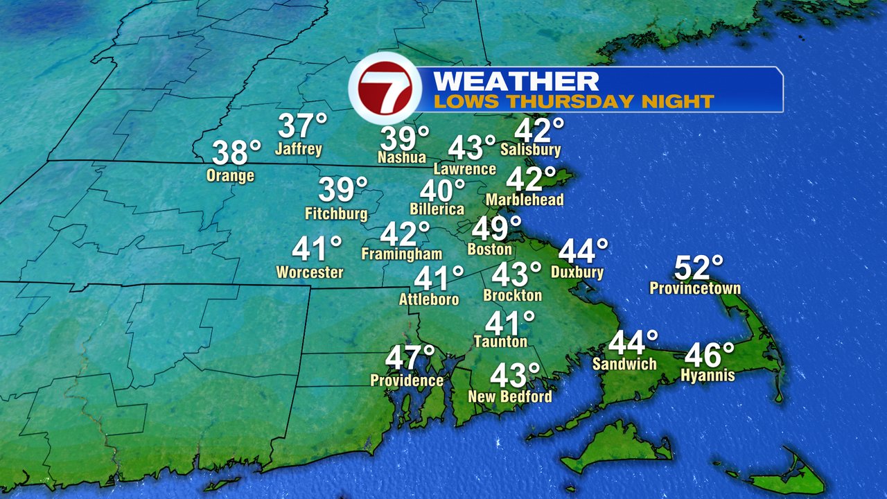
Once skies clear tomorrow evening, temps tumble and the heat will likely kick on inside many homes as temps fade back into the upper 30s to mid 40s by Friday morning.
Friday and Saturday look dry and seasonably cool. Sunday, into early next week, scattered showers are possible at times.