If you liked yesterday’s weather, I think you’re going to like Sunday even more.

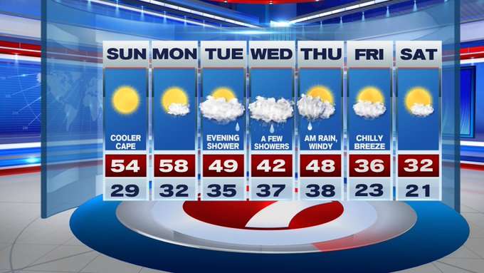
For your Sunday outdoor plans, you’ll get sun-filled and spring-like temperatures.
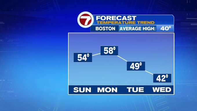
And the weekend warm-up that we’ve been experiencing does not stop once the work week commences. Monday also continues the warm-up with highs cresting close to 60! By Monday evening, clouds start to thicken ahead of our next weather maker.

Starting Tuesday evening and continuing through Thursday morning, we’re tracking on and off rain showers.
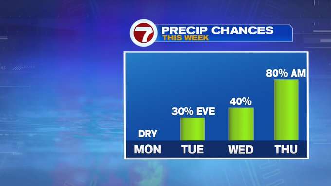
A few showers could mix with some snow flakes into southern NH, otherwise, the bulk of the precipitation will be rain.
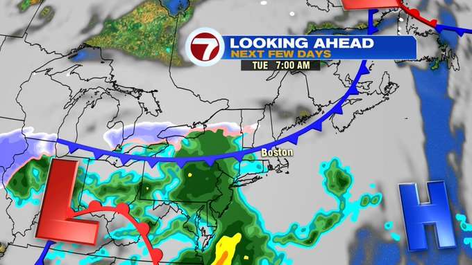
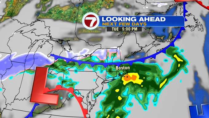

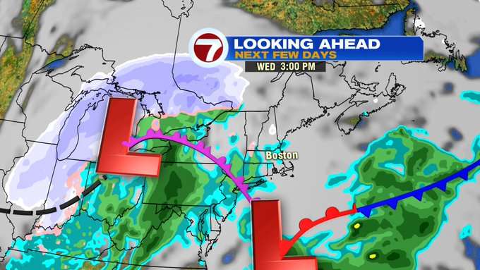
Once this system exits Thursday midday, winds will become gusty and we’ll see emerging sunshine.
Colder air trickles in for the end of the week, with highs on Friday only into the mid to upper 30s. The last Saturday of February will be much colder than this past Saturday. Highs will struggle to make it to the freezing mark next Saturday, but at least we’ll be tracking plentiful sunshine for Leap Day, the last day of meteorological winter.
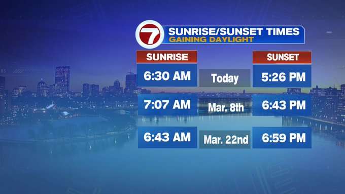
We’re just two Sundays away from Daylight Saving Time, and nearly 4 weeks away from our first 7PM sunset of 2020.