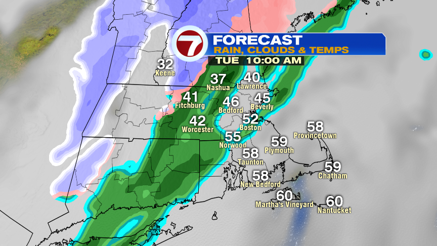
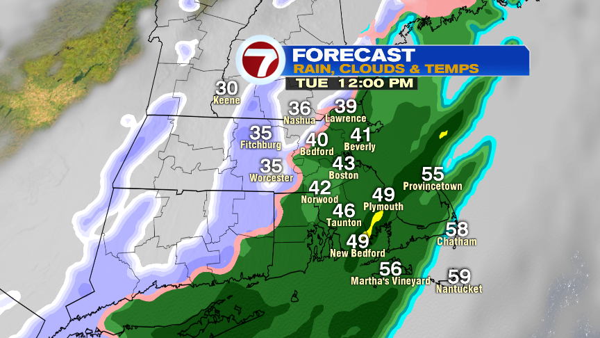
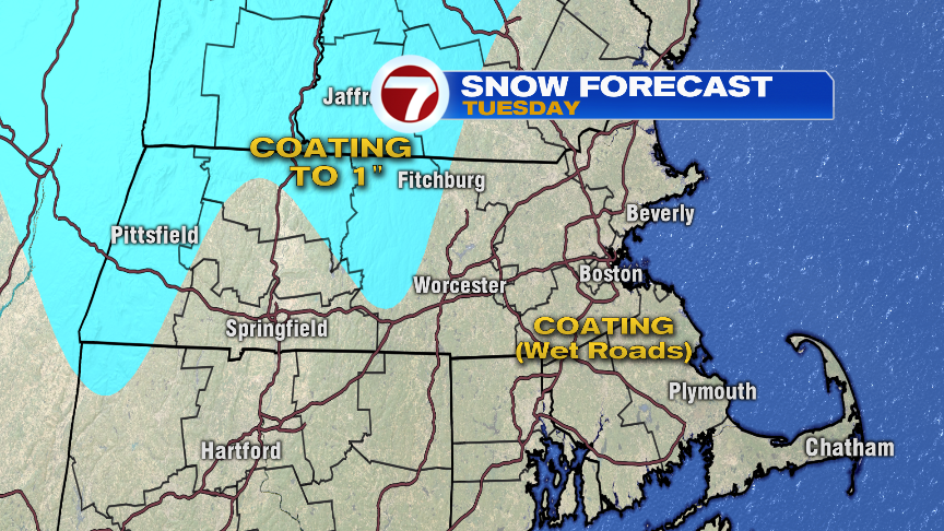
Temps are all over the map this morning, from the lower 30s across northern Mass to near 60 along the south coast. We battle patchy fog, patchy drizzle and even a few showers for the morning commute as milder air tries to work north for several hours. Temps peak around 10-11am, and then start to back track through the rest of the day. As temps drop, drops turn to flakes, allowing for wintry feel and look to the air. Showers turn to snow showers around lunch time in Worcester County and around 2pm in the Boston metro area. Even across the Cape, snow showers are likely after 4pm.

For the most part, roads stay wet, but we’ll likely see a few late-day slick spots northwest of 495, where temps are fastest to fall below freezing. For this evening, any spots that have residual moisture on them, will ice over. Although with a gusty wind, hopefully most roads can dry out before icing over. We’ll watch for some evening slick spots though.
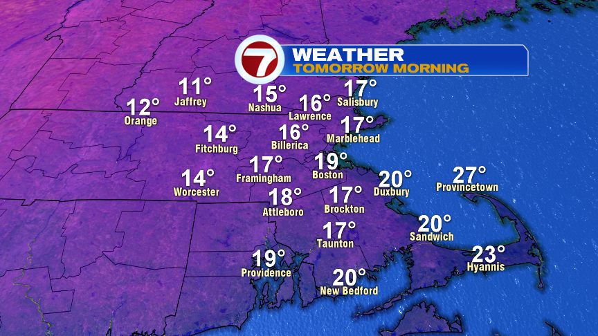
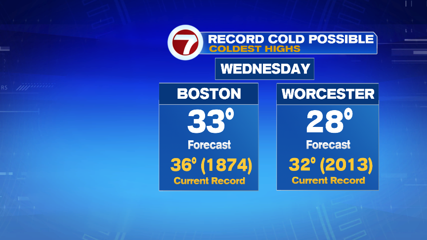
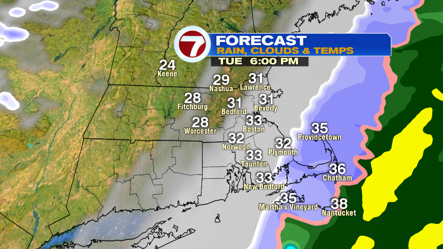
Tomorrow is all about the cold. Temps start in the teens with wind chills near 0 in the morning as gusty northwest winds push past 30mph. Highs only recover into the upper 20s and lower 30s, which would break the records for coldest high temps for the date.