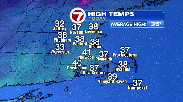
Today felt more like January with highs into the mid to upper 30s for most of the area along with scattered snow showers.
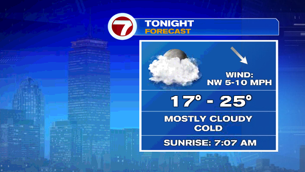
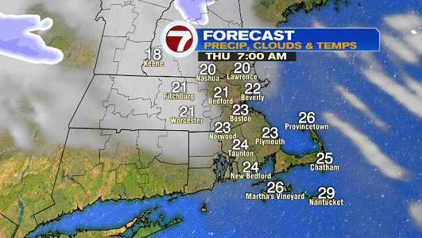
Tonight, temperatures dip into the upper teens to mid 20s under mostly cloudy skies.
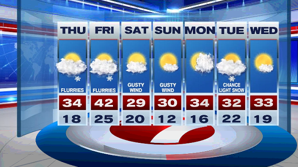
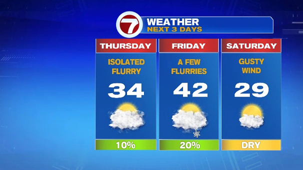
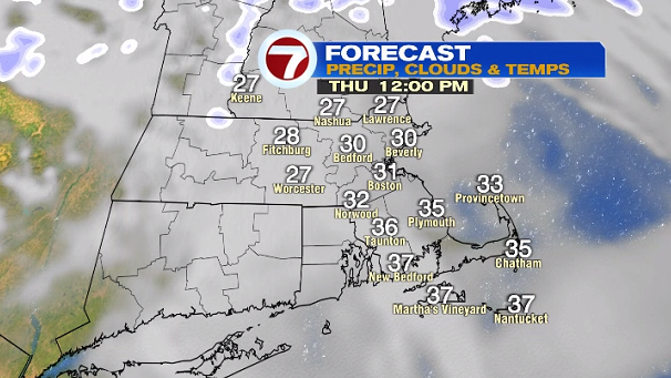
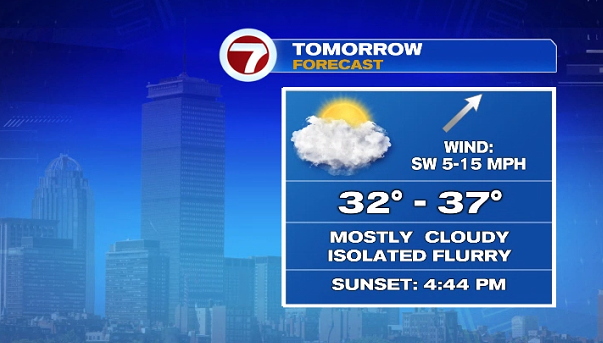
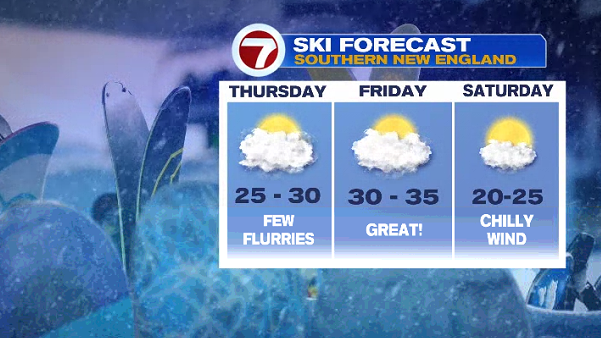
Thursday brings a spot flurry chance in the afternoon, otherwise mostly cloudy with highs into the 30s.
Friday is slightly warmer with highs into the low 40s and that’s the warmest day out of the 7-day forecast. A few flurries are also possible Friday late afternoon/early evening. Friday looks to be the best day to hit the slopes:

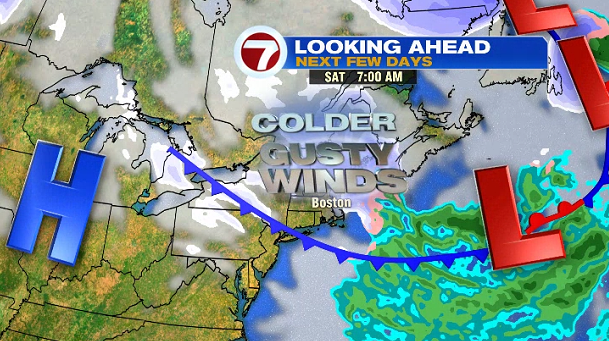
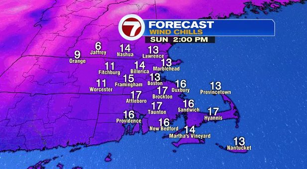
Our attention turns towards the weekend as colder air swings in from the northwest along with gusty winds that will bring biting cold wind chills to southern New England both weekend days.
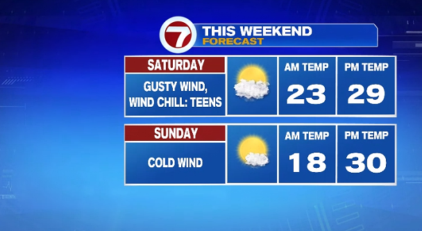
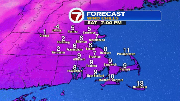
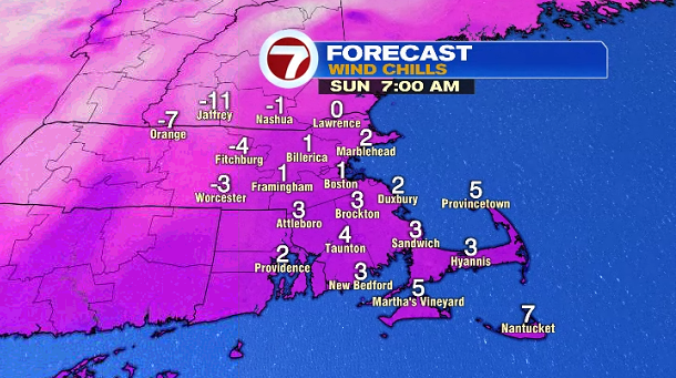
Just how cold will it feel? During the afternoons on Saturday and Sunday, wind chills will be in the teens, while overnight Saturday night into Sunday morning, wind chills will dip into the single digits.
For the start of the next work week, the colder trend sticks around. Monday brings morning sunshine to afternoon clouds followed by snow showers Tuesday, and sunshine for Wednesday with highs into the low 30s.