We were off to a dangerously foggy start earlier this morning when the fog was so dense that visibilites were down to less than a half of a mile to a quarter of a mile.
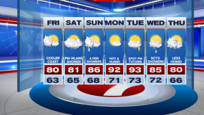
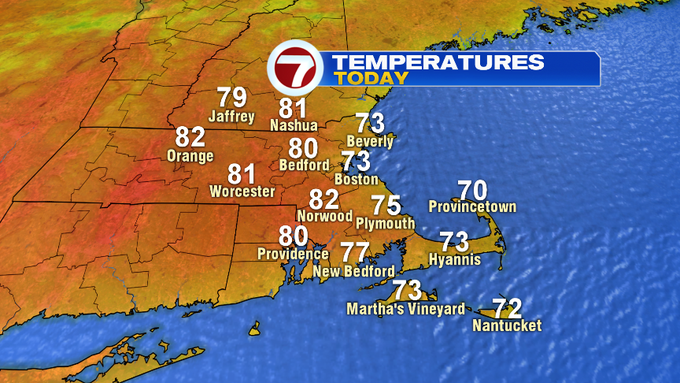
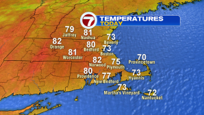
Thankfully, we are seeing improving conditions, along with the return of some sunshine. Today will be nearly a copy-cat of yesterday’s beautiful day, with highs around 80 inland, 70s along the coast.
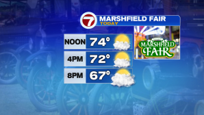
Picture perfect for opening day of the Marshfield Fair this afternoon and into the evening.
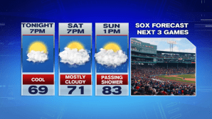
Heading to Fenway this weekend? A passing shower is possible for Sunday’s game, otherwise dry conditions for tonight’s and Saturday’s game.
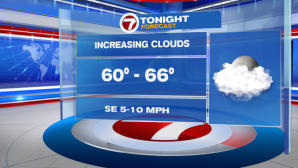
Overnight, temperatures do not fall too much, with lows only into the 60s due to our increasing cloud cover, with a chance for some patchy fog in spots.
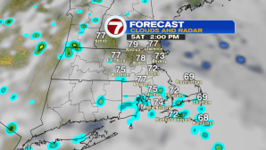
Saturday morning features mainly cloudy skies with a few showers off to the northwest. However, we are not tracking a washout for your weekend.

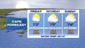
For your weekend outdoor plans, the Cape features more fog early Saturday, with a spot shower more likely on Sunday as opposed to Saturday.
As for the Lakes and Mountains region of NH, expect a few showers Saturday as well as Sunday, but again, both days will not be complete washouts, dry times will prevail over wet times, however the clouds do stick around both weekend days.

A warm-up is on the way beginning Sunday and continuing into the start of the next work week. Not only are we tracking the heat, we are also tracking the humidity.
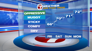
Dewpoints will reach into the low 70s, coupled with highs into the low 90s Monday, it will feel quite oppressive. 90s stick around for Tuesday, but we have a chance for a spotty afternoon thunderstorm.
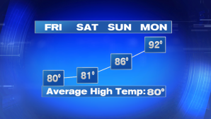
Highs slip back into the 80s Wednesday and Thursday, with Thursday feeling much more refreshing.