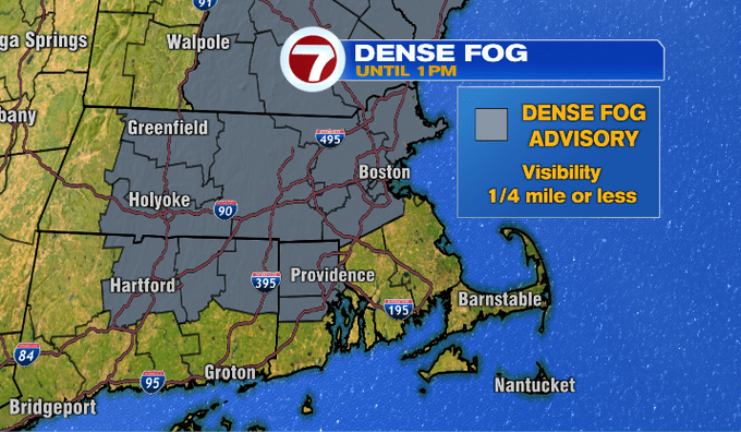
A Dense Fog Advisory remains in place until 1pm for most of southern New England, aside from SE MA and the Cape and Islands.
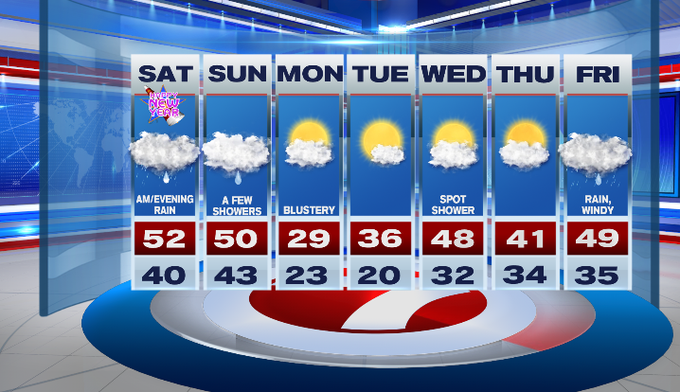
The clouds will stick around through the weekend, but it will be mild with highs today into the low 50s.
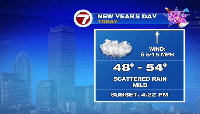
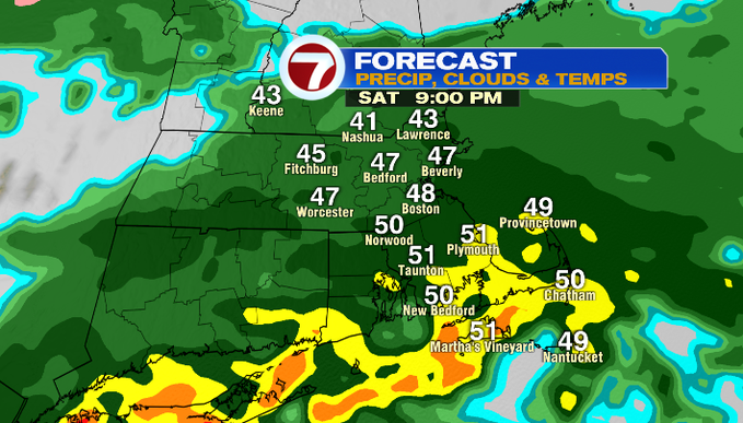
We’re waking up to a few showers this morning. These showers lift out and we’ll see some dry times around midday before more rain slides in from the southwest later this afternoon (closer to sunset). The rain will fill in across the area through the evening and we could even see a few pockets of heavy rain later tonight.
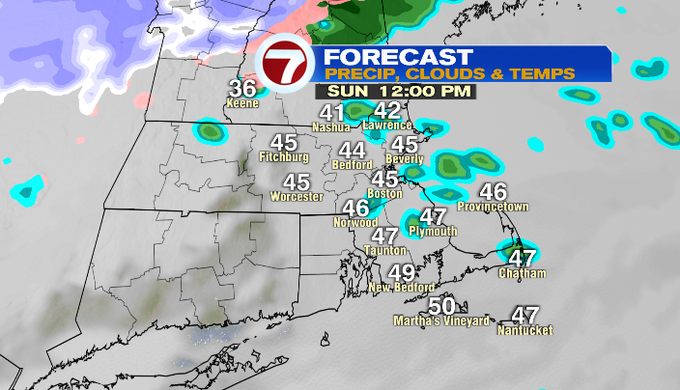
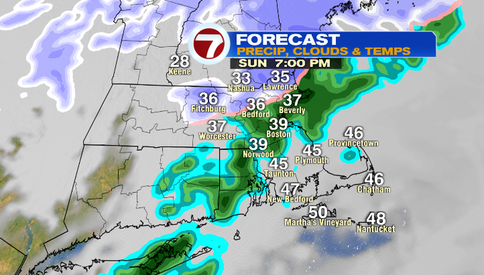
The rain moves out by Sunday morning (aside from a few lingering sprinkles). Highs Sunday will be around 50 ahead of a cold front that will swing in Sunday night, which could change over rain showers to some snow showers for southern NH and the higher elevations of north central MA.
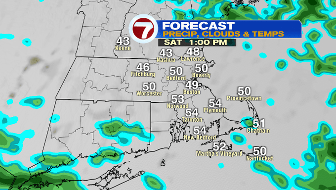
Tomorrow afternoon for the Pats game, it should be mainly dry aside from a passing shower with temperatures around 50 at kickoff.

The sunshine returns Monday as skies gradually clear through the day. However, this sunshine is coupled up with much colder air with highs into the upper 20s Monday. Wind chills will likely be in the teens.
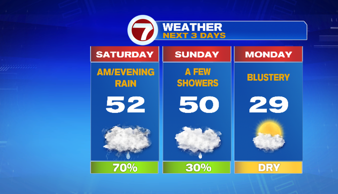
Thankfully, the cold is short-lived as temperatures moderate back into the upper 40s by midweek. By the end of the first week of 2022, rain returns Friday.