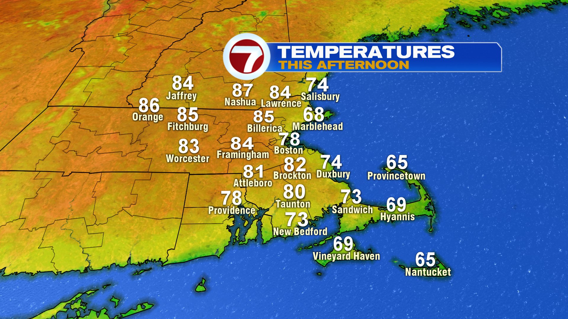
After another start with fog and low clouds, sun will appear quicker than it did yesterday as fog and clouds thin out and burn off by 10am for many towns and cities. Along the coast, banks of fog will linger near the waters edge, with perhaps coastal fog rolling in and out through the day across Cape Ann and Cape Cod, where temps stay in the 60s. Inland, widespread low to mid 80s will prevail as sunshine quickly gets to work, providing plenty of warmth.
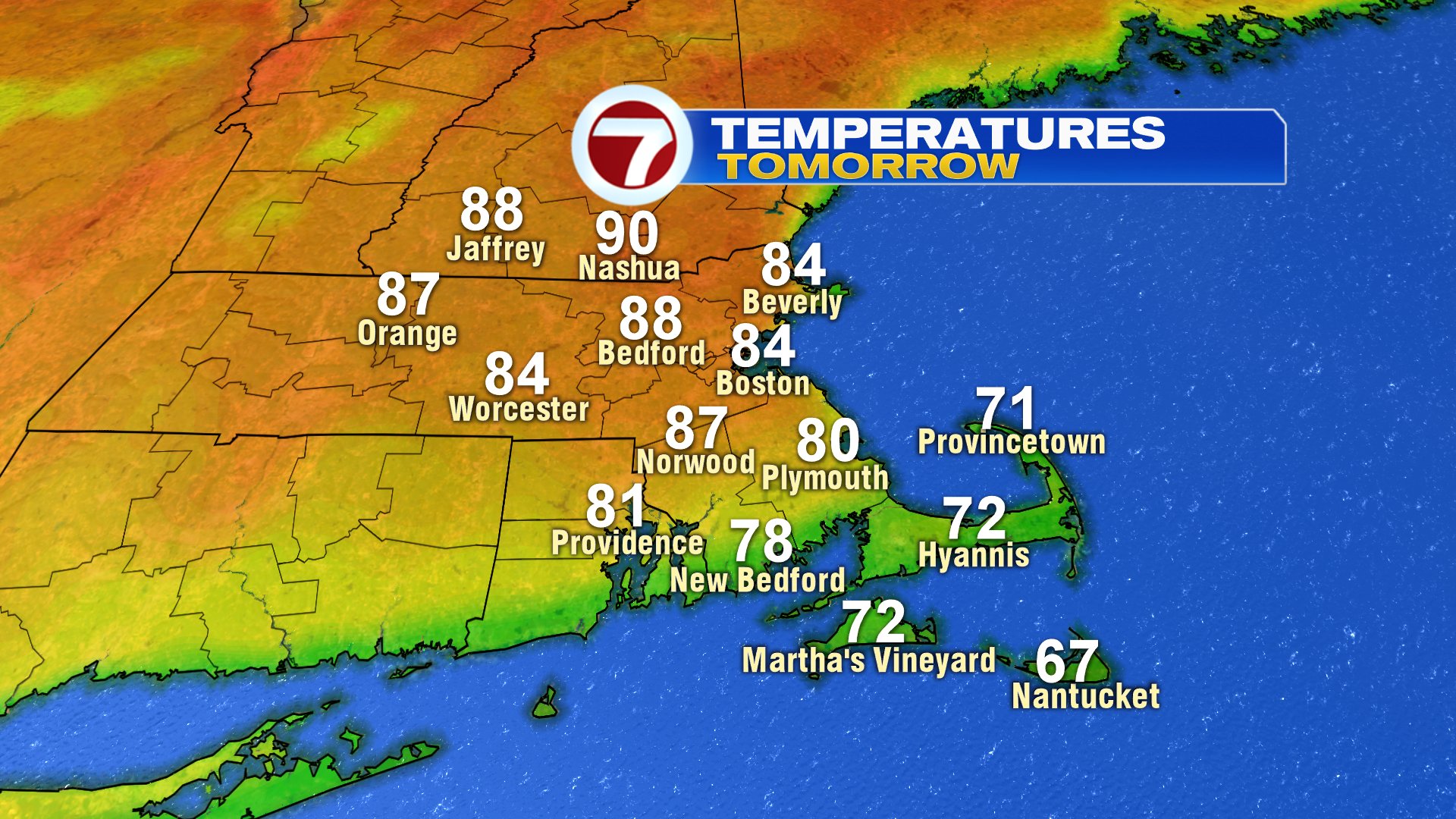
Highs tomorrow reach near 90 across northern Mass and Southern NH after patchy low clouds and fog burns off quickly. Dew points rise into the low to mid 60s the next several days, so it does turn more humid as well.

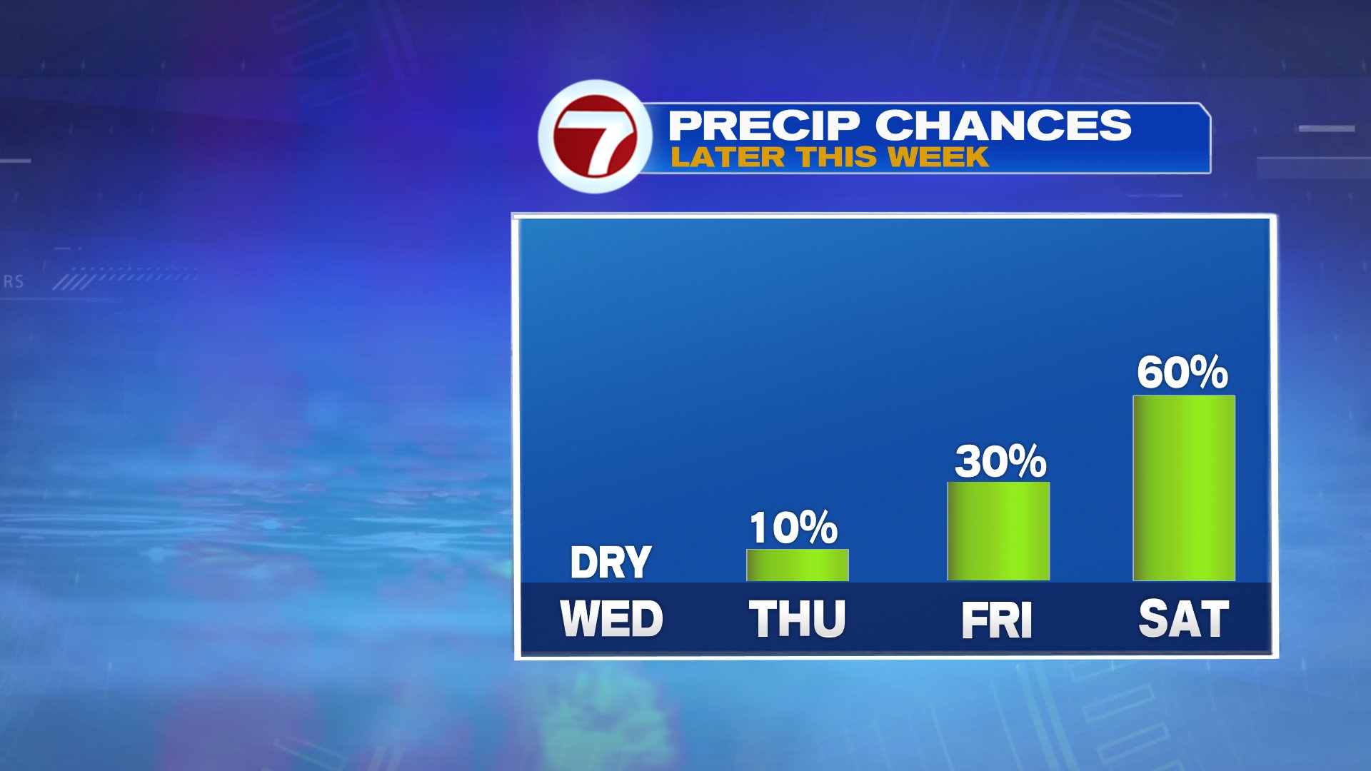
Rain chances are slim the next few days as we await the chance for scattered showers and storms near the end of the week. Even then, not all towns catch rain Friday, although it’ll be more widespread Friday night and Saturday. No washout, but certainly a day to keep an eye to the sky. Lower humidity and dry air prevails Sunday with highs back to near 70.