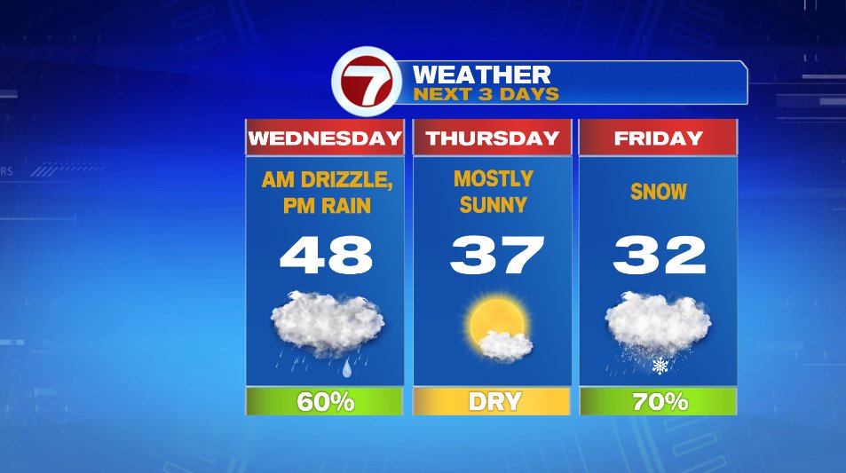
A little bit of everything is on the way over the next three days. Typical New England, right!? We have warm, cold, sun, and several types of precipitation on the way between now and the weekend.
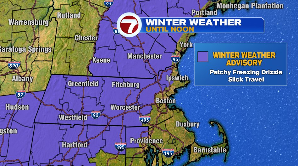
This Morning:
This morning watch for slick spots on the roads, sidewalks, and your driveway. Patchy freezing drizzle will develop from about 7am to Noon. We have a winter weather advisory in effect for that reason. Most of us should be ok by 10am but the hillier terrain will have some cold air linger for a bit longer this morning. That winter weather advisory is officially for everyone outside of 128, but it’s most likely on the 495 corridor from I-93 in Lowell to Route 2 in the Acton area and northwest of there. So if you’re in southern New Hampshire or north of Route 2 be careful on the roads this morning.
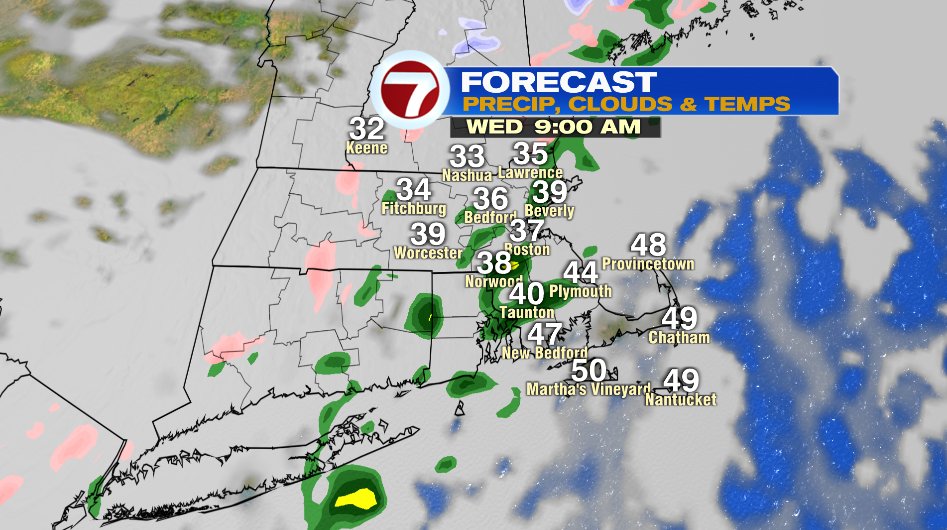
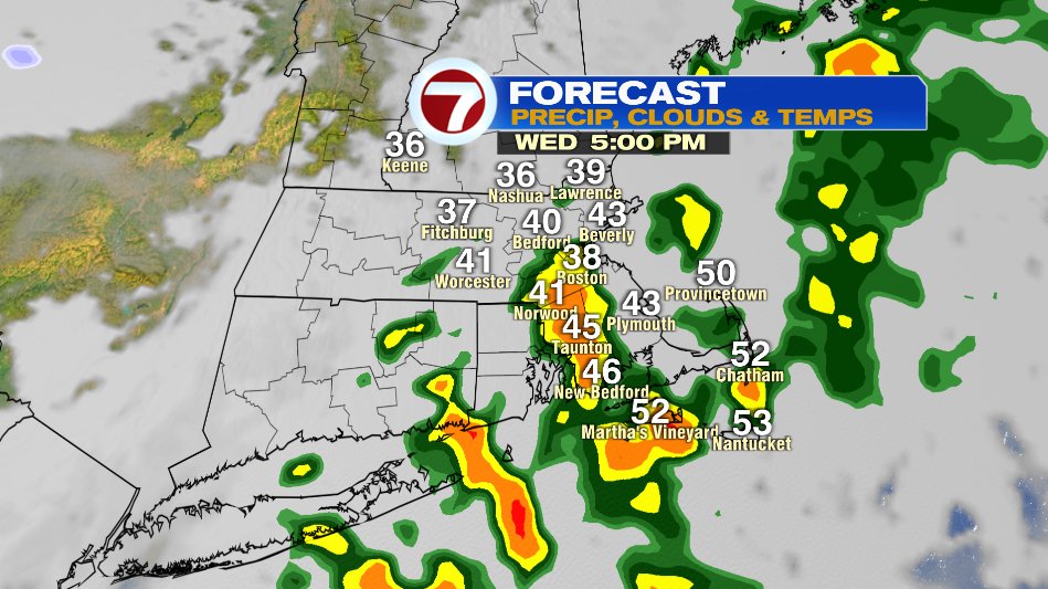
This Afternoon:
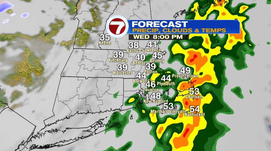
This afternoon temperatures will climb to the upper 40s and even low 50s. That will flip the precipitation over to just rain. We’ll have spot showers/drizzle until noon-1pm. After 1pm showers will become more scattered with some embedded heavier pockets and even downpours. If you’re west of I-95 you’ll probably be dry by 2-3pm with those showers lingering in the afternoon and evening east of I-95 and especially SE Mass and the Cape.
Thursday:
Behind the rain we’ll bring the clear skies back and temperatures will cool back down. We’ll see the sun return on Thursday and temperatures will be back to more typical January levels in the upper 30s.
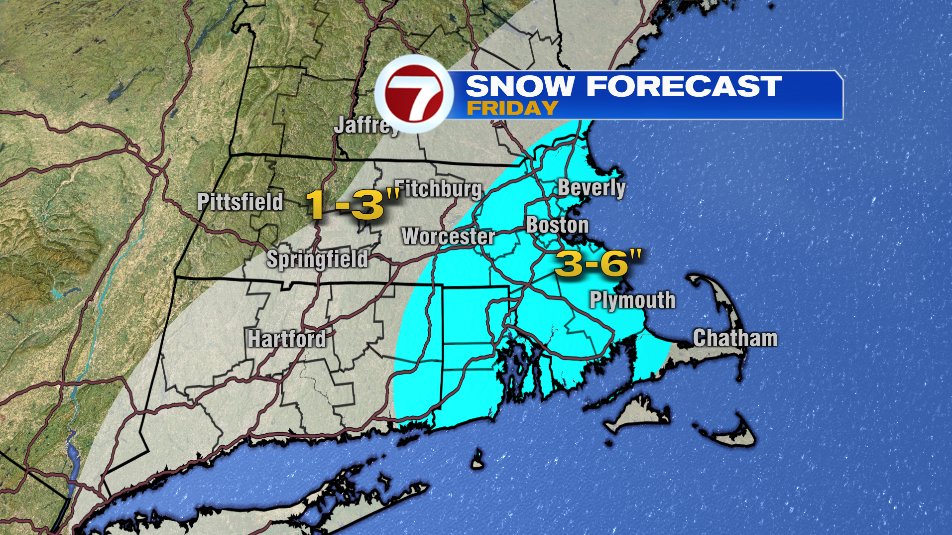
Friday:
Friday is the day that’s grabbing all the headlines in the forecast as our first decent snow arrives in southern New England. It’s still early but here’s a few takeaways:
- It is cold enough that it will be snow for everyone. Maybe some minimal mixing on the Cape which will bring down totals slightly but we’ll still see accumulation there.
- Wind is not a concern. It will get a little gusty but it’s not a Nor’easter and we shouldn’t see damaging winds with this storm.
- It’s a fast moving storm and it’s with us for about 12 hours: 3am to 3pm on Friday. So the Friday morning commute will be the one with the most significant/only impacts.
- The snow that does fall will make you bust out the shovels and send the plow trucks out during the day on Friday.
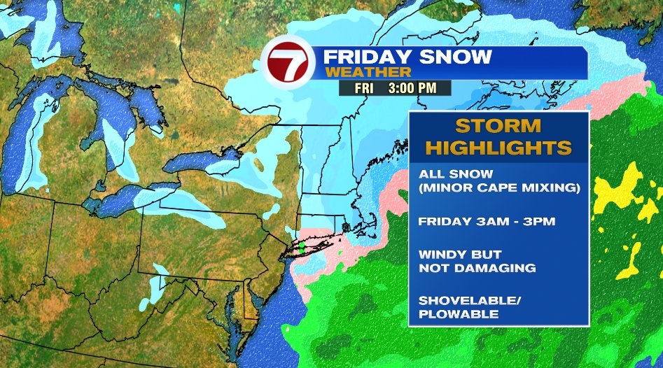
So how much snow? Well here’s an early look at forecast amounts. Expect some tweaks between now and Friday.