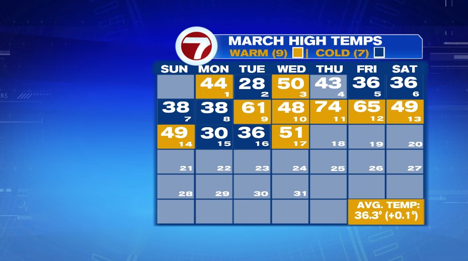
Well today was a nice day. Hopefully you got to get outside and enjoy it. If not, go for a nice neighborhood walk this evening as temperatures will stay mild and skies quiet. Boston’s high hit 51 before a seabreeze kicked in. To date, March is 0.1° above average. Yesterday it was 0.1° below average. So basically the back and forth we’ve seen is typical March stuff and when you average it out, we’re right about perfect for what you’d expect in the month.
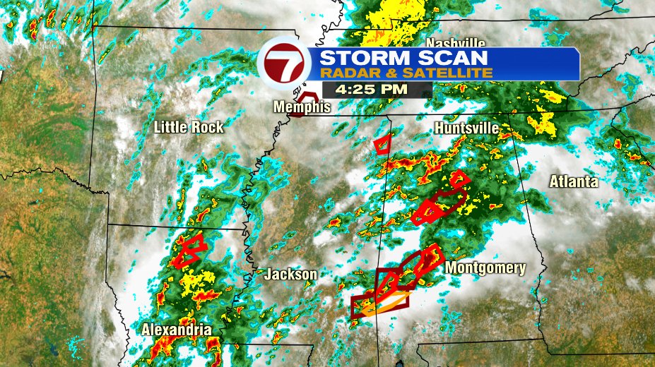
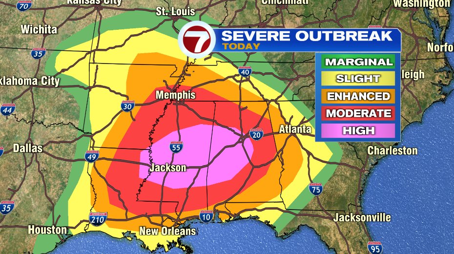
But because March is March we know this won’t last forever, and we’ll watch changes in here as soon as tomorrow. Our storm system is currently in the deep south and unfortunately causing a severe weather outbreak there. The radar snapshot is at 4:25 and is just a snapshot of the evening. Those areas are expecting several hours of numerous, long track tornadoes.
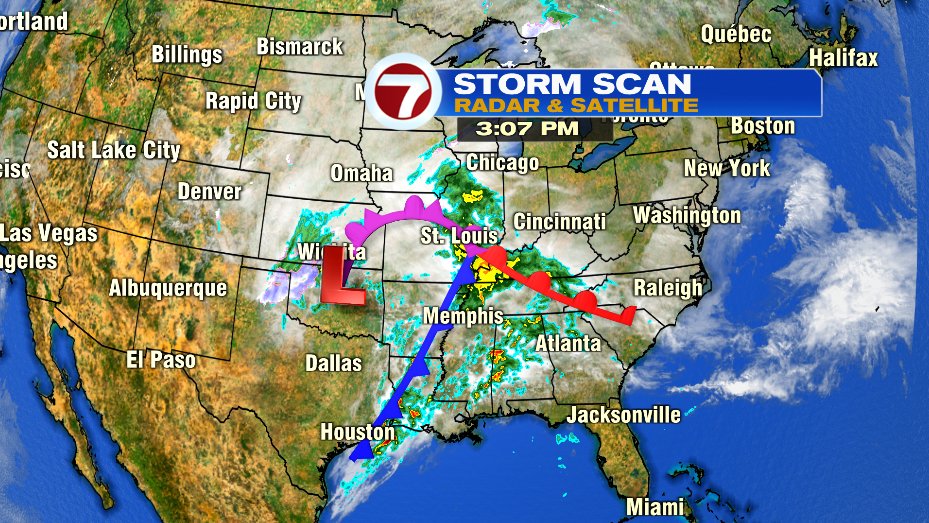
In fact, that area is under a “high” risk of severe weather which is the highest level of risk the National Weather Service and Storm Prediction Center will issue. For the record… THERE IS NO SEVERE WEATHER RISK for us when that storm comes to New England.
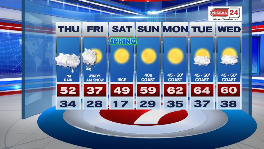
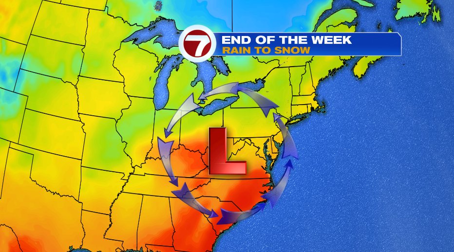
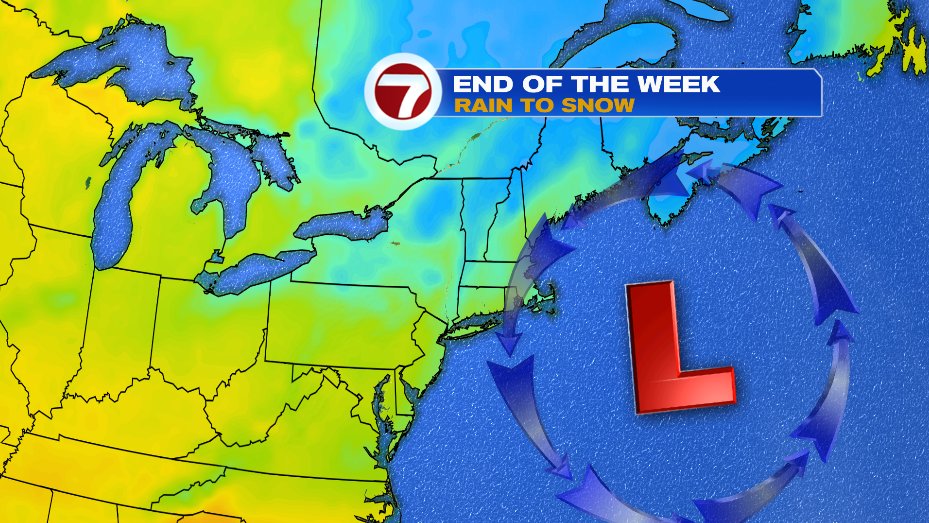
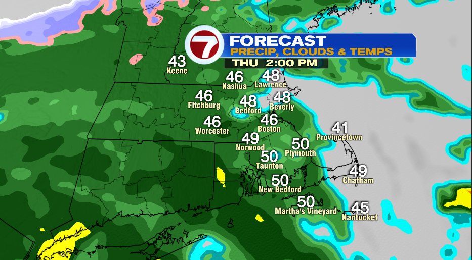
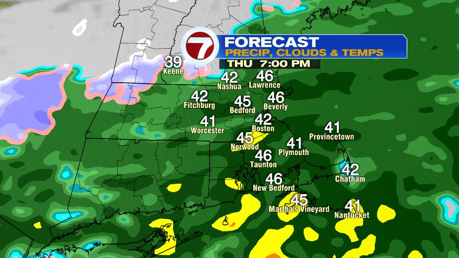
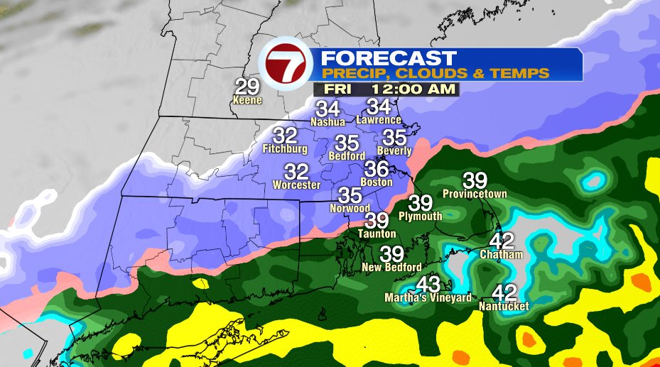
But we’ll watch that area of low pressure and the winds around it and how that will affect our weather. On Thursday (map 1) the low is to our southwest which will give us south winds. That will keep temperatures near 50 tomorrow. But as it exits (map 2) that same circulation will turn to the north and the cold air north of us will plunge in and change the back edge of the rain over to wet snow.
Below is a timeline:
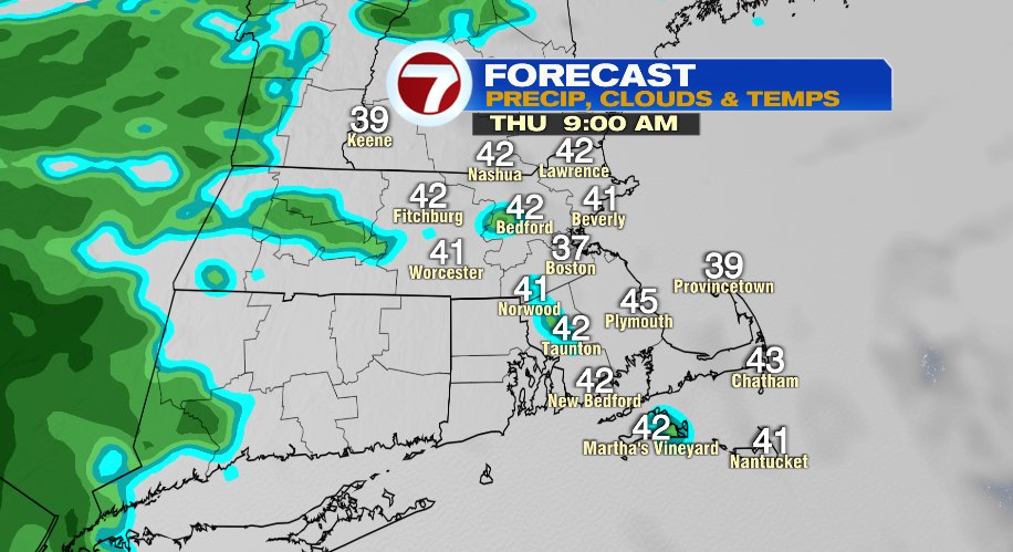
- Cloudy morning with a sprinkle possible
- Steady rain begins early afternoon and lasts all evening long
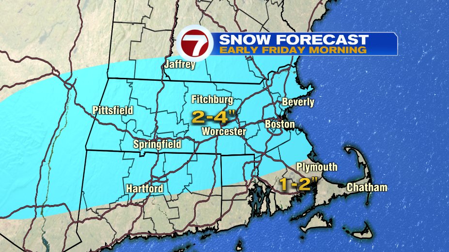
- Cold air changes rain to snow around midnight
- Snow exits by sunrise Friday
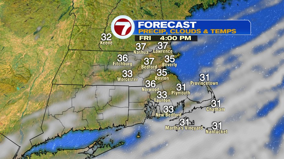
- Sunshine breaks out Friday afternoon
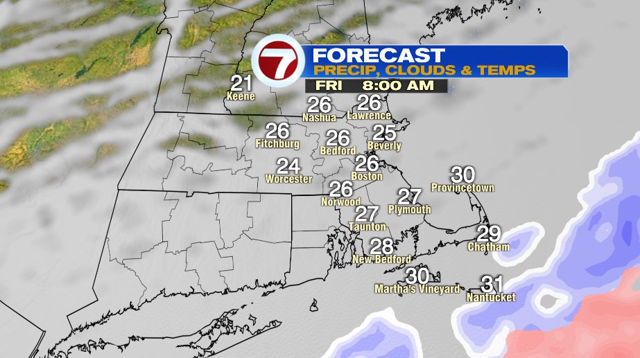
In total most of us will see 2-4″ of snow. But it’s March so it’s going to depend where you measure it. Elevated surfaces, yes. So if you look at your deck railing, mailbox, car windshield. But on the road surfaces not so much. Road pavement temperatures are warm so a lot of this will melt on contact. Not saying there won’t be anything but there won’t be as much on the roads as you see on your car hood on Friday morning.
From there it’s all about spring! Sunshine the big story for the weekend and early next week. Temperatures mild for everyone but certainly a cooler on the coast pattern with temperatures in the low 60s vs upper 40s.