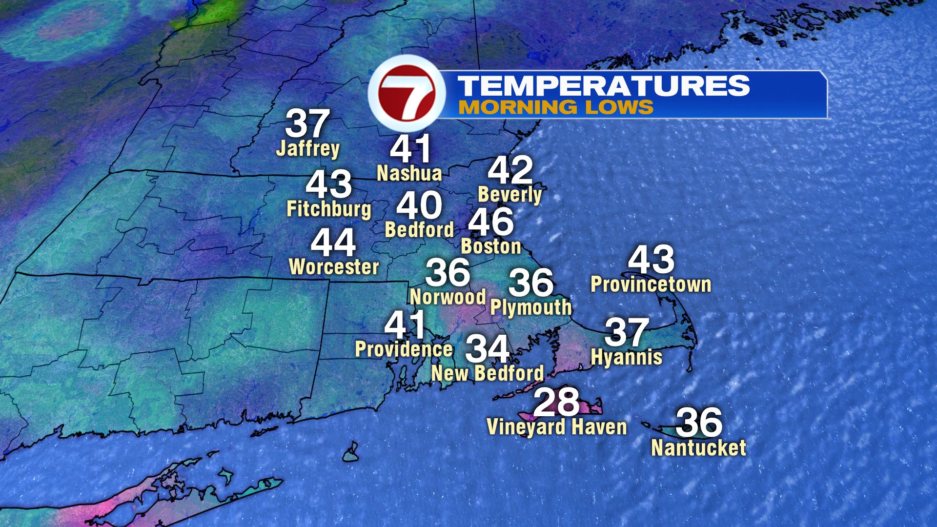
Chilling out for sure this morning as temps dropped into the 30s for many towns west and south of Boston, setting up a frosty start for many.
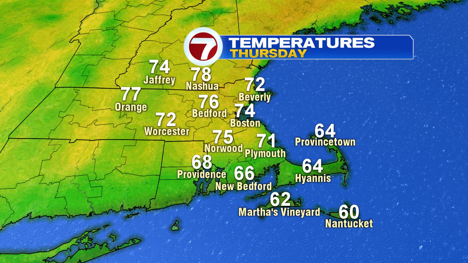
Despite that, temperatures are set to surge today, rebounding into the mid to upper 70s across much of the area, away from the South Coast. It’ll be noticeably cooler across Buzzards Bay, the Cape and across Cape Ann.
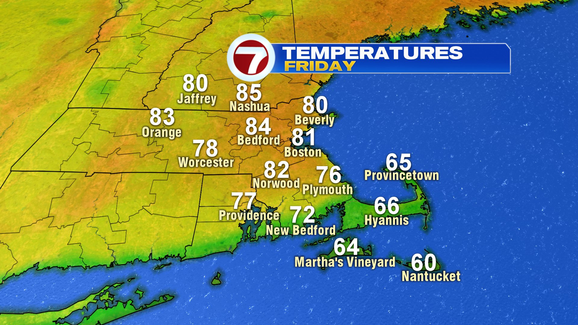
Tomorrow is another Spring stunner, with highs jumping up into the low to mid 80s with low humidity in place.
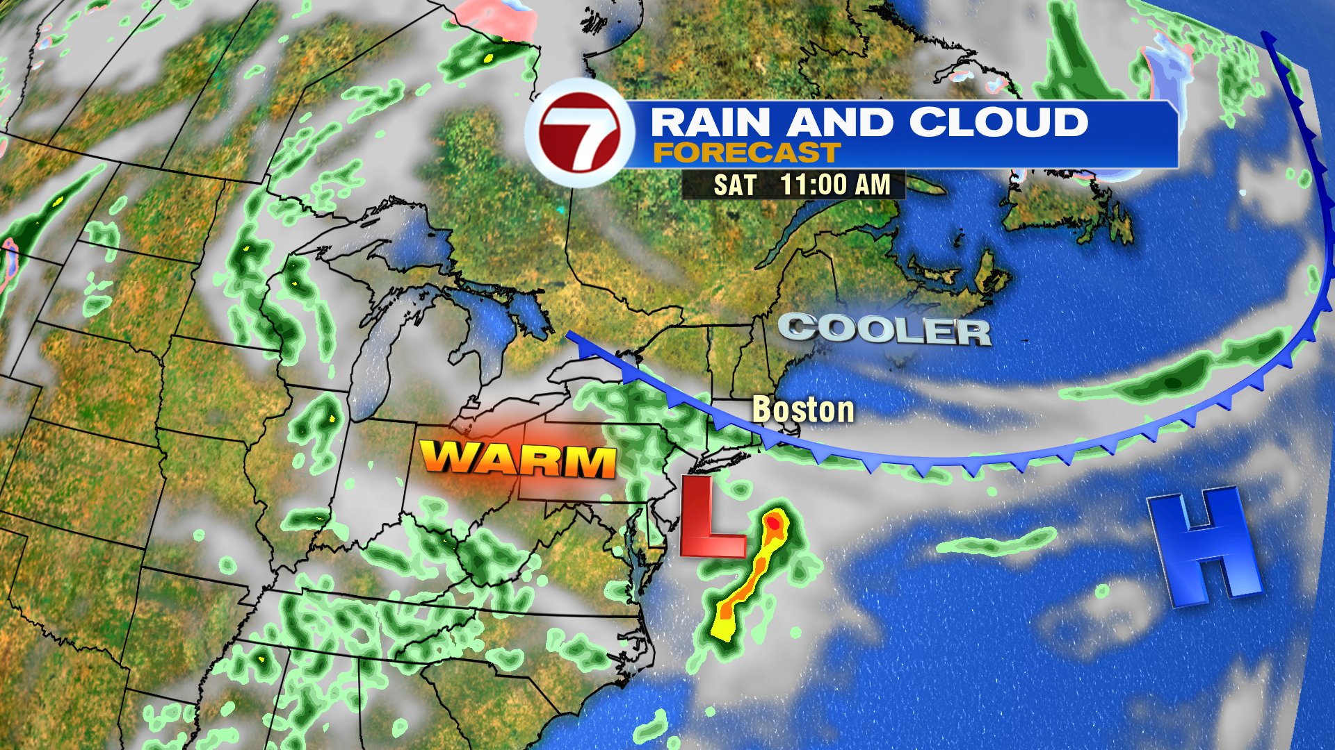
While most of the holiday weekend is dry, we do run the risk of showers Saturday, near and south of the Pike, especially in the morning. High pressure wins out through the day, and showers are pushed farther and farther south midday into the afternoon. Temps initially start well into the 60s to near 70 Saturday morning, then drop by midday as temps cool from east to west. Temps at the coast fall into the 50s and spend most of the weekend in the 50s. With that said, it does turn brighter Sunday and a bit milder on Memorial Day. Highs Sunday run in the low to mid 60s inland and near 70 inland Monday.