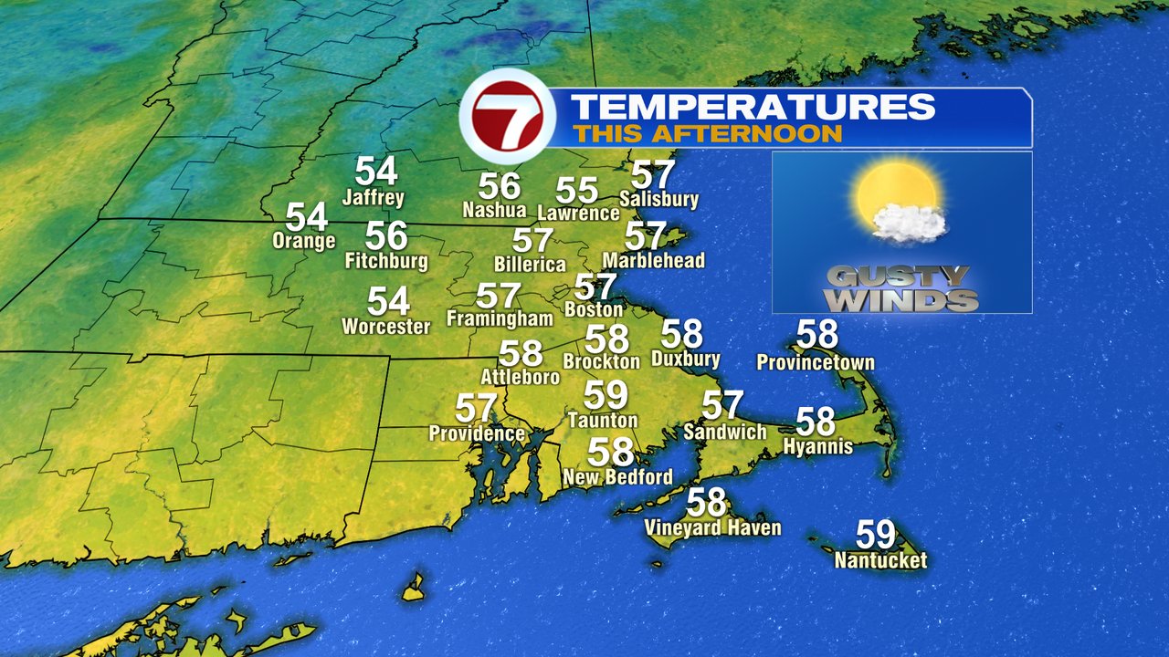
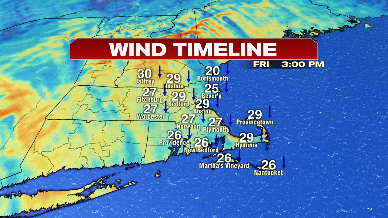
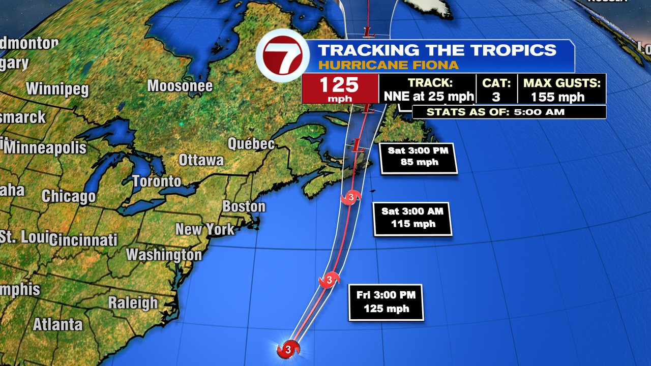
9:04pm yesterday, the Autumnal Equinox marked the end of Astronomical Summer and the start of Astronomical Fall. Right on cue, chilly air pushed in, and the feel of Fall is certain in the air today. In fact, it’s more of a mid to late October feel to the air vs. late September. Highs today run into the mid to upper 50s and winds gust to 30mph. At the coast, waves kick up to 5-10 feet thanks to Fiona, which will pass to our east tonight, and hammer Nova Scotia. Waves tomorrow at our coast will run 6-12 feet, elevating the risk for dangerous rip currents as well.
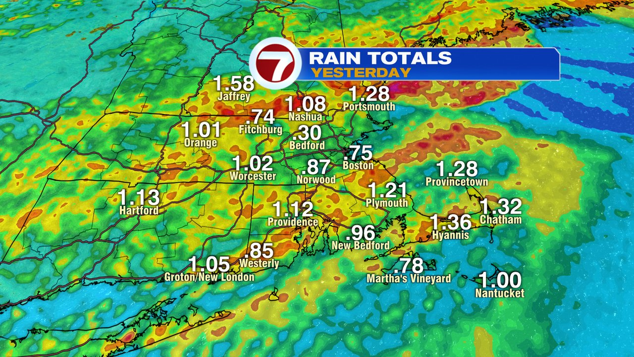
The chill is in the wake of yesterday’s cold front, which helped produce 0.75-1.50″ across much of the area, with locally 2″+ for parts of Southeast Mass. It was a beneficial rain event for sure.
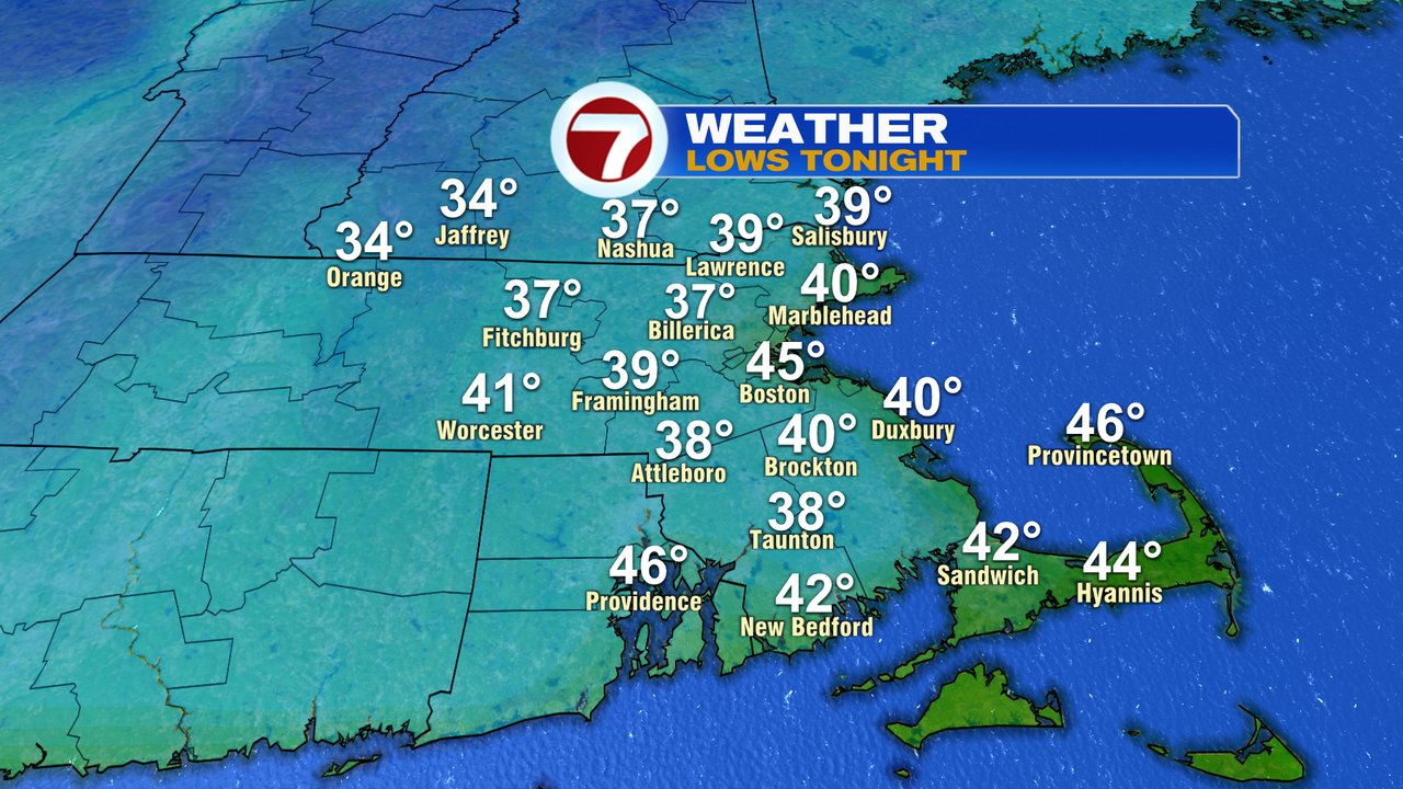
Tonight, as clear skies and a diminishing wind win out, temps fall fast, back into the 30s to lower 40s for many by tomorrow morning.
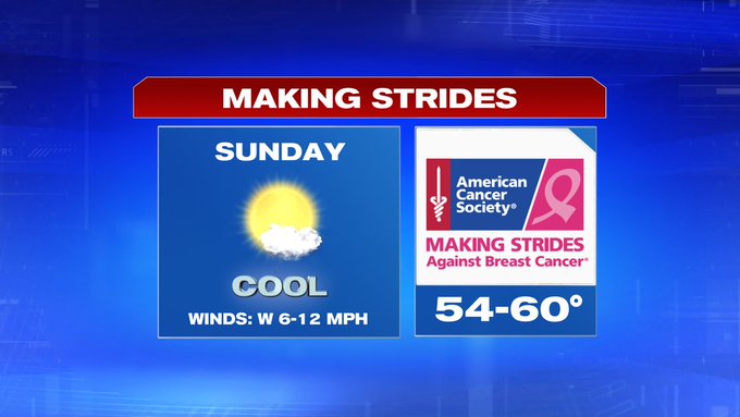
The bounce back is nice tomorrow, with highs in the mid 60s during the afternoon. Sunday, we’ll push to near 70 with increasing clouds. Although a spot shower can’t be ruled out late Sunday, a better chance for a few scattered showers will push in Sunday night/Monday morning. Overall, it’ll be a nice weekend with a cool, but comfortable start Sunday for the Making Strides Walk in Boston, and a nice afternoon for the Pats Game.

In the tropics, Fiona is just west of Bermuda this morning and will slam into Nova Scotia tonight, into tomorrow, producing winds gusts there near 100mph. Cape Brenton Island and Prince Edward Island will likely see some of the highest impacts.
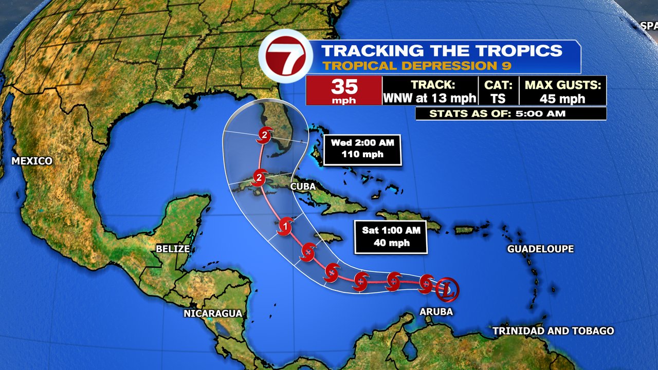
Tropical Depression 9 has also formed in the Caribbean this morning and will likely become a hurricane by early next week as it crosses Cuba and approaches Florida.