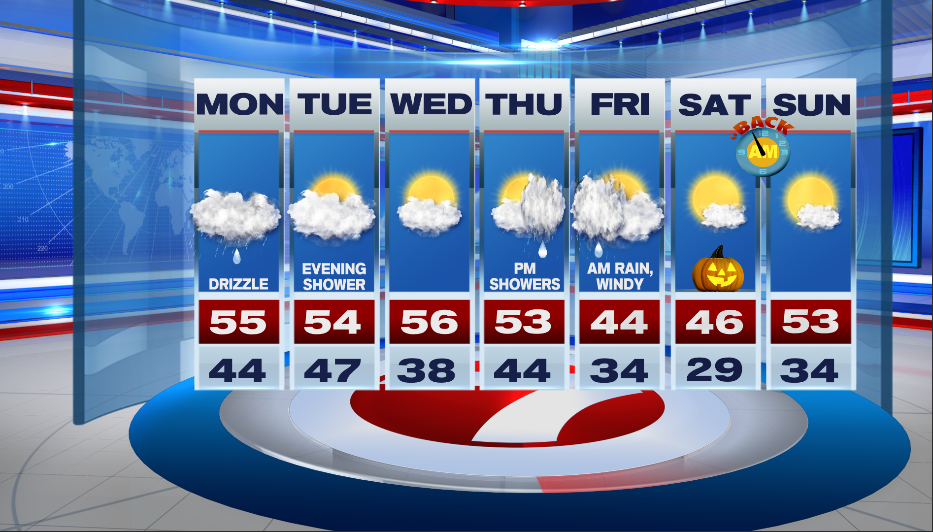
7Weather- We’ll be stuck under the clouds to kick off the week, and then we have a big cool down by Friday.
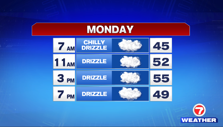
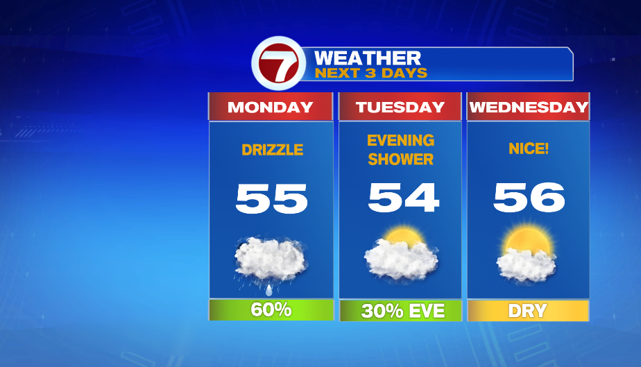
Monday’s forecast is “meh”…. gloomy, chilly, with drizzle. The day starts in the mid 40s, and highs reach into the mid 50s in the afternoon. There will be a coastal breeze with a sustained wind at 10-15 mph. Inland areas will have a light breeze.
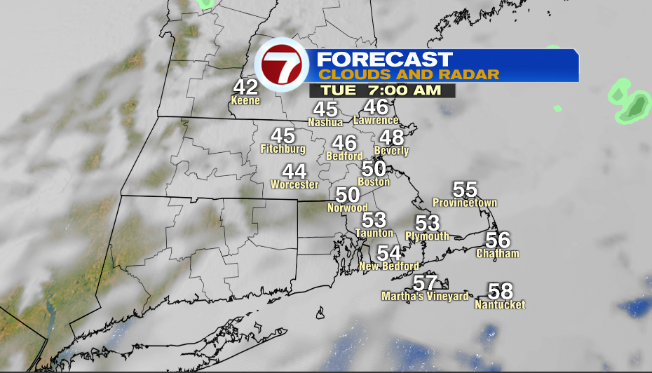
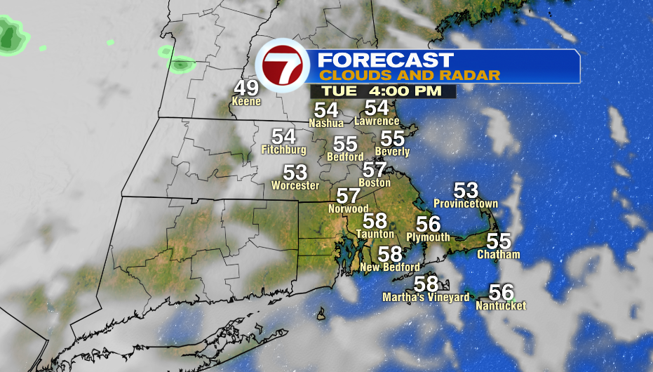
Tuesday starts overcast with a slight chance for patchy drizzle, and then we could see peeks of sun in the afternoon. Once again, highs reach into the mid 50s.
There’s a quick, weak wave that could bring in a few showers Tuesday night. They look to move out right before sunrise of Wednesday. This means that we could wake up to cloudy skies Wednesday morning, and then it gradually clears up. Highs will be near 55º.
Thursday has some sun some early, and then clouds and showers move in throughout the afternoon. The rain continues Thursday night into Friday morning. At the same time, cold air is pushing in. For most it looks like rain, but it’s possible that our higher elevations see their first snowflakes!
Halloween morning is cold in the mid and upper 20s, and then afternoon is chilly with highs in the mid 40s.