
Today is the pick of the weekend for your outdoor plans – especially if you’re a big fan of the summer season. Highs are expected to climb around 80 this afternoon under mostly sunny skies.
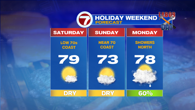
A light seabreeze is possible at the local beaches and coastline, so temperatures may be into the mid 70s at times.
Tonight, temperatures will slide into the low to mid 50s north and west, around 60 for Boston, SE MA and the Cape and Islands.
We start off cool again Sunday morning, before rebounding back into the mid 70s, around 70 at the coast due to an onshore breeze through most of the day. Cloud cover will also thicken into Sunday afternoon.
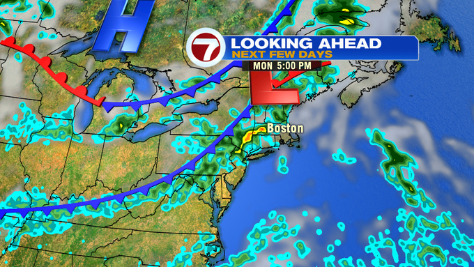
For Labor Day Monday, a front approaches from the west, which will bring a chance for showers.

The shower threat will be north by late morning to midday, with a chance for showers possible (with a rumble of thunder not ruled completely out) areas along and north of the Pike by late afternoon into the early evening.
SE MA, the Cape and Islands, should remain dry for your Labor Day plans.
Now Tuesday and Wednesday brings the humidity and the summery temperatures back as everyone heads back to work and school after the long holiday weekend. Highs will stretch into the 80s both days, with Wednesday featuring a chance for showers/storms by the afternoon.
Thursday and Friday features a cool down, with more clouds and highs around 70 Thursday, 60s Friday.

As for Hurricane Dorian, as of the 11AM update from the National Hurricane Center, Dorian has strengthened since the previous update at 8AM. Now packing 150 MPH sustained winds, it is a high end Cat. 4 Hurricane, situated a little over 400 miles east of West Palm Beach, Florida.

Tropical Storm force winds are expected into northwestern Bahamas by tonight, with hurricane conditions likely Sunday. The track of Dorian has shifted slightly since the previous update.
The cone of uncertainty has shifted slightly north and eastward, with the center of the cone staying offshore, however, with a jog to the west, the storm could still bring damaging winds, rain, and battering surf along the Florida East Coast from early Tuesday and continuing into Wednesday.
It looks like the threat then moves towards coastal GA and the Carolinas as the storm path curls north through Thursday.