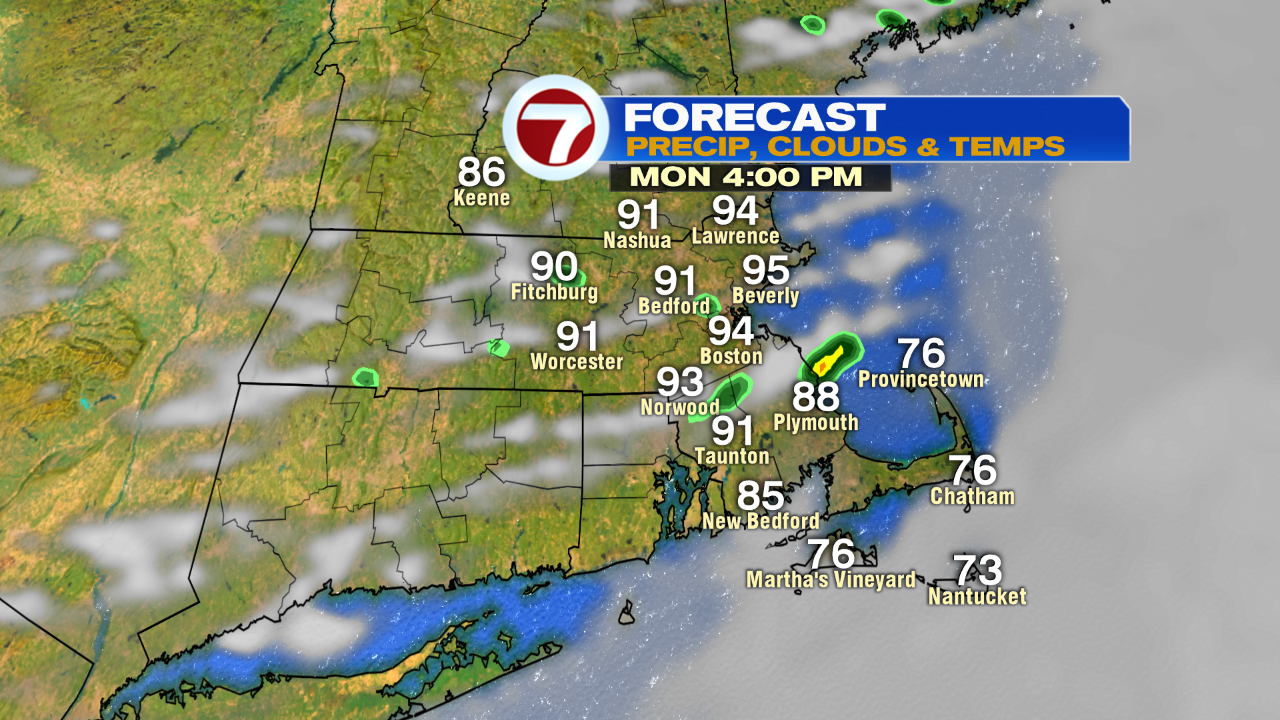
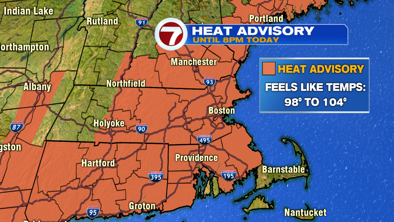
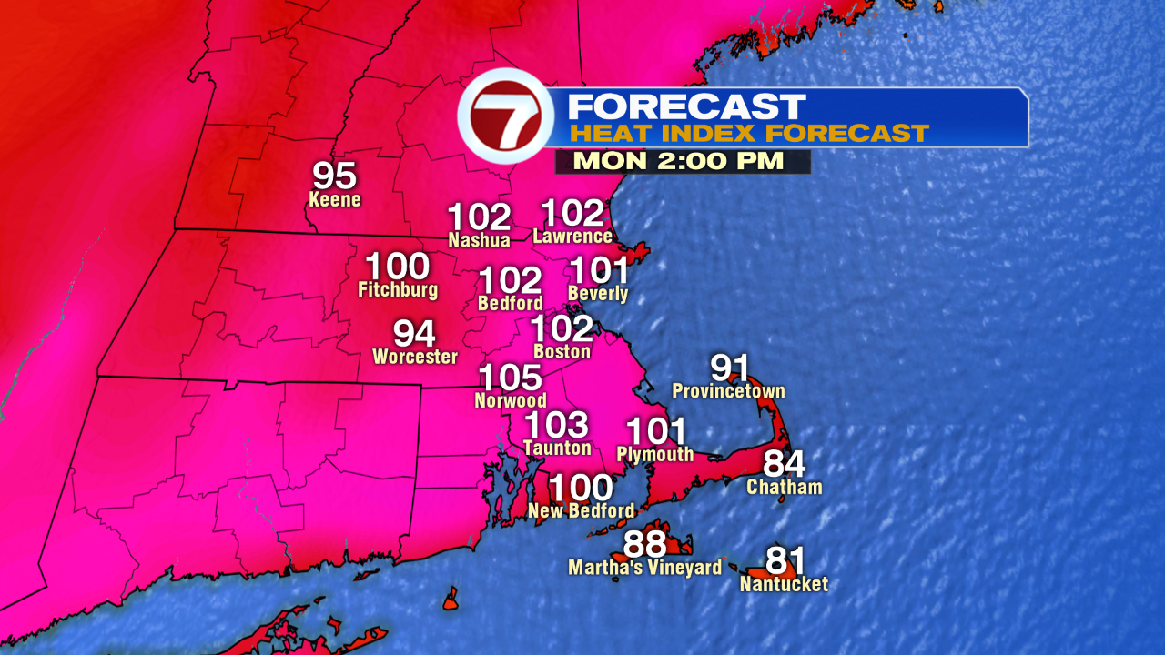
Back to back 90 degree days over the weekend set the stage for another hot day today, as the same air mass is in place. With today being the 3rd day of 90+, we’ll clinch the heat wave across many areas. The temps in the low to mid 90s this afternoon, combined with dew points running in the low to mid 70s, will produce a heat index of 98-104. With that in mind, a heat advisory is in place. If you have to work outside, stay hydrated and take breaks! If you’re heading pool side or to the beach today, keep an eye to the sky as a few isolated thunderstorms will fire. The main risk from these storms will be lightning and downpours, but one or two could prove to provide damaging win gusts. The time frame to watch is 3-7pm for any isolated severe weather.
While tomorrow offers to be another hot day with temps near or above 90, it’ll be much less humid as dew points drop into the 50s. No storms fire tomorrow and localized sea breezes kick in at the coast. A great beach day overall!

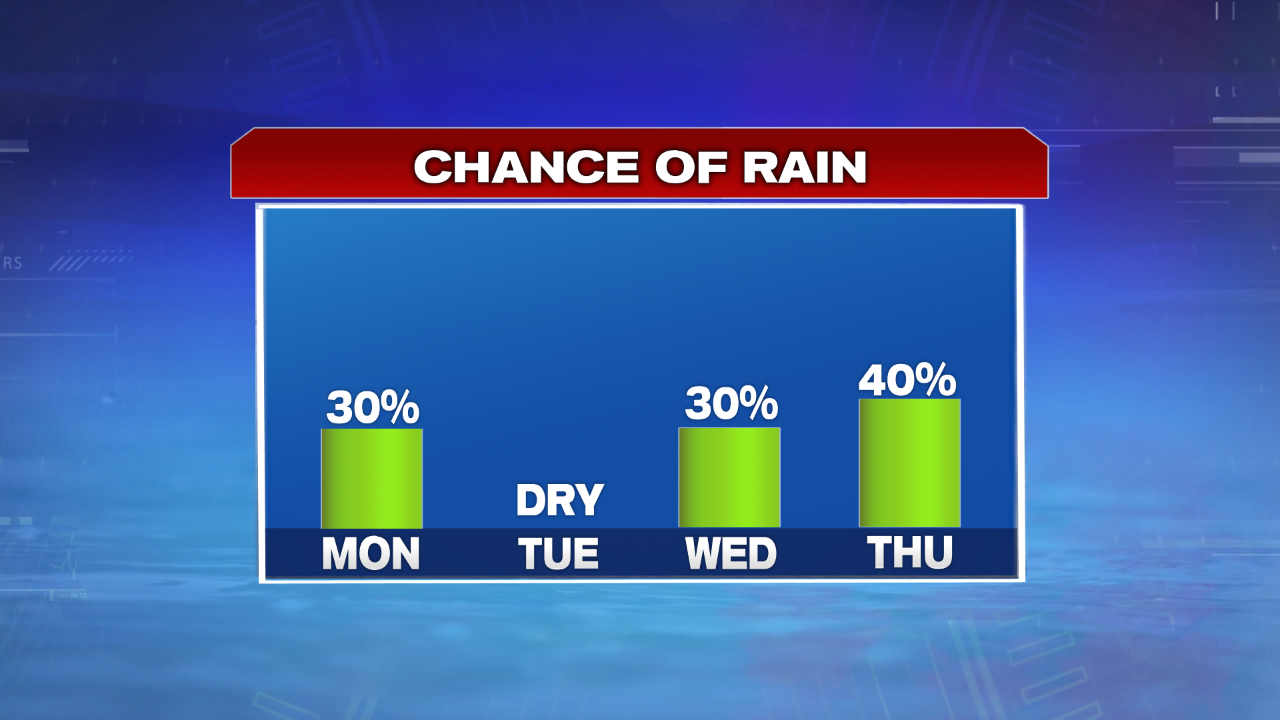
Scattered showers and storms return Wednesday and Thursday. Next weekend looks warm and dry, but not as hot as this past weekend.